The end of the year is often a time of reflection and appreciation and we at the California Natural Diversity Database appreciate all the species detection data we receive throughout the year. We are thankful for contributors like you for helping us conserve California’s many sensitive species. We rarely get the opportunity to get out of the office and do field work ourselves, so we appreciate your awesome photos as a welcome reminder of what makes this job worth doing. We couldn't do it without your continued efforts!

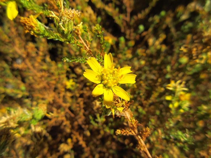
Deinandra minthornii (Hemizonia minthornii) – Santa Susana tarplant
Submitted by Chris Dunn and Patrick Crooks, Padre Associates Inc.
This interesting plant was found at the Boeing Santa Susana Field Laboratory site in Ventura County. The site formerly housed everything needed to test rocket engines, but ten years ago Boeing decided to preserve the site as open space habitat. It has since become a sanctuary for plants and animals alike. Deinandra minthornii is endemic to California and is listed as 1B.2 (rare or endangered in California and elsewhere, fairly endangered in California) in the California Rare Plant Ranking system. It is commonly found in rocky areas of chaparral and coastal scrub. Chris assisted in some interesting work on the conservation of D. minthornii. In a study of the plant, it was determined that D. minthornii was highly pollinator dependent, having a much better seed viability when greater numbers of pollinators visited the plant. Plants found near areas of the Santa Susana Field Laboratory that had been seeded with native forbs were found to have greater numbers of pollinators visiting. This led to the enhanced viability of D. minthornii seeds in those areas. The study concludes by encouraging the use of local forb seed mixes in general restoration practices to help in the conservation of plants that are pollinator dependent. Thank you, Chris and Patrick, for sharing this amazing work that you do!
For those interested in the study: Galea, M., V. Wojcik, and C. Dunn. 2016. Using Pollinator Seed Mixes in Landscape Restoration Boosts Bee Visitation and Reproduction in the Rare Local Endemic Santa Susana Tarweed, Deinandra minthornii. BioOne. Vol. 36 (4).

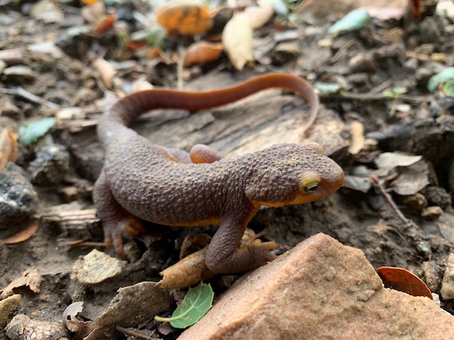
Taricha torosa – Coast Range newt
Submitted by Peter Gaede
Peter found this Coast Range newt, also commonly known as the California newt, out and about near Las Llagas Canyon in Santa Barbara County. This species is endemic to California and research has shown that coastal populations in Monterey County and south are suffering from habitat loss and because of this, is considered a California Special Species of Concern. Coast Range newts are terrestrial during warmer months and migrate to bodies of water to breed from December through March. Their rough skin gives off a poisonous neurotoxin known as tetrodotoxin to ward off predators. Tetrodotoxin is found throughout their skin, muscles, and blood and is strong enough to kill animals and even people. A study was conducted that showed the neurotoxin found in a single Coast Range newt’s skin is powerful enough to kill around 2,000 mice! Their sticky tongue helps them catch prey like worms, snails, slugs, and even their own eggs and larvae. They are found in chaparral, woodland, and grassland habitat. Currently, the database has 88 mapped occurrences along the southern coast from Monterey county to San Diego county. Thank you, Peter, for catching such a detailed look of this awesome amphibian!
Do you have some great photos of rare plants or wildlife detections? Submit them along with your findings through our Online Field Survey Form and see if your photos get showcased!