The  CNDDB Online Field Survey Form is a fantastic tool for observers to submit their findings to us. Often times, reporters include pictures of species and habitats along with the forms. Over the years, we have come across great photo submissions and want to start highlighting a few each month. Here are the April photos of the month!
Rana boylii – foothill yellow-legged frog
Submitted by Lauren Dusek of Stillwater Sciences
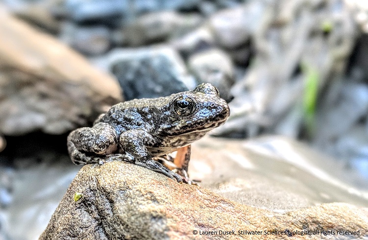
Lauren came across 2 adult foothill yellow-legged frogs perched on a rock near the Van Duzen River in Humboldt County and was able to snap a photo of one of them. Currently, Rana boylii is a candidate species for the California Endangered Species Act and has been a species of focus for the CNDDB for the past year. Thank you Lauren, for your great submission!
Erythronium citrinum var. citrinum – lemon-colored fawn lily
Submitted by Daniel D. Palmer of the California Department of Transportation
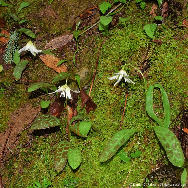
Daniel found these amazing plants in Trinity County along a road cut under the canopy of a hardwood, conifer mixed forest. Erythronium citrinum var. citrinum is a California Rare Plant Rank 4 plant found in northwestern California and up into Oregon. Thank you Daniel, for this amazing picture and submission!
Do you have some great photos of rare plant or wildlife detections? Submit them along with your findings through our Online Field Survey Form and see if your photos get showcased!