Science Spotlight

rss
  • May 4, 2017

bald eagle in flight, wings stretched above body
balk eagle in flight, wings nearly horizontal

Once on the verge of extinction in the lower 48 states, the bald eagle (Haliaeetus leucocephalus) has made a remarkable comeback in California. Management programs and protective laws (most notably, a ban on the pesticide DDT) have had a profoundly positive effect on both the reproductive success and survival rate of the species. Its breeding range is rapidly expanding and today, bald eagles can be found in 42 of California’s 58 counties, rebounding from a low of eight counties in the mid-1990s.

Though the U.S. Fish and Wildlife Service removed the bald eagle from its list of threatened and endangered species in 2007, the species remains endangered under California state law, and data is constantly being gathered and analyzed to support ongoing population recovery efforts. But studying California’s eagle population is more difficult than one might think. Although reports of single eagle sightings are a useful tool for determining range expansion, they are often inconsistent and inappropriate for estimating the overall population. A better method is documenting bald eagle observations and breeding territories and monitoring them over time. To do that, CDFW relies heavily on survey data submitted by other agency partners, researchers, consultants and the general public.

According to CDFW’s Statewide Raptor Coordinator Carie Battistone, there are two ways for members of the public to contribute to this important database.

Single observations can be reported using the California Natural Diversity Data Base (CNDDB) Online Field Survey Form. This may include breeding (for example, a nest location or a pair constructing a nest) or nonbreeding (a single bird foraging or perched) observations. For all data submissions, the more information that is provided to the CNDDB on population size, site condition, threats, etc., the better.

People who have more time (or experience in long-term monitoring) should use the link opens in new windowBald Eagle Nesting Territory Survey Form (PDF). This form is typically used by observers who monitor a nest frequently during an entire breeding season (from when a pair arrives at or builds a nest to when the young fledge). The information recorded on this form allows CDFW to determine nest success and productivity. Observers take notes during each survey they conduct, including behavior, the number of adults and young seen, number of fledglings, predation events, nest conditions, etc. Observers should closely follow the survey instructions and keep their distance from the eagles so as to not disturb breeding activities.

Various other types of data are tracked in CDFW’s databases, including the coordinates of observation or nest location, land ownership, the number of nests within a territory, the nest-tree type and nest condition, the number of surveys at a territory or nest, the number of adults or sub-adults seen, the number of eggs laid, the number of young fledged, predation events associated with an observation, general behavior, and other pertinent information.

“The more information we have on nest location, behaviors and breeding activities, the easier it is for us to decipher how eagles are using their territory and what the status is at any given site,” said Battistone.

According to Battistone, 371 nest sites have been reported and entered in CDFW’s bald eagle database to date (early 1990s through 2016). This data, however, is incomplete -- not all nests are reported or known, and of the nests that are entered in the database not all are surveyed every year.

CDFW receives regular reports of bald eagle sightings throughout the state during both the breeding and nonbreeding season, and as the population continues to grow and expand it is expected the number of sightings will continue to increase.

“Because the bald eagle population seems to be increasing in California, reports of new nests are not entirely surprising,” Battistone said. “However, to get a better understanding of the extent of the population increase and expansion throughout different regions of California, it is helpful to have the most complete dataset possible. We encourage and appreciate participation from the public!”

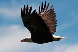
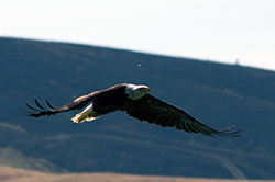
Bald eagle photos used with permission, courtesy of Marcia Grefsrud.

Categories: Wildlife Research
  • April 18, 2017

California hosts approximately 6,500 different kinds of plants that occur naturally in the state, and many of these are found nowhere else in the world. Some of these plants are so rare or have been so impacted by human influence that they are at risk of permanent extinction from the wild and have been protected by state and federal laws. The California Department of Fish and Wildlife’s (CDFW) Native Plant Program is developing and implementing standardized and repeatable monitoring plans for ten state and federally listed plant species on nine CDFW Ecological Reserves throughout the state. This work is funded by a federal grant awarded in 2015.

a man kneels to look at wildflowers

One of the plants being monitored is Butte County meadowfoam (Limnanthes floccosa ssp. californica), which occurs at North Table Mountain Ecological Reserve, north of Oroville in Butte County. The reserve is on an elevated basalt mesa that was created by ancient lava flows and supports a rare type of vernal pool called Northern Basalt Flow Vernal Pools. There were only 498 Butte County meadowfoam plants found on the reserve this spring. The reserve also supports a high diversity of other plant species that erupt with bright colors in the spring and attract hordes of visitors.

Another plant being monitored is the endangered Slender-petaled thelypodium (Thelypodium stenopetalum) that occurs at Baldwin Lake Ecological Reserve, in the San Bernardino Mountains near Big Bear. The reserve is in a unique environment known as the pebble plains, which only occur in Big Bear Valley and nearby Holcomb Valley. The pebble plains were formed when glaciers receded during the Pleistocene age and mainly consist of clay soils overlain by a layer of orange and white quartzite pebbles. Slender-petaled thelypodium only grows in this rare pebble plain habitat, and only 15 plants were found on the reserve last spring. Other rare plant species such as the endangered bird-foot checkerbloom (Sidalcea pedata) are found on the reserve and in the surrounding pebble plain habitat.

The monitoring project also includes plants at Little Red Mountain, Boggs Lake, Loch Lomond, Stone Ridge, Phoenix Field, Pine Hill and Apricum Hill Ecological Reserves. The grant is funded through January 2018 and the Native Plant Program has applied for another grant to continue this project.

Categories: General
  • April 6, 2017

Two women in lab coats simulate oiled bird intake
Three tan tents set up in campground

About 10 environmental scientists from CDFW’s Office of Spill Prevention and Response (OSPR) participated in a large-scale oil spill drill along the Feather River on March 21. The drill was intended to help wildlife response teams prepare for a potential train derailment. OSPR has a long history of oil spill response in marine environments but recently expanded its scope statewide to include inland waters. This Feather River exercise was the first time a substantial wildlife response drill has been held inland, testing responders’ abilities to resolve many operational and technical issues presented by a river spill.

Whereas marine spills typically require rescue of seabirds and occasionally marine mammals, the kinds of animals potentially affected by inland spills are quite different and varied, potentially including raptors, songbirds, reptiles, amphibians, rodents, foxes, and other mammals. The need to capture and care for these species during an oil spill presents unique challenges for scientist responders. The goal is to have the necessary protocols in place and practiced.

The drill was put on by the California Oiled Wildlife Care Network (OWCN), an organization funded by OSPR and managed by the UC Davis School of Veterinary Medicine to provide best achievable care of oiled wildlife. The OWCN currently maintains a network of 40 wildlife rehabilitation organizations, trained and ready to respond to oil spills anywhere in the state. Sixteen of these organizations participated in Tuesday’s drill, including two local organizations, Shasta Wildlife Rescue and Rehabilitation and North Valley Animal Disaster Group.

In addition to practicing wildlife response activities, the drill provided the opportunity to test a new Geographic Response Plan (GRP) for the Feather River. GRPs identify the location and nature of resources at risk in the event of a spill, and outline appropriate tactical response strategies to minimize oiling and other injury. During a real spill, OSPR environmental scientists serve as subject-matter experts who help ensure that the GRP is implemented appropriately. A simulated situation like this one gives them a valuable opportunity to conduct a realistic ‘dry run,’ as well as to analyze elements of the GRP and make adjustments as necessary.

To learn more about OSPR, visit www.wildlife.ca.gov/OSPR.

Categories: General
  • March 29, 2017

Pronghorn antelope (Antilocapra americana) were once one of the most numerous large mammals in California, with populations estimated to have been as high as 500,000 prior to the Gold Rush era. In the mid-1800s, pronghorn were nearly extirpated by market-shooting to feed California’s rapidly expanding human population.

The remaining population of pronghorn has long been understudied. Prior data collected on the species have been limited to herd counts and habitat selection. In recent years, there has been growing concern over pronghorn populations, particularly in northeastern California. During the harsh winter of 1992, the number of pronghorn dropped almost 50 percent to an estimated 5,000 individuals. The northeastern portion of the state currently supports a population of approximately 4,500 animals that occur primarily in Modoc, Lassen, Siskiyou and Shasta counties and has been fairly stable, with slow declines, since about 2000. The herd’s inability to rebound has prompted scientists to try to understand the specific conditions leading to the declines.

In 2016 the Institute for Wildlife Studies (IWS) completed a two-year study, with funding from CDFW’s Big Game Management Account, which explored aspects of the pronghorn population on the Modoc Plateau. The study involved 48 does (adult females) and 42 fawns that were radio-collared and followed until their deaths or the study’s end. The researcher’s objectives were to learn more about the pronghorn use of habitat, aspects of their reproduction and factors affecting survival of does and fawns.

The researchers found that for most of the year, pronghorn used open areas with less shrubby and more herbaceous vegetation within their sagebrush-steppe habitats. But during fawning, when does need to hide their young, they shifted to spending more time in areas with greater densities of shrubs and juniper trees. The annual survival rate for does in the study was 69 percent, which is low compared to other pronghorn populations. Mountain lions accounted for 80 percent of predator-related mortalities, most of which occurred during and just after the peak birthing period when does are most vulnerable. Fawn survival averaged 44 percent, a higher-than-typical figure, with unknown causes (37.5 percent) or suspected coyote predation (21 percent) accounting for most fawn mortalities.

The adults’ increased use of shrubby areas and conifer woodlands during fawning suggests an important factor in the population’s continued decline. Juniper woodlands have been encroaching on the sagebrush-steppe habitat in the Modoc Plateau for decades, and these juniper trees provide areas of concealment for ambush predators such as mountain lions. Most ungulate studies demonstrate that adult survival plays a more critical role in population stability than juvenile survival. CDFW may be able to reduce adult pronghorn mortality through habitat restoration – the removal of encroaching junipers could help to reduce predations by lions, and potentially increase the Modoc pronghorn population.

link opens in new windowRead complete report.

Categories: General
  • February 14, 2017

Arborimus albipes, a CA Critically Imperiled Species of Special Concern

The white-footed vole is one of the least-studied (and most difficult to catch!) mammals in North America. CDFW Environmental Scientist Dr. Scott Osborn, his collaborator Dr. Tim Bean of Humboldt State University’s Wildlife Department, and a small team of field biologists know that better than anyone – they spent the summer of 2014 setting traps for them in Humboldt and Del Norte counties. Designated a Species of Special Concern by CDFW, only nine records of the species were known in California prior to their study, which was aimed at determining how environmental conditions, such as climate (and future climate change), might affect their distribution.

Habitat modeling by Bean (based on the previous records) identified areas with high habitat suitability for the white-footed vole. Ten study sites were chosen along the North Coast for the field study, including three where voles had been successfully trapped in the 1990s. Using live traps (both pitfall traps made of two coffee cans taped together and Sherman live traps baited with oats and peanut butter), the team successfully trapped three voles. Notably, one of these was the first recorded capture of a white-footed vole in Del Norte County. All three voles were returned unharmed to their capture site after basic measurements and assessments of food plant preferences were made.

Although three voles might not seem like a large return on the investment of many hours of field work, the team actually had one of the highest capture rates of white-footed voles of any small mammal study in its geographic range, which includes coastal Oregon and the North Coast of California. Vegetation plots suggest that white-footed voles are tightly associated with stands of red alder trees – so now the biologists know that’s a likely place to find them. The habitat modeling work indicates that suitable habitat may currently exist as far south as Mendocino County, which is outside the known geographic range of the vole. On the other hand, it is possible that this species’ range may contract northward in a warmer and drier future. link opens in new windowOpen the Full Report (PDF)

bucket sunk into ground under shrubs   A tiny brown vole sits on green leaves in a metal bucket

Categories: Wildlife Research
CDFW Science Institute logo

Subscribe

Receive Science Institute news by email.