CNDDB News Blog

CNDDB logo

Subscribe

Sign up to receive new posts by email.

    Search

    All CNDDB Blog Posts

    rss

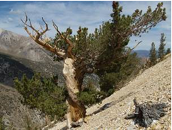
    California Native Plant Societytree on mountainside

    Space is available in two CNPS workshops on CNPS-CDFW vegetation mapping methods.

    Vegetation Rapid Assessment / Relevé
    July 19-21, UC WMRC Crooked Creek Station, White Mountains outside of Bishop
    Taught by Julie Evens, Vegetation Program Director, CNPS; Jennifer Buck-Diaz, Vegetation Ecologist, CNPS
    $555 CNPS Members / $585 Non-Members, INCLUDES ALL MEALS AND LODGING

    This course will be a combination of lecture and field exercises in vegetation sampling with a focus on collecting data using the CNPS-CDFW combined vegetation rapid assessment / relevé method. We will discuss applications of fine-scale vegetation sampling, classification and mapping, how to document rare natural communities, and how vegetation information fits into planning documents

    Vegetation Mapping
    August 1-3, UC Berkeley GIF Lab & field sites in Marin County
    Taught by Julie Evens, Vegetation Program Director, CNPS; Todd Keeler-Wolf, Senior Vegetation Ecologist, VegCAMP Program, CDFW; John Menke, Senior Vegetation Mapping Specialist, AIS
    $665 CNPS Members / $695 Non-Members

    Through a combination of field and computer exercises, participants will learn techniques for fine-scale vegetation mapping. Participants will learn about vegetation sampling, classification, and photo interpretation, practice creating a vegetation map using Geographic Information Systems, collect reconnaissance samples to support the 2nd edition of A Manual of California Vegetation classification, practice techniques of photo interpretation, delineation, and attribution, and validate a vegetation map through accuracy assessment.

    Categories:   General

    Room is still available in both our April 26th and April 27th training classes in San Diego.

    The CNDDB/RareFind/BIOS class is a six-hour course describing the background, purpose, and use of both the CNDDB dataset and the BIOS web-based map viewing tool (which includes access to the CNDDB). The class includes instruction and exercises on using many of the tools in both the online RareFind 5 and in BIOS 5, as well as viewing and querying the CNDDB dataset in BIOS. The course cost is $125. This class is open to people outside of the Department of Fish and Wildlife as well as to CDFW staff. The fee is waived for CDFW staff.  Registration information can be found on the CNDDB Training page.


    Categories:   General

    In October 2014, the CNDDB launched the Online Field Survey Form, an application designed to streamline submission of individual observations, capture data in a spatial database, and allow users to see reports of their submissions. As of February 2016 there are over 2,400 records in this system. For CNDDB subscribers we are making unprocessed animal observations from this system available after preliminary review via the CNDDB/Spotted Owl BIOS map viewer. The goal is to increase information flow, allowing users to view submissions before they are fully mapped and incorporated into RareFind5 and the CNDDB GIS data. Please consider submitting your observations of CNDDB tracked species via this tool. For additional information see the Online Field Survey Form section of the Submitting Data to the CNDDB webpage.

    Categories:   General