Van Damme SMCA Banner Image
Ten Mile Estuary SMCA Banner Image
Steamboat Rock SC Banner Image
Ano Nuevo SMR Banner Image
Farallon Islands SMR Banner Image
Carmel Pinnacles SMR Banner Image
Santa Barbara Island SMR Banner Image
Blue Cavern SMCA Banner Image
Long Point SMR Banner Image

California Marine Protected Areas (MPAs)

Find an MPA

Use the clickable map below to access regulations and maps, and further explore California MPAs, or see this list of MPAs by county

cell phoneMPA Interactive Web Map

Marine Protected Areas Overview

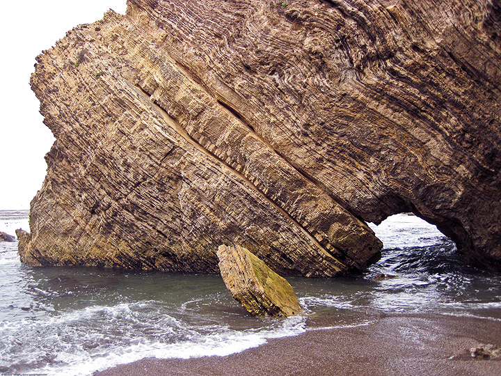
tall shoreline rock with arched hole

California's coast and ocean are among our most treasured resources. The productivity, wildness, and beauty found here is central to California's identity, heritage, and economy. The need to safeguard the long-term health of California's marine life was recognized by the California Legislature in 1999 with the passage of the Marine Life Protection Act. This Act aims to protect California’s marine natural heritage through establishing a statewide network of marine protected areas (MPAs) designed, created, and managed using sound science and stakeholder input.

MPAs protect the diversity and abundance of marine life, the habitats they depend on, and the integrity of marine ecosystems. The Marine Life Protection Act recognizes that a combination of MPAs with varied amounts of allowed activities and protections (marine reserves, marine conservation areas, and marine parks) can help conserve biological diversity, provide a sanctuary for marine life, and enhance recreational and educational opportunities. MPAs can also provide scientific reference points to assist with resource management decisions, and protect a variety of marine habitats, communities, and ecosystems for their economic and intrinsic value, for generations to come.

Learn more!

Frequently Asked Questions

What are marine protected areas (MPAs)?

MPAs are named, discrete geographic marine or estuarine areas designed to protect or conserve marine life and habitat. More information

MPA Network Interpretive Brochure (in English and Español)

Definitions and Acronyms

Marine Life Protection Act

What can I do in an MPA?

Unless specifically prohibited, all non-extractive uses such as swimming, wading, boating, diving and surfing are allowed in MPAs. The Marine Life Protection Act (MLPA) relies upon the Marine Managed Area Improvement Act (MMAIA) to define the types of MPAs and uses that are allowed within those MPAs. The MMAIA indicates that, to the extent possible, MPAs should be open to the public for managed enjoyment and study. One of the goals of the MLPA is to improve the recreational, educational and study opportunities within MPAs subject to minimal human disturbance. It is not the intent of the MLPA to prevent access to MPAs for non-extractive activities.

The three main types of MPAs – state marine reserve (SMR), state marine park (SMP), and state marine conservation area (SMCA) – each have different rules about the activities that may or may not be undertaken within the MPA. In general, SMRs do not allow any type of extractive activities (including fishing or kelp harvesting) with the exception of scientific collecting under a permit, SMPs do not allow any commercial extraction, and SMCAs restrict some types of commercial and/or recreational extraction.

How do I know where MPAs are located?

Most MPA boundaries are designed to use major onshore landmarks and simple due north/south or east/west lines for easy recognition. However, it is ultimately up to the user to determine if they are in an MPA. See the MPA map to find individual MPAs. In some cases, boundaries that are complex or hard to determine may be marked with buoys, however marking all MPA boundaries with buoys is not possible due to depths and ocean conditions.

Is it legal to travel through or anchor in an MPA with catch on board?

If an MPA is closed to fishing, entry, etc., will it always be closed?

Just because an area is closed to one type of use or another does not mean that it will always be that way. The adaptive management approach recommends that the MPAs be re-assessed regularly, and during that assessment the MPA designation can change.

The Marine Life Protection Act (MLPA) allows CDFW to re-examine MPAs and the MPA Network to determine how effectively they are meeting MLPA goals. This examination is accomplished during what is known as a Decadal Management Review. Every 10 years California's MPAs are assessed for effectiveness. Changes may be necessary, either to individual MPAs or the Network as a whole, depending on how well the MPAs are meeting their goals.


How do MPAs affect fishing regulations and closures?

MPAs and the Marine Life Protection Act are intended to complement existing fishery regulations and are not intended to replace existing regulations. MPAs address a broad array of ecosystem concerns and, in particular, allow for interactions between both fished and unfished species to occur in a more natural setting. If any changes to fisheries regulations were required in response to MPAs, this would occur through existing systems established in fisheries management plans and other regulatory frameworks.

More FAQs

Marine Region (Region 7)
Regional Manager: Dr. Craig Shuman
Main Office: 20 Lower Ragsdale Drive, Suite 100, Monterey, CA  93940
Email CDFW's Marine Region  |  (831) 649-2870
Office Locations  |  Marine Blog  |  Subscribe