Today we tip our hat to stoneflies, aquatic insects in the order Plecoptera. Stoneflies have a worldwide distribution of over 3,000 species, around 160 of which occur in California. They’re a hugely important part of riparian food webs!
Stoneflies spend the first 1-4 years of their life underwater as nymphs (or naiads). The nymphs require well-oxygenated water and are highly sensitive to pollution. They undergo successive molts, finally emerging from the water for their final molt into adult form when conditions are just right. Adults are typically winged, though not strong fliers, and survive just a few weeks to mate and lay their eggs over water, beginning the cycle again. Ralph and Lisa Cutter’s film,  Bugs of the Underworld, includes a beautifully-filmed stonefly’s-eye view of this life cycle.
Of the two stonefly species CNDDB currently tracks, the Lake Tahoe benthic stonefly (Capnia lacustra) is unusual in that it is wingless and spends its entire life cycle underwater, in the deep-water plant beds 30 to 90 meters below the surface of Lake Tahoe. UNR biologist Annie Caires documented an even more surprising adaptation during her studies of the species: live birth! An article in New Scientist shares more about Dr. Caires’ findings. Unfortunately, the studies also showed habitat and population declines for this unique organism.
At least seven of California’s native stonefly species have developed another astonishing behavior: communication by drumming! Certain species signal potential mates by tapping their posterior abdomens on resonant substrates, producing characteristic rhythms. Dedicated researchers have developed special equipment to record these unique drumming signals. John Sandberg, at CDFW’s Aquatic Bioassessment Lab at CSU Chico, takes his miniature stonefly recording studio into the field; his website includes instructions on how to build your own recording setup. If you’re not ready for that level of dedication, don’t worry: the website also has a page of downloadable recordings and videos of drumming for several species.
If you enjoy these sounds as much as we did, stay tuned for Dr. Sandberg and coauthor Luke Myers’ upcoming manuscript summarizing the known Nearctic signal description from 1977 to 2015. The manuscript, to be published in the online journal Illiesia, will provide a starting point for all future research.
Let the incredible sounds and remarkable behaviors of these tiny animals be a reminder to us all to pay more attention to the insects around us! See the Special Animals List on our website for a complete list of the insects and other invertebrates we track. And don’t forget to report your observations on our Online Field Survey Form!
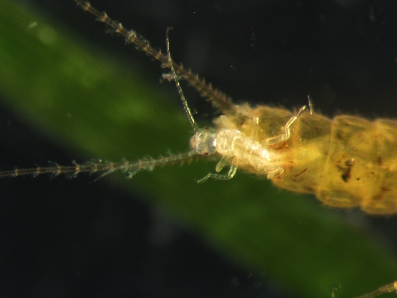
Live birth of Capnia lacustra nymph (Credit: Annie Caires)
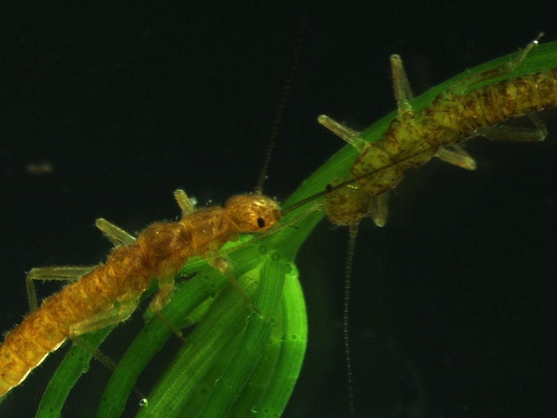
Wingless, aquatic adults of Capnia lacustra (credit: Annie Caires)