Overview
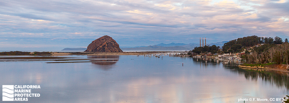
Morro Bay Estuary is a semi-enclosed body of water protected from full exposure to the Pacific Ocean by a lengthy sandspit running south from Morro Rock. Located in San Luis Obispo County, this estuary is one of the largest wetland ecosystems on California’s central coast. Fresh water flowing from Chorro and Los Osos creeks mixes with salt water from the ocean, creating a range of diverse ecosystems in the estuary that support many sensitive species.
Morro Bay State Marine Reserve (SMR) and Morro Bay State Marine Recreational Management Area (SMRMA) are neighboring marine managed areas that encompass nearly four square miles of this estuary. Morro Bay SMR protects less than one square mile of a very shallow, inland portion of the estuary including mostly tidal flats and coastal marsh habitats. Morro Bay SMRMA protects more than three square miles of sandy beach, tidal flat, coastal marsh, and eelgrass bed habitats. The estuary provides critical bird habitat, and is recognized as a National Estuary; the bay is also home to a small commercial fishing fleet, and partially borders the charming fishing and tourist town of Morro Bay.
Regulations
Morro Bay SMR
It is unlawful to injure, damage, take, or possess any living, geological, or cultural marine resource.
California Code of Regulations Title 14, Section 632(b)(92)(opens in new tab)
Morro Bay SMRMA
It is unlawful to injure, damage, take, or possess any living, geological, or cultural marine resource, EXCEPT:
Take of waterfowl in accordance with general waterfowl regulations is allowed. North of latitude 35° 19.700’ N only: Recreational take of finfish, commercial oyster aquaculture, and storing finfish taken outside of the SMRMA for bait purposes is allowed.
California Code of Regulations Title 14, Section 632(b)(91)(opens in new tab)
Quick Facts
Morro Bay SMR
MPA size: 0.88 square miles
Shoreline span: 0.8 miles
Depth range: 0 to 10 feet
Habitat composition*:
- Estuary: 0.83 square miles
- Coastal marsh: 1.64 square miles
Morro Bay SMRMA
SMRMA size: 3.07 square miles
Depth range: 0 to 18 feet
Shoreline span: 5.7 miles
Habitat composition*:
- Estuary: 3.02 square miles
- Eelgrass: 0.99 square miles
- Coastal marsh: 2.41 square miles
*Habitat calculations are based on three-dimensional area and may exceed the total MPA area listed above.