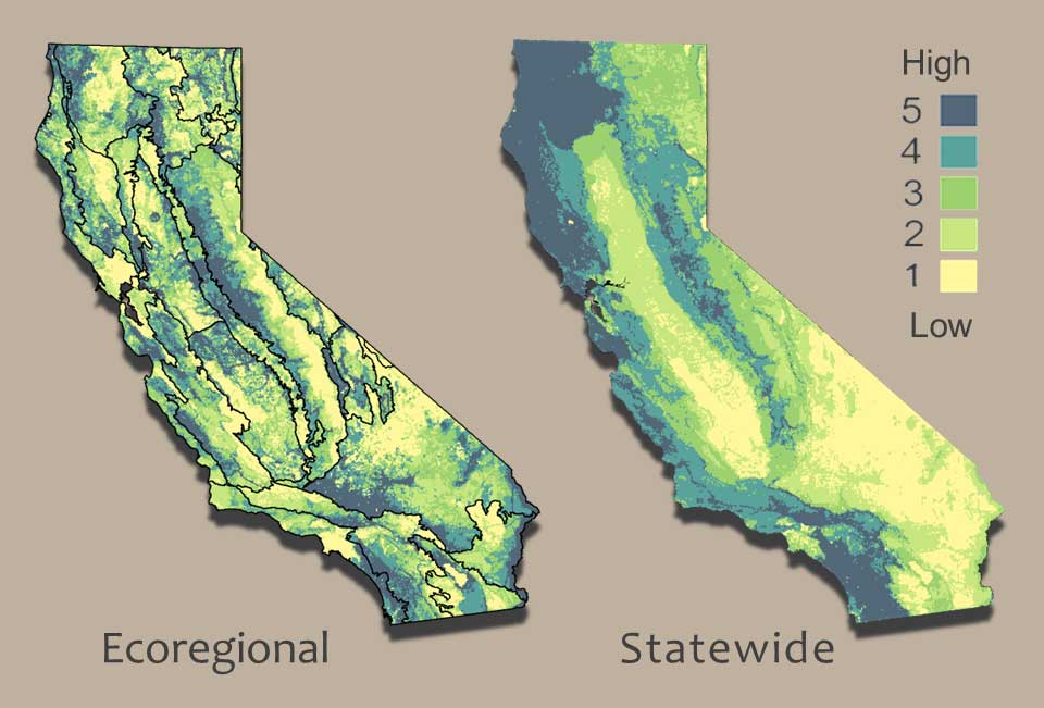
 Terrestrial Native Species Richness at Multiple Scales.
The Conservation Analysis Unit (CAU) maintains authoritative datasets on California’s wildlife, vegetation and habitats, conducts research to address conservation questions, and develops and maintains a suite of tools which leverage this information to assist a variety of stakeholders with conservation decision-making.
We seek to further knowledge and understanding of priority conservation areas through our data acquisitions and research programs which focus on landscape-level spatial analyses. These include habitat suitability modeling, species range and distribution modeling, climate change vulnerability assessments, habitat connectivity modeling, and the compilation and integration of other landscape datasets.
Contacts
| Name |
Title |
| Melanie Gogol-Prokurat, Ph.D. |
Lead Ecologist/ Supervisor (CAU, CNDDB) |
| Michael Hardy, Ph.D. |
Spatial Ecologist - Terrestrial Connectivity |
| Evan Greenspan |
RADMAP Project Lead - Ecological Modeler |
| ConservationAnalysis@wildlife.ca.gov |