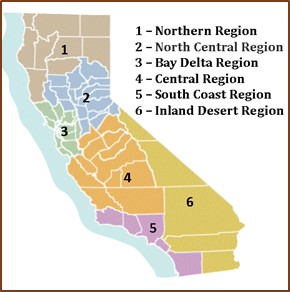
The CDFW divides the state into six terrestrial administrative Regions plus one marine region. Staff in each of the six terrestrial CDFW Regions identified linear segments of infrastructure that currently present barriers to wildlife populations in their jurisdiction. In doing so, the Regions used all available empirical information in their possession, including existing connectivity and road crossing studies, collared-animal movement data, roadkill observations, and professional expertise.
Barriers were defined as: Infrastructure or incompatible land uses that impede wildlife movement or population connectivity between habitat areas. Barriers are frequently long, linear segments of infrastructure such as roads, railways, and canals, as well as fencing. Barriers are also often land conversions between habitat areas; e.g., development or agricultural conversion between patches of natural lands.
The criteria used to evaluate the potential impact of barriers to wildlife populations include:
- Important habitat or landscape linkage identified in a species movement or regional connectivity study, or necessary for connectivity between or within important habitat blocks.
- Known ungulate migration routes, including those identified in response to SO 3362.
- Movement corridors for sensitive, keystone, or other high priority species according to species-specific studies, genetic studies, or published recovery plans.
- Known areas of high wildlife mortality due to infrastructure use (e.g., roadkill, drowning).
- Areas suggested by available data to be important or functionally significant crossing locations where barrier improvement would benefit wildlife populations, as identified by cameras or GPS data, or by the presence of landscape features where animals are known to cross more frequently than other areas (e.g., riparian corridors, canyon bottoms, ridges, and open space corridors).
- Areas where animals actively approach but are unable or refuse to cross.
- Quality of adjacent habitat surrounding the barrier within a landscape context.
- Durability of conservation status of adjacent lands (public lands, conservation easements, or lands with committed partners/landowners) and patch size.
- Linkages that could facilitate range shifts due to climate change (e.g., connects lower to higher elevations or habitats latitudinally).
- Areas also identified as fish passage barrier priorities.
Each Region then identified ten segments representing high priorities for remediation within their region, and the two top priority segments within each Region. Each barrier was placed into one of three groups based on remediation priority evaluated using the above criteria.
- Wildlife barriers: The full list of wildlife barrier locations identified to date where infrastructure or incompatible land uses impede wildlife movement or population connectivity between habitat areas.
- Priority wildlife barriers: The ten wildlife barrier segments with the highest priority for remediation in each of the six terrestrial CDFW Regions.
- Statewide top priorities: The two wildlife barrier segments with the highest priority for remediation in each of the six terrestrial CDFW Regions.