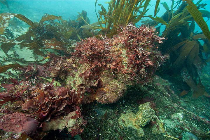
 Kelp and algae in Point Conception SMR. photo © R. Schwemmer/NOAA.
Point Conception, at the northwestern edge of the Southern California Bight, experiences dynamic mixing of cold, nutrient-rich water moving south with the California Current and warmer water moving north from the tropics. On the south-facing coast of Point Conception, waters are more protected and relatively warm; this warm water combines with cold water from the west-facing coast of Point Conception. The mixing of warm and cooler waters creates an incredibly productive area populated with copper rockfish, greenspotted rockfish, wolf-eel, red rock crab, squat lobster, brittle stars, and bubblegum coral.
The area around Point Conception SMR is a mix of volcanic and marine terrace geologic formations that have been carved by waves and wind to create protected coves, rocky reefs, sandy beaches, exposed intertidal zones, surfgrass beds, and some small creek-mouth estuary systems. The area also has natural petroleum deposits; these “tar mounds” are slowly pushed to the surface of the seafloor by shifting tectonic plates.
Offshore, whales frequently cruise past the point during migrations, while tuna, white seabass, and sharks are commonly found in the open ocean. Closer to shore, kelp forests provide refuge for sea otters, vermilion rockfish, gorgonian corals, moray eels, harbor seals, and other mammals, fishes, and invertebrates.
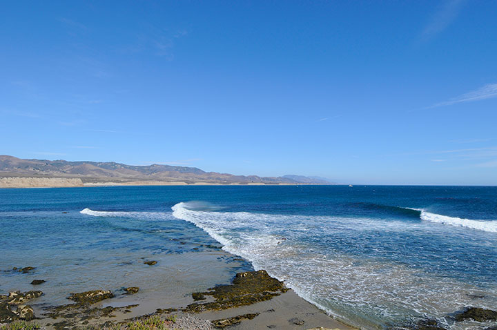 Looking towards Cojo Bay, near Point Conception. photo © R. Schwemmer/NOAA.
For centuries, Native American Tribes in California have relied on marine and coastal resources. Many Native American Tribes in California continue to regularly harvest marine resources within their ancestral territories and maintain relationships with the coast for ongoing customary uses. The areas surrounding Point Conception and much of the central coast have been home to a populous and prosperous native people known as the Chumash. The productive marine ecosystem still plays an important role in the lives of the Chumash people, who once used large ocean-going canoes, or tomols, to fish for large ocean fish, trap marine mammals, and trade amongst the widespread villages along the mainland and Channel Islands. The Chumash people called the point Humqaq, meaning “The Raven Comes” and believed that the channel between Point Conception and San Miguel Island was the pathway through which souls of the dead transitioned from this world to the next.
When Europeans began to settle on this coastline in the late 18th-century Mission Era, much of the surrounding land was used for cattle ranching and farms. The region also has a long history of active and productive fishing by Spanish, Russian, Mexican, Chinese, Japanese, and Italian settlers. With the many mariners traveling along the California coast, a lighthouse was built on the point in 1856, which remains one of the oldest lighthouses along the West Coast. In 1913, the land around Point Conception was bought by the Bixby family who used the area for sheep and cattle herding for decades, protecting this piece of the California coast from development.
However, in 2007 a Boston-based investment firm bought the property for $140 million with plans to develop the land. Over the next decade, due to illegal drilling, road construction, and habitat destruction, the plans for development were barred and, in 2017, the ranch was purchased by The Nature Conservancy and set aside as a nature preserve. With the SMR at Point Conception, this unique meeting of land and sea will be preserved in its wild state for future generations to enjoy.
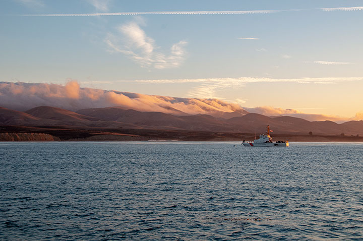 Looking towards Cojo Anchorage in Point Conception SMR. photo © R. Schwemmer/NOAA.
Bounded by private ranches and Vandenberg Space Force Base (previously Vandenberg Air Force Base), this MPA is quite challenging to access from land or sea. Its remoteness makes it one of the least-visited mainland MPAs along California’s south coast. While future development of the newly named Jack and Laura Dangermond Preserve (a nature preserve) will change access to Point Conception SMR, at this time the SMR is only accessible by boat.
Point Conception and Bixby Ranch are world-famous for their surf breaks, and scuba diving is possible at any of the protected reefs and coves. Due to protections afforded by the MPA and its location in a transitional zone between central and Southern California, it harbors some of the most abundant and diverse marine life in California. Point Conception SMR, though remote, is worth the effort to explore.