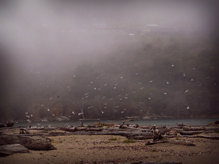
 Sea gulls and driftwood on the beach near the river mouth at Navarro River Estuary SMCA. photo © B. Johnson, CC BY-SA 2.0.
The Navarro River watershed is the largest coastal basin in Mendocino County, covering 315 square miles. This tidal river begins just south of the town of Philo, about 23 miles southeast of the SMCA in Anderson Valley. Flowing northwest, the river travels over 28 miles to the Pacific Ocean, much of it running through redwood forest on its way to the Navarro River Estuary SMCA.
From the mouth of the river, the MPA runs inland for about a mile, curving from the very wide, sandy beach to the Highway 1 Bridge. The north side of the estuary is a steep ridge that falls sharply into the river, while the south side is very low-lying and can occasionally flood during heavy rain events. Fresh water and saline ocean water mix in the estuary, creating a unique brackish water environment. It is not uncommon for a sand bar to form at the mouth of the estuary where ocean tides and river flow converge, temporarily separating the river and ocean environments.
Much of the area is lined with eelgrass beds where Dungeness crabs, ghost shrimp, and other invertebrates seek shelter. Flatfish, smelt, herring, and shiner perch use the protected estuary as a nursery ground. The estuary is also an important migration corridor for various species. Steelhead trout and coho salmon dwell in the estuary as juveniles before heading out to sea, and pass through the estuary as adults while migrating back to their spawning grounds upriver.
River otters also use the estuary as a transportation corridor and can be spotted swimming upstream. Other common wildlife sightings include roosting seabirds, harbor seals, California sea lions, and foraging shorebirds. From the beach, gray whales can occasionally be spotted out at sea as they migrate along this stretch of coast from December to April.
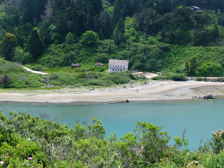 Captain Fletcher's Inn near Navarro River Estuary SMCA. photo © L. Kashiwada.
For centuries, Native American Tribes in California have relied on marine and coastal resources. Many Native American Tribes in California continue to regularly harvest marine resources within their ancestral territories and maintain relationships with the coast for ongoing customary uses. The Navarro River Estuary SMCA is located within the territory of the Central Coast Pomo people, known as the Bokéya Pó-ma. The Pomo word for the Navarro River is Nobá Da-bida. Through a factual record of historical take within the Navarro River Estuary SMCA, several tribes are exempt from MPA regulations.
In 1851, a Scottish sailor named Captain Charles Fletcher became the first European to settle along the Navarro River. In the early 1860s, he constructed an inn on the south shore of the estuary. He sold much of his land and constructed a lumber mill in 1861. The inn mainly housed sailors waiting the three-day period for their schooners to be loaded with lumber from the Navarro Mill. Fletcher also created the first ship-building enterprise in Navarro, building schooners to haul logs from the Mendocino coast. A train rail was constructed on the north bank of the river to transport logs across the estuary.
Over time, the town of Navarro reached a population of 1,000 people. A financial crisis forced the mill to shut in 1893, and after a series of fires and an earthquake, the once bustling town was significantly reduced. Throughout its history, Captain Fletcher's Inn served as a hotel for sailors, a stagecoach stop, a fishing resort, and eventually became known as Navarro-by-the-Sea. It ceased operations in the late 1970s, was purchased by California State Parks in 1996, and is now supported by State Parks and the Mendocino Area Parks Association as work continues to restore the historic building.
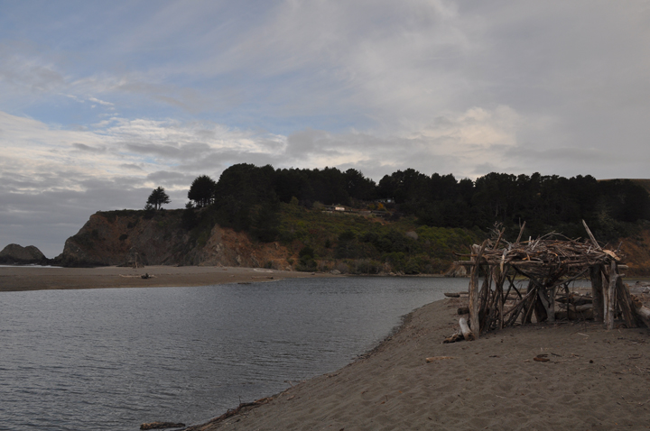 Driftwood structure built on the beach by visitors. photo © C. Steeds, CC BY 2.0.
Parking and a camping area are available off Highway 1 on Navarro Beach Road, located on the south side of the Navarro River Estuary SMCA. Navarro Beach Campground has 10 primitive sites that are available on a first-come, first-served basis. From the beach, look to the north and you may spot the striking Arch of the Navarro, a large rock arch jutting off the coastline.
The recreational take of salmonids by hook-and-line is allowed within the SMCA and fishing for steelhead is especially popular. Kayaking and canoeing are a peaceful way to explore the MPA and birdwatching opportunities abound within the estuary. West of the SMCA, Navarro Beach is a beautiful spot for beach walks and swimming. The estuary is the start of a river corridor that is surrounded by Navarro River Redwoods State Park. This 660 acre state park lines the river on either side and features spectacular redwoods.
This area consists of waters below the mean high tide line within the Navarro River Estuary, eastward of a line connecting the following two points:
39° 11.536 ′ N. lat. 123° 45.685 ′ W. long.; and
39° 11.489 ′ N. lat. 123° 45.516 ′ W. long.
and westward of a line connecting the following two points
39° 11.846 ′ N. lat. 123° 44.809 ′ W. long.; and
39° 11.803 ′ N. lat. 123° 44.843 ′ W. long.
California Code of Regulations Title 14, Section 632(b)(27)