James-Maughn_CC-BY-NC-2.0_HumpbackWhale_NaturalBridgesSMR.jpg?ver=41m9wZfnnmYKZE1kbfaJeQ%3d%3d) Humpback whale in Natural Bridges SMR. photo © J. Maugh, CC BY-NC 2.0.
Humpback whale in Natural Bridges SMR. photo © J. Maugh, CC BY-NC 2.0.
Most of Natural Bridges SMR stretches along a narrow band of rocky shoreline, interspersed with small sandy beaches, tidepools, and shallow wetlands. The intertidal area extends more than four miles along steep cliff faces, creating a sheltered habitat for sandcastle worms, acorn and gooseneck barnacles, mussels, anemones, bat stars, gobies, and tidepool sculpins. The tide recedes twice a day, creating pools teeming with life. Giant green anemones collect food with their tentacles, hermit crabs scuttle across colonies of mussels, and urchins and sea stars add color to the shallow waters.
Beyond the shoreline, surfgrass beds are anchored to the rocky seafloor, becoming exposed during low tides and submerged during high tides. The large clumps of surfgrass offer nursery habitat to a suite of plants and animals, improve water clarity, and protect the coast from erosion. During negative low tides, when the surfgrass is exposed to the air, birds feast on invertebrates seeking protection within the shoots of surfgrass. Surf smelt, barred surfperch, grass rockfish, copper rockfish, and lingcod inhabit the nearshore waters.
With ample offshore rocks and more than four miles of mostly undeveloped coastline, this MPA provides abundant feeding, resting, and breeding areas for migratory and resident birds. Black oystercatchers, plovers, willets, gulls, and godwits hunt onshore by probing the sand for buried prey or picking through the tidepools. Brown pelicans, cormorants, and murres dive in the productive waters to feast on schools of baitfish. Migrating whales, seals, and otters can often be spotted offshore.
Alison-Young_CC-BY-NC-2.0_FeatherBoaKelp_NaturalBridgesSMR.jpg?ver=1IrLyIMNfqJZDRyh0lEVGQ%3d%3d) Feather boa kelp at Natural Bridges SMR. photo © A. Young, CC BY-NC 2.0.
Feather boa kelp at Natural Bridges SMR. photo © A. Young, CC BY-NC 2.0.
For centuries, Native American Tribes in California have relied on marine and coastal resources. Many Native American Tribes in California continue to regularly harvest marine resources within their ancestral territories and maintain relationships with the coast for ongoing customary uses. The first people to inhabit this area were the Uypin tribe, whose descendants are now known as the Ohlone. The Uypin hunted marine mammals and harvested fish and shellfish throughout their territory. Today, the Ohlone maintain a presence along the Central Coast, with individuals living throughout the region and continuing traditional practices.
Spanish explorers first visited this area in the early 1600s. Mission Santa Cruz was founded in 1791, at about the time fur hunting and fishing in the area began to increase. By 1834, this area was governed by Mexican authorities who used the coastal lands for cattle grazing. A developer planned to build an exclusive hotel in the area, naming nearby streets after large cities in hopes that people from places such as Modesto and Sacramento would choose to build summer homes nearby. Financial troubles meant plans for the hotel never came to fruition. In 1933, the State of California purchased the land, ensuring its protection as a state park. Open space surrounded the state park until development began around the coastal property in the 1970s.
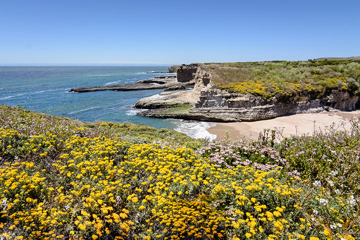
 Wilder Ranch State Park on the western edge of Natural Bridges SMR. photo © B. Kozera, CC BY-NC-ND 2.0.
Natural Bridges SMR lies adjacent to Natural Bridges State Beach, a 65-acre haven for outdoor enthusiasts. The beach is easily accessible with parking, restrooms, picnic tables, and a visitor center. The beach area is a great spot for beachcombing, building sandcastles, and tidepooling. From shore, wildlife viewing opportunities abound; bring binoculars to check out shorebirds, seals, sea otters, and migrating whales. Surfing and boogie boarding are also popular, and on windy days, windsurfers and kite flyers are common.
Natural Bridges State Beach also offers various educational opportunities. During low tides, docents lead tidepool explorations year round. During fall and winter, when monarch butterflies migrate through the area, butterfly tours leave from the visitor center on weekends. Guided nature walks are offered year round on topics ranging from wildflowers to birds. A network of trails through the Monarch Butterfly Natural Preserve and the Moore Creek Wetlands Natural Preserve offer hiking and exploration opportunities. Natural Bridges SMR prohibits take of any kind.