Estero Americano State Marine Recreational Management Area

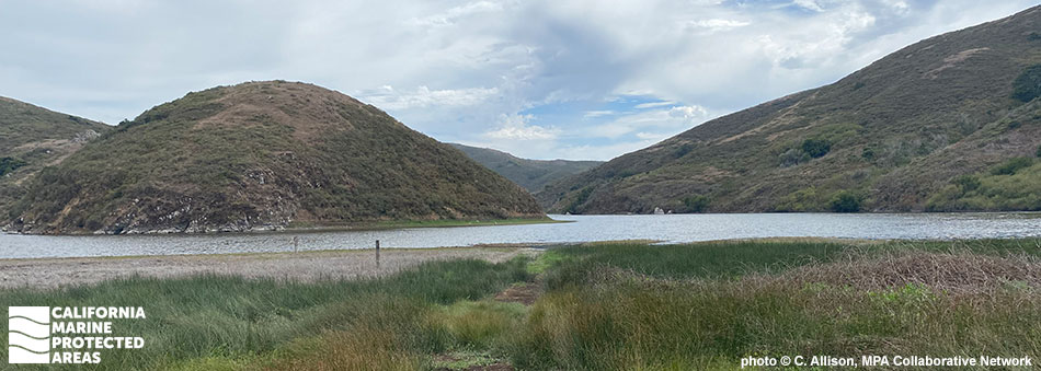
grey and blue skies meet round brown and green hills, they rolling into a small body of water, dark green salt grass lines the shore

Overview

Located on the border between Marin County and Sonoma County, Estero Americano State Marine Recreational Management Area (SMRMA) protects the western portion of Estero Americano Estuary and the adjacent shoreline. Though it is a relatively small Marine Managed Area (MMA), encompassing only about a tenth of a square mile and reaching a maximum depth of about 10 feet, a wide range of key habitats flourish in this environment. The estuary and tidal creek habitats contain beds of eelgrass, an important underwater plant that helps filter the water and provides food and habitat to many species.

Depending on the year and season, a sandbar may be present at the mouth of the estuary. Species that inhabit this MMA and benefit from its protection include striped bass, starry flounder, ghost shrimp, mud shrimp, brackish water clams, gobies, and a variety of seabirds. Sandy and rocky beach habitat are found where the estuary meets the Pacific Ocean. Because surrounding lands are privately owned, Estero Americano SMRMA is not easily accessible by foot or car. The best way for the public to access the SMRMA is through events regularly hosted by the Sonoma Land Trust, but it is also feasible to reach the SMRMA by boat or kayak.

Regulations

It is unlawful to injure, damage, take, or possess any living, geological, or cultural marine resource, EXCEPT:

Take of waterfowl in accordance with general waterfowl regulations is allowed.

California Code of Regulations Title 14, Section 632(b)(41)(opens in new tab)

Quick Facts

SMRMA size: 0.13 square miles

Shoreline span: 1.2 miles

Depth range: 0 to 10 feet

Habitat composition*:

  • Estuary: 0.12 square miles
  • Eelgrass: 0.01 square miles
  • Coastal marsh: 0.03 square miles

*Habitat calculations are based on 3-dimensional area and may exceed the total MPA area listed above.

About Estero Americano State Marine Recreational Management Area

Natural History

standing atop a hillside, an interpretive sign surrounded by knee high brush, has photos of local birds and mammals, down the hill the creek weaves in and out of other brown hills
Looking southwest from Estero Lane to Estero Americano SMRMA. photo © C. Allison, MPA Collaborative Network

The Estero Americano estuary environment is dynamic and subject to significant seasonal changes. During rainy winters, narrow streams flow towards the Pacific and often flood, while the mouth of the estuary widens. In summer droughts, parts of the estuary can significantly dry up. More than 44 marine and freshwater fish species inhabit the tidal estuary, including steelhead trout and tidewater goby. Nearly 140 different species of birds use the shallow waters and surrounding wetland habitat.

The diverse wetland region consists of brackish marsh, freshwater marsh, mudflats and estuarine creeks, with grazed pastures and willow thickets lining the banks. Due to the diverse array of habitats and the hundreds of species that populate the region, the Estero Americano Estuary has been recognized by the California Department of Fish and Wildlife as one of the most important habitat areas in the state.


Cultural History

fine lengths of yellow green salt grass meet on soft sandy soil in sturdy stems
Salt grass in Estero Americano SMRMA. photo © Isleofcondors, CC BY-NC 2.0

For centuries, Native American Tribes in California have relied on marine and coastal resources. Many Native American Tribes in California continue to regularly harvest marine resources within their ancestral territories and maintain relationships with the coast for ongoing customary uses. The native Miwok peoples inhabited the coastal area around Estero Americano Estuary until the end of the 18th century. The Miwok were hunter-gatherers and relied on certain marine resources for food, including salmon and seaweed.

However, the indigenous peoples were quickly overrun by foreign explorers after Spanish ships arrived in the 1700s. One of the first ships carried Don Juan Francisco de la Bodega y Quadra, for whom Bodega Bay was named. The area became inundated with European pioneers, from Spanish fleets to Russian fur traders hunting seals and otters. When Mexico gained independence from Spain, the Spanish lands passed to Mexican citizens, who established ranches throughout what is now Sonoma County. Beginning in the mid 1800s, the area around Estero Americano Estuary was heavily used for agriculture. Due to over 100 years of human activity in the surrounding watershed, sedimentation became a pervasive problem.

In 2016, a handful of conservation groups dedicated to preserving this environment, including the Sonoma Land Trust and the California Coastal Conservancy, purchased a 547-acre ranch in the area and are now committed to protecting this iconic coastal ecosystem.


Recreation

a white kayak sits on coarse sand in the foreground, green calm waters extend out to rolling green hills meeting an overcast gray sky
A kayak ready for launch at Estero Americano SMRMA. photo © D. L. Brown, CC BY-NC 2.0

Estero Americano SMRMA prohibits the take of all living marine resources, except for recreational waterfowl hunting. The estuary flows into Bodega Bay, with Doran Regional Park to the north and Dillon Beach to the south. Windsurfing, fishing, kayaking and camping are popular activities along this stretch of coast.

Since this MMA is inaccessible by land, public visitors can launch a boat or kayak at Doran Boat Launch and travel south to reach the shore along the estuary; just be sure to check the tides. The closest campgrounds are north of the estuary at Doran Regional Park or Bodega Dunes, or Lawson’s Landing near Dillon Beach to the south.

Just outside of the MMA in Bodega Bay, fishing charters offer the opportunity to dive into the local fishing scene and catch salmon, rockfish, and crab. Home to an abundance of wildlife, visitors and hikers can soak up the picturesque scenery dotted with wildflowers from a spring bloom, birds flying overhead, and fish meandering in the estuarine waters.

Boundary

This area includes the waters below the mean high tide line within Estero Americano westward of longitude:
122° 59.250' W.

California Code of Regulations Title 14, Section 632(b)(41)

Downloads for Estero Americano State Marine Recreational Management Area

Map

Map of Estero Americano State Marine Recreational Management Area - click to enlarge in new tab

Facts, Map & Regulations

MPA fact sheet - click to enlarge in new tab