South Fork Eel River Adult Steelhead Sonar Monitoring Project
California Trout, Inc.
Overview
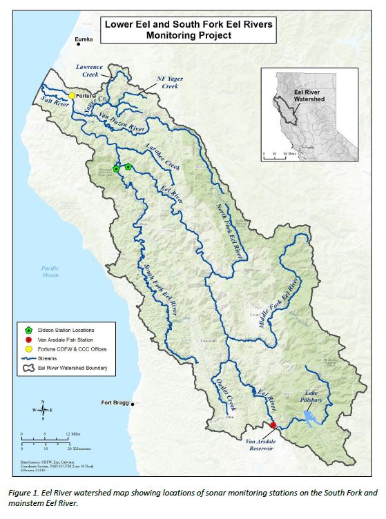
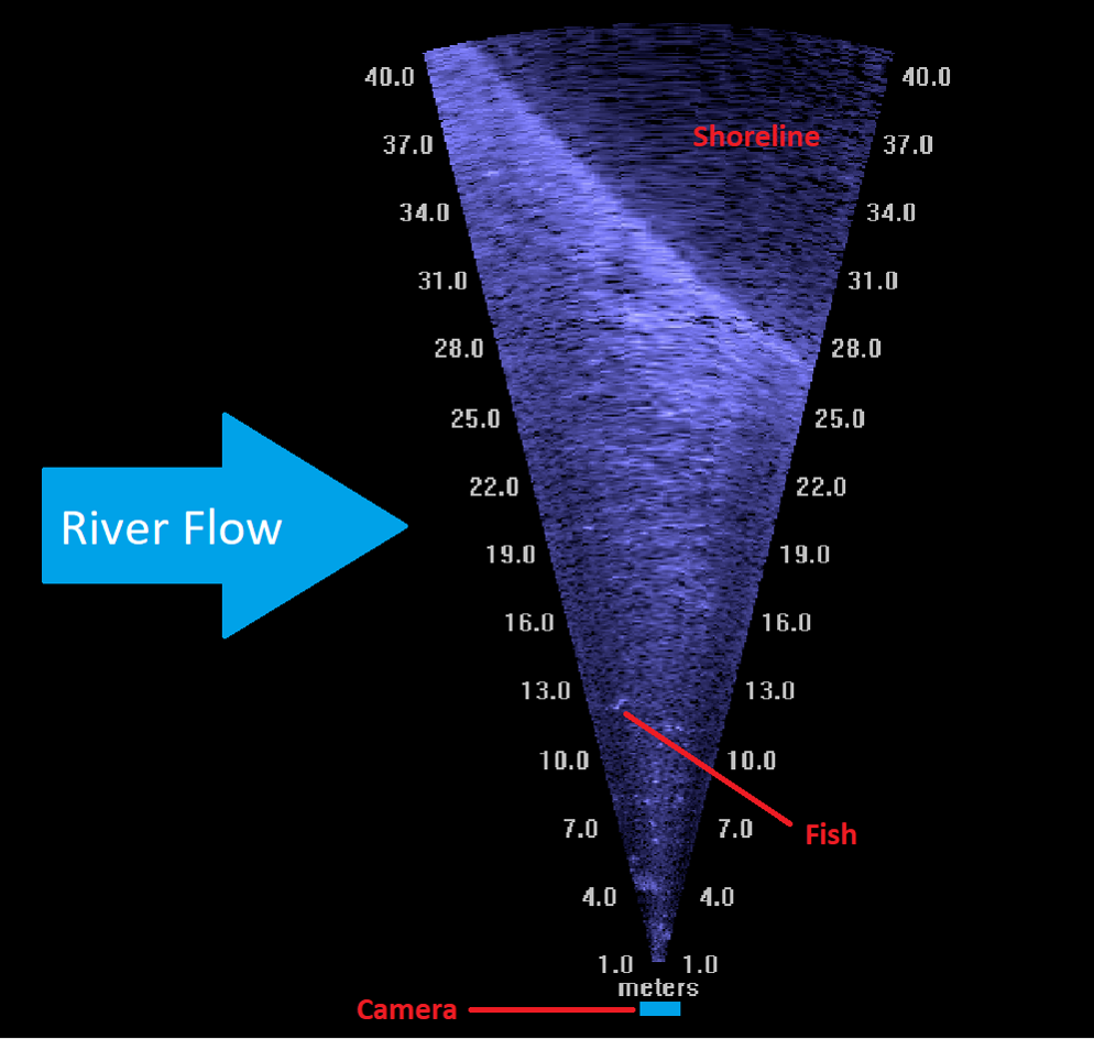
ARIS/DIDSON sonar equipment will be used to estimate the number of steelhead entering the South Fork Eel River to spawn, as well as the number of spawners returning to the ocean. The project provides a direct benefit to anglers with conservation concerns who wish to know the run size of the South Fork Eel River steelhead population. The project will also inform CDFW of the number of wild steelhead and Chinook Salmon available for the in-river catch and release recreational survey by helping assess angler impact on the resource by providing a comparison between the total escapement estimate and the number of released steelhead reported through the Steelhead Report Card program. Additionally, the project will be used to help educate anglers on conservation issues through public events such as the Humboldt Steelhead Days celebrating the Eel River's famed steelhead runs.
Project Updates
California Trout has used funding from the CDFW Steelhead Report and Restoration Card Program to enumerate the 2018-19 spawning run of Steelhead, Chinook Salmon, and Coho Salmon on the South Fork Eel River with a SONAR video camera. The camera was deployed from November 22, 2018 until May 15, 2019
Population Estimates 2018-19
- Steelhead - 3,382
- Coho Salmon - 1,980
- Chinook Salmon - 3,831
Maps/Images

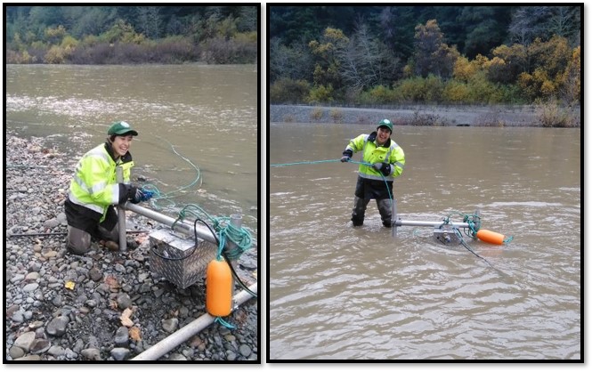
 Qing-Qiu Swain setting up and deploying a sonar camera in custom housing on the South Fork Eel River - November 2018. Photo by Matt Metheny.
 Photo by Matt Metheny.
North Cow Creek Fish Barrier Removal
Western Shasta Resource Conservation District
Overview
This project will provide design plans to remove or modify a fish barrier and improve fish passage over the abandoned pipe siphon in North Cow Creek. The siphon impedes adult steelhead and Chinook Salmon passage at flows under approximately 500 cubic feet per second(cfs)and juvenile steelhead and Chinook Salmon passage at flows under approximately 100 cfs. Consultants will be subcontracted to provide options on how to appropriately address fish passage and stay in compliance with environmental regulations; the modification or removal of the pipe will be determined with the completion of the designs. A working partnership will be established between private organizations, agencies (local, state, and federal), and landowners. The completion of this project design is the first phase of a multi-phase project that will lead to the modification or removal of a fish passage barrier, which will increase the number of fish able to migrate upstream in North Cow Creek. Final design plans will be determined through a Technical Advisory Committee (TAC) comprised of engineers, environmental agencies, and consultants.
Field data (longitudinal profile, locations of structures, etc.) to complete the project design was collected in late summer 2019. The design engineer, Cascade Stream Solutions (Cascade), believes if the siphon is removed, the streambed will headcut upstream eliminating the abrupt change in grade and allow for fish passage in a wide range of conditions; however, the time period required for the channel slope to adjust and reach a stable slope is unknown. Cascade developed three options for stakeholder consideration.
Option A
Removes the siphon and slopes the stream bed at about 10 percent to catch existing ground. It is likely prudent to identify the stability of the upstream bed by scarifying the upstream substrate and assessing the bed's structural integrity. If the bed substrate needs to be loosened to ensure natural mobilization during moderate flows an excavator will be used to do so.
Site Grading Plans and Cross Sections
Option B
The same as Option A, but with a re-profiled bed slope of 7.5 percent.
Site Grading Plans and Cross Sections
Option C3
Similar to Options A and B, but involves re-profiling the streambed to a slope of about 1.5 percent, which is the slope Cascade believes the channel is likely to evolve to match.
Site Grading Plans and Cross Sections
Expected Changes to Flow Velocity
Cascade used SRH-2D, a two-dimensional depth averaged hydraulic model, to compare flow conditions between the existing conditions and Options A and C3. The models are not calibrated but provide a qualitative assessment of flow conditions. The velocity scale was capped at 7 feet per second (fps) to simplify the visual comparison between scenarios.
SRH-2D Contour Plots (100 and 500 cfs)
Cascade, CDFW, and NOAA engineers identified three goals for the design:
- creating immediate fish passage for juvenile salmonids
- allowing the streambed to naturally reconfigure itself
- limiting the amount of project impact and disturbance
In order to achieve these goals, a compromise between Option A and Option C3 would be preferable. The suggested design strategy is to create the channel gradient conditions created in Option C3, but not spanning the entire width of the channel. A 10-foot-wide channel will be re-graded in order to create the 1.5 percent slope conditions that create desirable flow velocities. If the hydraulic analysis reveals velocity conditions that are too high in the channel to allow adult and juvenile fish to migrate upstream, Cascade will incorporate ‘alcoves’ branching from the 10-foot-wide channel to lessen the velocities.
A secondary suggestion was to move the 180 linear ft of channel re-grading downstream. Design option C3 puts most of the stream re-grading upstream of where the siphon will be removed. Moving the excavation area downstream may allow for more of a balance between the cut and fill by filling in the area where the siphon will be removed.
Cascade will be taking these design objectives, analyzing the hydraulic conditions they would create, and submitting a final design for review.
Maps/Images


 Western Shasta. RCD photo by Ross Perry.
 CDFW Photo by Patricia Bratcher.