What is the Refuge Water Supply Program?
The goal of CDFW's Refuge Water Supply Program (RWSP) is to implement the Central Valley Project Improvement Act (CVPIA) mandate to provide "firm water supplies of a suitable quality and quantity to maintain and improve wetland habitat." Water delivery to state managed wetlands includes Gray Lodge WA, North Grasslands WA (China Island and Salt Slough Units), Volta WA, Los Banos WA, and Mendota WA, and is provided by Reclamation through two long-term contracts with CDFW. CVPIA also requires upgrading or building conveyance facilities necessary to deliver required amounts of water to each of the 19 managed wetlands. CVPIA refuge water supply is mitigation for both Central Valley Project (CVP) operations and the closure and cleanup of Kesterson Reservoir.
The cost share component of RWSP activities are divided by activities relating to the two types of water supply provided by the program: Level 2 and Incremental Level 4. Level 2 water supply costs are reimbursable by CVP contractors. Incremental Level 4 water supply costs have a 25% state cost share component which can be directly reimbursed by the state or through in-kind contributions. The state participates in RWSP cost share by providing state grants for refuge water conveyance projects and through in-kind refuge water supply.
See Program Details for more information.
What is the CDFW's Role in the Refuge Water Supply Program?
CDFW coordinates closely with the U.S. Bureau of Reclamation, U.S. Fish and Wildlife Service, Grassland Resource Conservation District, and the Central Valley Joint Venture to provide and manage water supplies for wetland habitat on 19 specific federal, state, and private managed wetlands in the Central Valley as identified in Section 3406(d) of the Central Valley Project Improvement Act (CVPIA).
CVPIA Refuge Area Locations
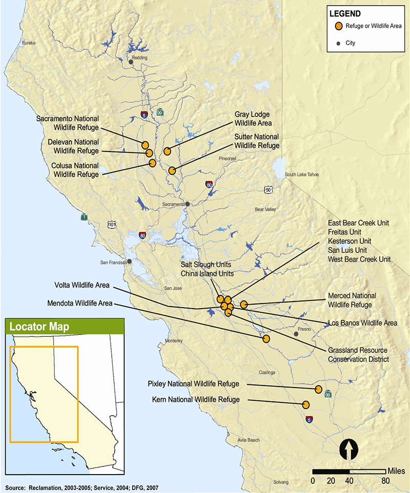 Map showing locations of the 19 wetland habitat areas. (click to enlarge)
Documents
External Program Partners
For more information, contact Jeffrey Shu at (916) 539-8951 or Jeffrey.Shu@Wildlife.ca.gov