South La Jolla State Marine Reserve/State Marine Conservation Area

a tree growing precariously from an embankment above a rocky beach at sunset

Overview

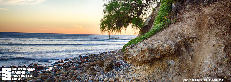
Located approximately 10 miles north of the City of San Diego, South La Jolla State Marine Reserve (SMR) and South La Jolla State Marine Conservation Area (SMCA) are adjoining marine protected areas (MPAs) that protect an array of habitats.

South La Jolla SMR provides protection for more than five square miles of dense kelp forest, rocky and sandy intertidal areas, and rocky reefs. This MPA’s diverse habitats are home to spawning grunion, garibaldi, giant sea bass, and leopard sharks.

South La Jolla SMCA provides protection for nearly two and a half square miles of sandy seafloor, dense kelp forests, and rocky reefs. These habitats are home to an array of creatures including abalone, yellowtail, brown pelicans, and California sea lions.

With an onshore-offshore orientation, the larger SMR stretches from shore to a depth of 180 feet where it meets the adjacent SMCA. The SMCA extends to the three-nautical-mile state water limit, reaching depths greater than 270 feet. Encompassing a variety of habitats and depths, there are many ways to enjoy the South La Jolla MPAs, including surfing, birdwatching, tidepooling, kayaking, snorkeling, and scuba diving.

Regulations

South La Jolla SMR

It is unlawful to injure, damage, take, or possess any living, geological, or cultural marine resource.

California Code of Regulations Title 14, Section 632(b)(143)(opens in new tab)

South La Jolla SMCA

It is unlawful to injure, damage, take, or possess any living, geological, or cultural marine resource, EXCEPT:
Recreational take of pelagic finfish (northern anchovy, barracudas, billfishes, dorado (dolphinfish), Pacific herring, jack mackerel, Pacific mackerel, salmon, Pacific sardine, blue shark, salmon shark, shortfin mako shark, thresher shark, swordfish, tunas, Pacific bonito, and yellowtail) by hook-and-line only is allowed.

California Code of Regulations Title 14, Section 632(b)(144)(opens in new tab)

Quick Facts

South La Jolla SMR

MPA size: 5.04 square miles

Shoreline span: 2.3 miles

Depth range: 0 to 180 feet

Habitat composition*:

  • Rock: 5.55 square miles
  • Sand/mud: 2.67 square miles

South La Jolla SMCA

MPA size: 2.46 square miles

Depth range: 147 to 275 feet

Habitat composition*:

  • Rock: 0.60 square miles
  • Sand: 1.85 square miles

*Habitat calculations are based on 3-dimensional area and may exceed the total MPA area listed above.

Photo Gallery

14 JUL
2022

Pacific white-sided dolphin in South La Jolla SMCA

0

photo © kmherpkid, CC BY-NC 2.0

Showing 0 Comment

Video Gallery

Southern California Marine Protected Area Highlights

California's MPA Network

About South La Jolla State Marine Reserve/State Marine Conservation Area

Natural History

tall white bird with long beak and legs in a tidepool
Snowy egret in a tidepool at South La Jolla SMR. photo © BJ Stacey, CC BY-NC 2.0

The area around San Diego once received much more rain than it does now, and large rivers and lagoons were common in ancient times. The combination of these ancient lagoons, rivers, and tectonic activity created the coves, sea cliffs, and canyons of the MPAs we see today. Kelp forests, surfgrass beds, hard and soft sea floor, sandy beaches, and rocky shores exist within these MPAs, creating conditions for high biological diversity.

These environments support a rich assemblage of marine creatures including invertebrates like aggregating anemones, mantis shrimp, and sea stars, and fish such as grunion, barred sand bass, black perch, and garibaldi. It is also common to see sea lions, flocks of brown pelicans, and occasionally migrating gray whales. All seven species of abalone found in California are protected within South La Jolla SMR and SMCA. Along the shore, cliffs provide nooks for roosting seabirds and wave-cut marine terraces provide the occasional harbor seal with a resting place.

Cultural History

an exposed rock, surrounded by ocean, covered with seabirds
Bird Rock, in South La Jolla SMR. Photo © Russell Street, CC BY-SA 2.0

For centuries, Native American Tribes in California have relied on marine and coastal resources. Many Native American Tribes in California continue to regularly harvest marine resources within their ancestral territories and maintain relationships with the coast for ongoing customary uses. Kumeyaay people have lived and currently live in San Diego County. The tidepools of La Jolla, teeming with edible animals and plants, were harvested by the Kumeyaay for both food and jewelry for thousands of years. Abundant Native American prehistoric artifacts and human remains have been found along this stretch of coast.

European exploration in Southern California began in 1602 when Sebastian Vizcaino was sent by Spain to map the California coast. Settlement did not begin, however, until 1769 with the Portola Expedition and beginning of the Mission Era. With Spanish settlement, the land was used for cattle ranching, farming, and logging, which transformed the landscape. After the United States acquired California in 1848, homesteading and small communities began to form. A large housing boom in 1880 sparked the interest of developers from the bustling port city of San Diego, and La Jolla began to develop into a seaside residential town. Nearby, Scripps Institution of Oceanography, one of the oldest marine science research facilities in the United States, remains a hub for cutting-edge marine research. The MPAs are some of the most studied temperate marine systems in the world.

Recreation

surfer in the water below large rocks
A surfer entering the water in South La Jolla SMR. photo © Jason Rosenberg, CC BY 2.0

In South La Jolla SMR, there is no take of any marine resource permitted. The MPA is easily accessed and provides many recreational opportunities. While the SMCA is offshore and only accessible by boat or kayak, it does offer opportunities for fishing. Recreational anglers are permitted to fish by hook-and-line for pelagic finfish within the South La Jolla SMCA, but no other take is permitted.

Visitors and residents can enjoy surfing, kayaking, scuba diving, snorkeling, tidepooling, and sunbathing. Beginning to intermediate surfers can catch waves at Law Street Beach or Tourmaline, while the more experienced can venture to Big Rock or Bird Rock. Snorkeling and scuba diving can also be rewarding with the right mix of conditions. Low tide exposes tidepools with the best spots being at Sun Gold Point, Bird Rock, and Pacific Beach (False) Point.

Calumet Park, Tourmaline Surfing Park, and Palisades Park offer beautiful views of the MPAs. An expansive sandy beach can be found south of Pacific Beach Point and to the north lie many secluded coves. Many local species living within the La Jolla MPAs can be observed at nearby Birch Aquarium, which is affiliated with the Scripps Institution of Oceanography and open to the public.

Coordinates

South La Jolla SMR

This area is bounded by the mean high tide line and straight lines connecting the following points in the order listed:

32° 49.573′ N. lat. 117° 16.781′ W. long.;
32° 49.573′ N. lat. 117° 19.000′ W. long.;
32° 47.945′ N. lat. 117° 19.000′ W. long.; and
32° 47.945′ N. lat. 117° 15.495′ W. long.

California Code of Regulations Title 14, Section 632(b)(143)

South La Jolla SMCA

This area is bounded by straight lines connecting the following points in the order listed except where noted:

32° 49.573′ N. lat. 117° 19.000′ W. long.;
32° 49.573′ N. lat. 117° 20.528′ W. long.; thence southward along the three nautical mile offshore boundary to
32° 47.945′ N. lat. 117° 20.068′ W. long.;
32° 47.945′ N. lat. 117° 19.000′ W. long.; and
32° 49.573′ N. lat. 117° 19.000′ W. long.

California Code of Regulations Title 14, Section 632(b)(144)

Downloads for South La Jolla SMR

Map

Map of South La Jolla State Marine Reserve - click to enlarge in new tab

Facts, Map & Regulations

MPA fact sheet - click to enlarge in new tab

Downloads for South La Jolla SMCA

Map

Map of South La Jolla State Marine Conservation Area - click to enlarge in new tab

Facts, Map & Regulations

MPA fact sheet - click to enlarge in new tab