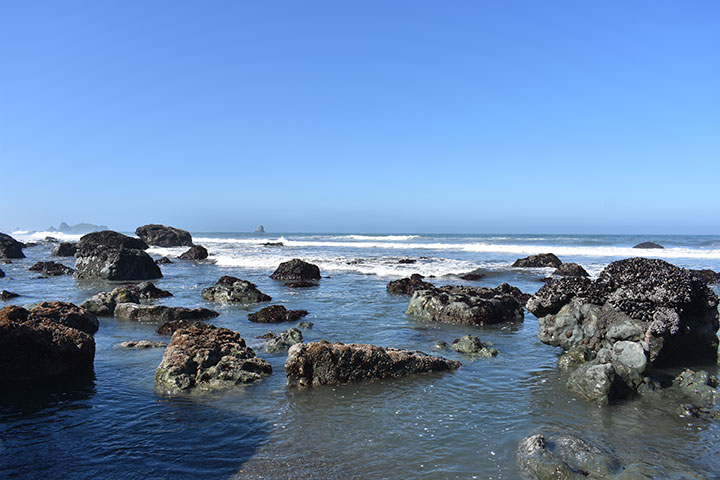
 Rocky intertidal area at Pyramid Point SMCA. photo © Rosa Laucci, CC BY-NC 2.0.
The shore that borders Pyramid Point SMCA consists of sandy beaches backed by coastal bluffs. The bluffs are composed of cobble and beach sands, pushed upwards by tectonic activity to form a marine terrace, which is a landform that persists inland. Dune fields cover the bluffs and terrace in the southern part of the MPA. The coastline offers walkable beaches strewn with driftwood washed ashore by waves and high tides.
A predominantly sandy seafloor comprises the majority of submerged habitat. With a gently sloping seafloor producing steady plunging waves, the nearshore habitat is ideal for surf smelt, surfperch, and sand crabs. Interspersed amongst the soft seafloor, shallow submerged rocks and rocky reefs provide habitat for lingcod, black rockfish, canary rockfish, blue rockfish, abalone, anemones, urchins, and sea cucumbers.
Above water, the offshore rocks provide habitat for cackling geese while also hosting some of California’s only breeding colonies of tufted puffins and fork-tailed storm petrels. Large rookeries of great blue heron, black-crowned night heron, and snowy egrets also find refuge on Pyramid Point SMCA’s offshore rocks.
Recent surveys inside Pyramid Point SMCA have documented unprecedented losses of kelp due to a dramatic increase in purple urchins, which are voracious herbivores. Formerly lush kelp forests have given way to “urchin barrens”, expanses of bare rock carpeted with hungry urchins. These hardy, spiny creatures often outcompete other herbivores such as abalone. Local red abalone populations have decreased considerably over the last few years. The rise of urchins and associated decline in kelp and abalone is likely due to a combination of issues including unusually high ocean temperatures, changing ocean circulation patterns caused by climate change, and the decimation of sea star populations–major urchin predators–due to Sea Star Wasting Syndrome. Researchers are working to better understand these issues. This MPA may provide a reference point for the surrounding fished areas to determine if recovery within the MPA is more rapid than outside the MPA, and may help to enable appropriate management decisions.
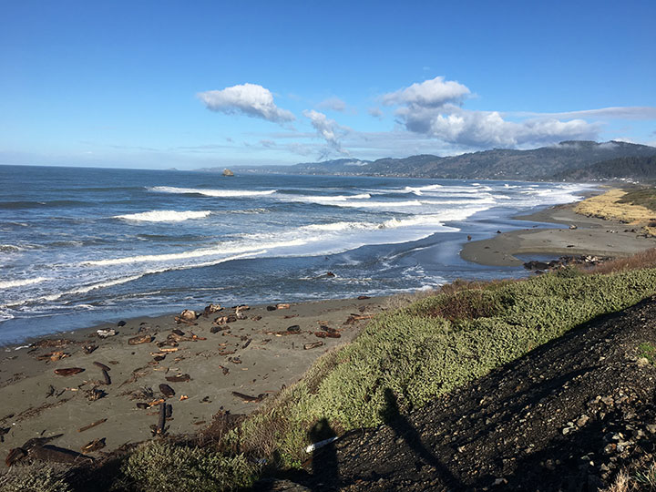 Looking north from the southern boundary at Pyramid Point SMCA. photo © Rosa Laucci, CC BY-NC 2.0.
For centuries, Native American Tribes in California have relied on marine and coastal resources. Many Native American Tribes in California continue to regularly harvest marine resources within their ancestral territories and maintain relationships with the coast for ongoing customary uses. Tolowa Dee-ni’ people have occupied village sites from just north of False Klamath to the Sixes River in Oregon, and up watersheds extending inland from the sea, for thousands of years. They call Pyramid Point Tr’uu-luu-k’wvt, which means “line-fishing-upon”. It is situated in the heart of the Tolowa Dee-ni’ ancestral territory. Through a factual record of historical take within the Pyramid Point SMCA, the Tolowa Dee-ni' Nation is exempt from the MPA regulations.
The first documented European activity in the area traces back to the early 1820s. Jedediah Smith arrived with a group of fur trappers in what is now Del Norte County and named California’s northernmost river, Smith River, after himself. In the 1850s, northwestern California's population grew quickly from an influx of gold miners. Smith River, a small city about four miles from the coast, is where many of these transplants settled, with many descendants still living here.
Today the Tolowa Dee-ni’ Nation resides just south of the MPA border, and the land adjacent to the MPA is dotted with homes, bed and breakfasts, and agricultural lands. Highway 101 provides easy access to the coast and views of the MPA from the road.
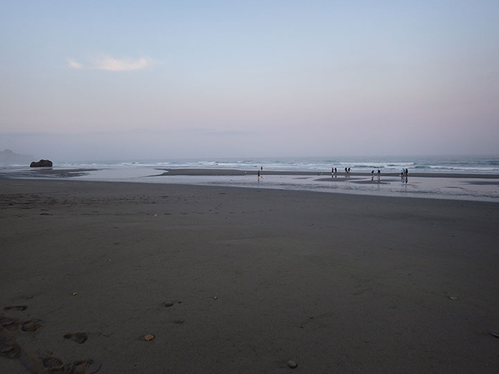 People walking the beach at Pyramid Point SMCA. photo © Karina Nielsen, CC BY-NC-SA 4.0.
Pyramid Point SMCA offers visitors secluded beaches with ample recreational activities. Bird watchers can point binoculars towards the offshore rocks to see nesting birds, surfers can brave the cold waters to ride the waves, and scuba divers can dip beneath the surface to see marine life up close. Visitors can also try their hand at recreational fishing; take of surf smelt by dip or throw net is permitted within Pyramid Point SMCA.
The coastline is dotted with sea stacks and offshore rocks, so this stretch of California can be dangerous to navigate by boat. California’s northernmost state beach, Pelican State Beach, lies adjacent to the MPA and offers beautiful ocean views and easy parking for visitors; the waters adjacent to Pelican State Beach are a great place for scuba divers to enter the water. Nearby, Clifford Kamph Memorial Park offers tent-only campsites, picnic areas, public restrooms, and easy access to Pyramid Point SMCA. Clifford Kamph Memorial Park lines up with the offshore Cone Rock and is an easy access point for surfers to reach the coast.