southwestwanderer_CC-BY-NC-2.0_PectoralSandpiper_MoroCojoSloughSMR.jpg) Pectoral sandpiper in Moro Cojo Slough SMR. photo © Southwest Wanderer, CC BY-NC 2.0.
Pectoral sandpiper in Moro Cojo Slough SMR. photo © Southwest Wanderer, CC BY-NC 2.0.
Moro Cojo Slough once received fresh water from a river flowing from the valley to the ocean, which made the water less brackish than it is currently. The environment changed nearly 18,000 years ago when glaciers started melting and sea level rose by hundreds of feet. Salt water inundated the river mouth near Moro Cojo Slough. Over time, the tidal wetland accumulated more sediment, forming the salt marshes and mudflats that are present today.
As a tidal wetland that has been transformed over the years, Moro Cojo Slough is a dynamic estuarine environment with fluctuating salinity. Estuaries are often sinks for agriculture runoff, which can lead to eutrophication. Eutrophication occurs when excessive nutrient input leads to a lack of oxygen in the water. The water in Moro Cojo Slough is primarily brackish; it has also been polluted by upstream agriculture within the watershed. Before the introduction of heavily salty, brackish water, Moro Cojo Slough likely once supported steelhead trout.
This shallow coastal buffer zone now plays a vital role in filtering water before it drains into Moss Landing Harbor, and eventually enters the Pacific Ocean. Currently, Moro Cojo Slough’s coastal marsh, mudflat, and eelgrass habitats are home to an abundance of marine species and seabirds. An array of plants and animals reside in these brackish waters, including eelgrass, pickleweed, oysters, gaper clams, and longjaw mudsuckers.
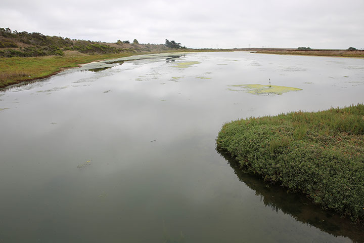 The main channel in Moro Cojo Slough SMR. CDFW photo by C. Wilson.
For centuries, Native American Tribes in California have relied on marine and coastal resources. Many Native American Tribes in California continue to regularly harvest marine resources within their ancestral territories and maintain relationships with the coast for ongoing customary uses.
The area around Moro Cojo Slough is within the historical range of Ohlone, or Costanoan, peoples. They gathered mussels, clams, and oysters from the mudflats and hunted rays and other fish. Today, the Ohlone maintain a presence along the central California coast, with individuals living throughout the region who continue traditional practices.
The first Spanish explorers arrived in this area with the Cabrillo Expedition of 1542. European settlement of the area began during the Mission Era of the 1700s, and in 1770 the Presidio of Monterey and the Mission of San Carlos Borromeo de Carmelo were established. When Mexico took control of ‘Alta California' in the 1820s, the land around Moro Cojo Slough was divided into land grants, which resulted in a landscape dominated by grazing cows, sheep, and horses. The intense cattle ranching drastically changed the native flora and fauna, converting the local watershed to a landscape covered with mustard, foxtail, and wild oat grasslands. Railroads, roads, dams, and dikes were built in the late 1800s, further altering the area's tidal flow and the natural estuarine ecosystem.
The Moro Cojo Slough Management and Enhancement Plan was enacted in 2001 to improve water quality, restore wildlife habitat, reduce sedimentation and erosion, and replenish aquifers. The Central Coast Wetlands Group along with multiple organizations and research institutions worked to restore over 300 acres of the watershed. In 2007, Moro Cojo Slough became a state marine reserve, prohibiting the take of any marine resources in order to facilitate the recovery of the many species that live in this tidal wetland.
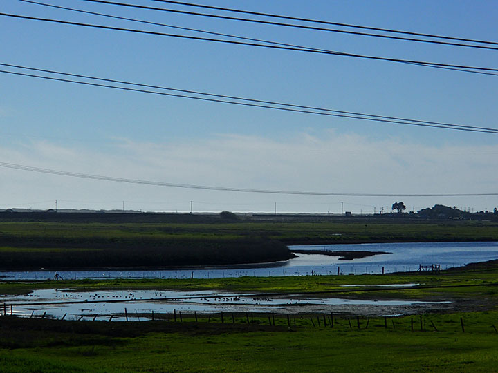 Eastern end of Moro Cojo Slough SMR. photo © C. Allison, MPA Collaborative Network CC BY-NC 2.0.
The region surrounding Moro Cojo Slough offers an abundance of coastal activities to help visitors explore and learn about these unique marine environments. Nature walks around Moro Cojo Slough and kayak and eco-tours in the adjacent Elkhorn Slough help visitors to understand and experience nature in northern Monterey County. Whale watching tours out of nearby Moss Landing Harbor offer visitors the chance to see gray, humpback, and occasionally blue whales swim and feed in the cold, productive Monterey Bay waters. There are a couple eateries and shops in the quaint town of Moss Landing, near the western end of Moro Cojo Slough. Just northwest of the slough is Moss Landing State Beach, a long stretch of sandy beach that is a popular place for surfing, windsurfing, and horseback riding.