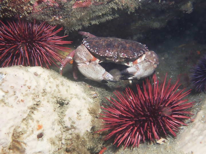
 Rock crab and red sea urchins at MacKerricher SMCA. photo © K. Joe.
This long stretch of coast boasts sandy beaches, intertidal and offshore rocks, steep bluffs, creek outlets, and pocket coves between headlands. The tidepools are rich with seaweeds, including dwarf rockweed, Turkish towel, feather boa kelp, and bladder wrack. Living amongst the algae are invertebrates such as mussels, barnacles, limpets, and anemones. The careful observer may see small fish dart around in the tidepools, shore crabs tucked under ledges, and cryptic octopi.
Black oystercatchers pick prey items from the seaweed and cormorants sun themselves on nearby rocks before diving back into the water in search of fish. Washed up kelp, known as wrack, decomposes on the beach and provides food for many animals. Worms, clams, and sand crabs burrow into the sand, while shorebirds, like sandpipers and whimbrels, probe the sand for their meals.
Offshore, soft seafloor habitat supports Dungeness crab, sand dollars, sea pens, and flatfish. Interspersed rocky reef areas provide solid footholds for bull kelp and other algae to attach and create underwater forests. Groundfish such as rockfish, lingcod, and cabezon are common here, mobile invertebrates like sea cucumbers, urchins, and box crabs navigate amongst the rocky outcroppings, and sedentary invertebrates like gorgonians and white-plumed anemones sway alongside the kelp in the current.
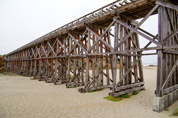 Trestle bridge, now a pedestrian walkway, over Pudding Creek. photo © CX15, CC BY-NC-ND 2.0.
For centuries, Native American Tribes in California have relied on marine and coastal resources. Many Native American Tribes in California continue to regularly harvest marine resources within their ancestral territories and maintain relationships with the coast for ongoing customary uses. Today, Coast Pomo and Coast Yuki peoples continue to gather foods and other resources in the practice of their Tribal traditions in and around MacKerricher SMCA beaches.
The Mendocino Indian Reservation, established in 1856, was officially decommissioned in 1865. Reservation land was then made available to former reservation employees and settlers to purchase for farming, logging, milling, and other extractive activities. This included a 1,000-acre plot of land purchased by Duncan MacKerricher and his wife, Jesse, at Laguna Point. Their heirs sold this land to State Parks in 1949. Before State Parks acquired the land, the coastline now encompassed by MacKerricher State Park was used by timber companies as a thoroughfare to haul lumber to the mill in Fort Bragg. The Ten Mile branch of the railroad was completed in 1916 with five trestle bridges between the mill site and Ten Mile River. The first trestle bridge, the one across Pudding Creek, almost 530 feet in length and 45 feet high, remains one of the most scenic relics of the former railroad and is now a multi-use recreational trail.
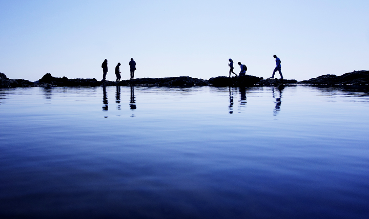 Tidepoolers at Glass Beach, MacKerricher SMCA. photo © P. Thoeny, CC BY-NC-ND 2.0.
MacKerricher SMCA is one of the most accessible MPAs in Mendocino County. MacKerricher State Park Road, the old timber haul road used in the late 1800s, runs almost the entire length of the coast bordering the SMCA, from Glass Beach in the south to Cleone in the north. This multi-use road is paved and available for walking, bicycling, horseback riding, and is wheelchair friendly.
In addition to foot paths along the bluffs, there are beach access points at Glass Beach, Pudding Creek, Virgin Creek, Laguna Point, and MacKerricher State Park. At multiple points, visitors have ample opportunity to watch for marine mammals and seabirds. Laguna Point boasts a popular, easy-access boardwalk. Scuba and free diving in the SMCA offers a close-up look at the abundant marine life. Onshore, visitors can explore tidepool areas at Glass Beach and Laguna Point to find anemones, octopi, nudibranchs (sea slugs), sea stars, crabs, small fish, and other marine life revealed by the retreating tide. Beach wheelchairs can also be reserved through the neighboring MacKerricher State Park.
MacKerricher SMCA is a great place to go fishing, and bull kelp and giant kelp may also be collected recreationally. Anglers can fish for redtail surfperch from shore, drop a trap or hoop net in the water to catch Dungeness crab, or dive beneath the surface to go spearfishing for lingcod.