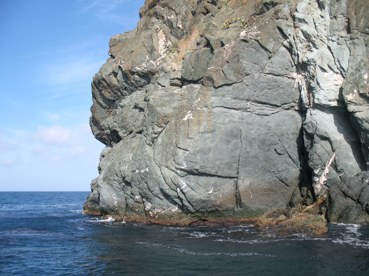
 Catalina Head, at the entrance to Cat Harbor SMCA. CDFW photo by T. Mason.
The different habitats within Cat Harbor SMCA include eelgrass, tidal flat, rocky shoreline, and sandy seafloor extending to depths greater than 180 feet. Along the rocky shoreline, you can spot a variety of invertebrates like limpets, turban snails, scaled worm snails, chitons, and a variety of crabs. The rocks also provide a convenient roosting and resting place for double-crested cormorants, whimbrels, willets, pelicans, and a variety of seabirds. Beneath the surface, common species include sea urchins, rockfish, garibaldi, scorpionfish, California sheephead, kelp bass, leopard sharks, and bat rays. Sea lions and harbor seals are frequently seen swimming in the shallows and sometimes haul out on the rocky shore near the harbor entrance.
Diving is best towards the end of summer and beginning of fall when water temperatures are still warm and underwater visibility sometimes reaches up to 50 feet.
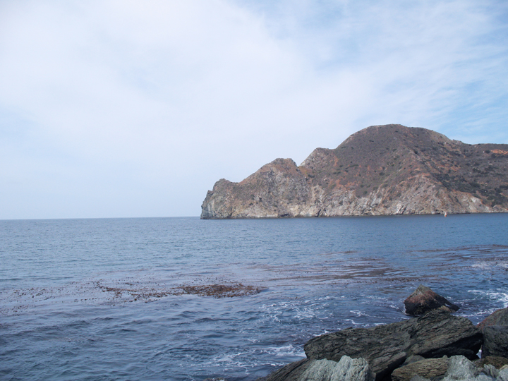 Entrance to Cat Harbor. CDFW photo by T. Mason.
For centuries, Native American Tribes in California have relied on marine and coastal resources. Many Native American Tribes in California continue to regularly harvest marine resources within their ancestral territories and maintain relationships with the coast for ongoing customary uses. Originally inhabited by Native Americans known as the Tongva, Catalina Island, also known as Pimugna or Pimu by these first peoples, provided abundant resources for permanent villages for thousands of years. Ancient tools hand-fashioned from stone, shell, and bone, and piles of abalone shells have been uncovered at ancient village sites.
Captain Juan Rodriguez Cabrillo, a Portuguese navigator in service to Spain, is likely the first European explorer to visit the island in 1542, anchoring two tiny caravel ships off the Bay of Avalon. In November 1602, Philip III of Spain sent an expedition under command of Sebastian Vizcaino to map the California coastline. Vizcaino anchored in what is now the crescent-shaped harbor of Avalon on Saint Catherine’s Day and renamed the small sunny island “Santa Catarina” or “Cathalina”.
Over the centuries, sailors from many countries including Russia, Japan, and the Philippines took shelter inside Santa Catalina Island's coves and harbors during long sea voyages. Cat Harbor has historically been a hot spot for smugglers, pirates, and bootleggers.
In the 1860s, silver, lead, and zinc mining was lucrative on the island, and to a lesser extent, gold mining. During the Civil War, the Union Army sent soldiers to establish Camp Santa on Santa Catalina Island to guard gold shipments meant to fund the Union Army. Shipments left the island from the adjacent town of Two Harbors. In 1864, Abraham Lincoln ordered the building of barracks between Cat Harbor and Two Harbors to house the soldiers. During World War II, the isthmus between the two harbors became a training center for the Coast Guard, and trainees lived in the barracks that once housed the Union soldiers. Today, the barracks stand as a historical landmark of this era.
In 1885, the island was sold for $200,000 to George R. Shatto, who sold land parcels to buyers from all over the country. In 1919, the island again changed hands and was sold for $3 million to the multi-millionaire chewing gum mogul and owner of the Chicago Cubs baseball team, William Wrigley Jr., who set out to make it a tourist destination. In the 1970s, Wrigley deeded 88 percent of the island to the Catalina Island Conservancy, and today much of it remains undeveloped and wild. Santa Catalina Island’s rich history can be seen in the many historic landmarks that dot the landscape.
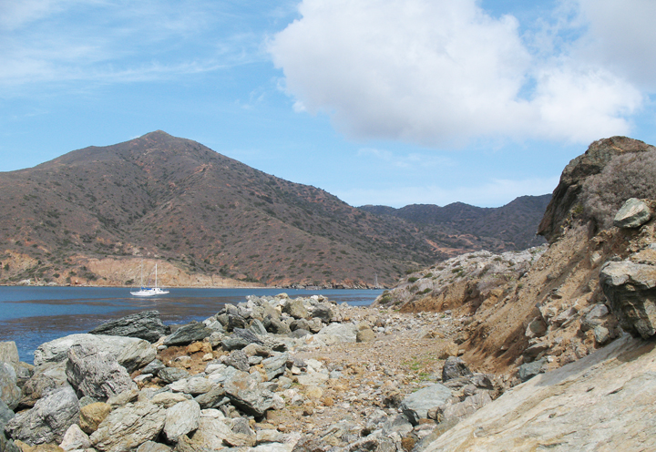 Sailboats at Cat Harbor. CDFW photo by T. Mason.
To visit this SMCA you need to take a ferry ride to Two Harbors, a rustic seaside village located at the isthmus of the island, or a private boat directly to Cat Harbor or Two Harbors. From Two Harbors, it is an easy half-mile walk to Cat Harbor SMCA. Trips depart daily to Catalina Island from the San Pedro District of Los Angeles, making travel to the island the easiest of any of the Channel Islands. Ferries also leave seasonally from Long Beach and Dana Point.
A wide assortment of water activities are encouraged in the SMCA, but the most popular include diving, snorkeling, kayaking, and boating. Recreational fishing is also popular within this SMCA. Take of California spiny lobster and sea urchin, finfish by hook-and-line or spearfishing, and market squid by hook-and-line are all permitted. There are also many great places surrounding the harbor to walk and take photos, like Ballast Point, which offers breathtaking views of the SMCA.