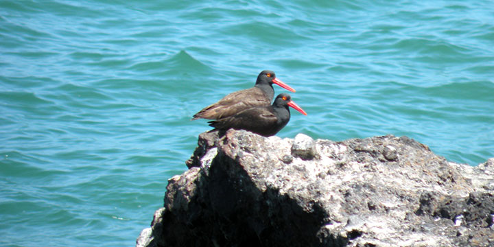
 Black oystercatchers at Carrington Point SMR. Photo © J. West, CC BY-NC 2.0.
Carrington Point SMR, like the rest of the Channel Islands region, is located at the convergence of warm currents that rush north up the Southern California coast and the cold California Current that pushes south from Alaska. Nutrient-rich water, combined with the mixing of temperatures and meeting of species from southern and northern ranges, account for the rich and varied marine life found at the Channel Islands.
Santa Rosa Island sits the second farthest west in an island chain that extends roughly east to west, and is influenced more heavily by the California Current. Along shore, Santa Rosa Island features gently sloping sandy beaches and sheer cliffs that plunge into the Pacific. Visitors can explore these sandy beaches and rocky shorelines, and look for seabirds like snowy plovers, willets, wandering tattlers, whimbrels, black turnstones, and sanderlings.
Moving beyond the shoreline, eelgrass beds line the sandy sections of the seafloor at Carrington Point SMR. Snails, sea stars, clams, and rock crabs find protection in the eelgrass beds while pipefish, señoritas and perch move amongst the long, swaying shoots. Sea urchins and California mussels can be found in the rocky intertidal areas near the surfgrass beds. Beyond this, large rocky reefs are home to giant kelp forests, where kelp bass, lingcod, cabezon, sea cucumbers, and scallops abound. From June to December, blue whales can be spotted feeding offshore as they migrate northward.
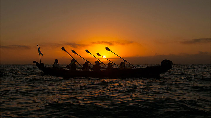 Chumash tribal members paddle a tomol, the traditional Chumash redwood plank canoe, near Carrington Point SMR. Photo © R. Schwemmer/NOAA.
For centuries, Native American Tribes in California have relied on marine and coastal resources. Many Native American Tribes in California continue to regularly harvest marine resources within their ancestral territories and maintain relationships with the coast for ongoing customary uses.
Traditionally home to the Chumash, there is documentation of almost continuous Native American occupation of Santa Rosa Island from around 10,000 to 200 years ago. The potentially oldest human remains in North and South America were found on Santa Rosa Island near Arlington Springs in 1959. Using modern carbon dating of a bone fragment, the remains were found to be around 13,000 years old. Eight historic Native American village sites have been discovered on the island.
The first recorded instance of European exploration dates to 1542 when Juan Rodriguez Cabrillo landed and documented three villages on the island. In 1850, the Channel Islands were added to the United States. Santa Rosa Island hosted cattle and sheep enterprises until 1998. From the 1940s to the 1960s, the island was also used for an army base, air force base, and exploratory oil drilling.
Channel Islands National Park was established in 1980, protecting Santa Rosa, Santa Cruz, and San Miguel Islands in addition to Anacapa and Santa Barbara Islands, which were previously protected by the Channel Islands National Monument. The Channel Islands National Marine Sanctuary was also established in 1980, protecting 1,470 square miles of ocean encompassing the waters up to six nautical miles offshore around each of the five islands.
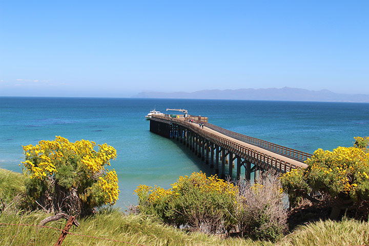 Bechers Bay Pier bordering Carrington Point SMR. Photo © D. Fulmer, CC BY-NC 2.0.
Santa Rosa Island is accessible by either boat or plane. Flights to the island take approximately 45 minutes and are offered year-round by charter through Channel Islands Aviation, while public boat trips with Island Packers out of Ventura Harbor can take upwards of three hours and run regularly from April to November, two-four days per week. Visitors can also access the island via private boats.
There is no visitor center, and no goods or services, but the island still offers many recreational opportunities including hiking, picnicking, camping, and diving, as well as fishing (outside any SMRs). There is no transportation on Santa Rosa Island, so Carrington Point SMR must be accessed on foot or by boat. Both commercial and recreational fishing are prohibited within the SMR, but swimming, surfing, boating, and diving are encouraged.