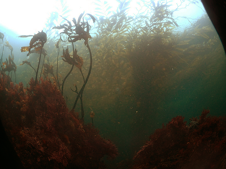
 Southern sea palm and giant kelp in Carmel Pinnacles SMR. Photo © Stefanie, CC BY-NC 2.0.
Located south of the Monterey Peninsula, Carmel Bay is known for white sand beaches lined by cypress trees, and the tidepools that dot the water’s edge. Carmel Pinnacles SMR lies offshore and contains kelp forests, rocky reefs and patches of sandy seafloor. In shallower areas, kelp greenling, black rockfish, and gopher rockfish thrive in the canopy of giant kelp. This fast-growing kelp attaches to large rocks on the seafloor and reaches to the surface, creating three-dimensional structure that serves as refuge for many species.
Carmel Pinnacles' unique bathymetry, including the prominent inner and outer pinnacles, makes it a popular dive spot. Steep granite canyon walls and rocky spires extend nearly 100 feet, and strawberry anemones, nudibranchs, and colorful hydrocorals cling to the shallow edges of the pinnacles. In deeper water, schools of vermilion rockfish and blue rockfish are abundant. Lingcod and cabezon weave between the rocky reefs, and wolf-eels peer out of crevices. Sea lions, sea otters, seals, and the occasional pod of Risso’s dolphins can be seen hunting in these waters.
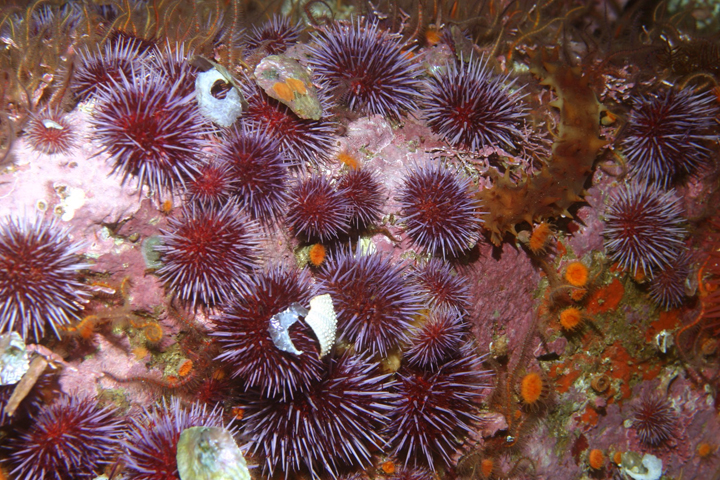
 Purple sea urchins, orange cup corals, a giant red sea cucumber and brittle stars in Carmel Pinnacles SMR. Photo © S. Lonhart/NOAA MBNMS CC0 1.0.
For centuries, Native American Tribes in California have relied on marine and coastal resources. Many Native American Tribes in California continue to regularly harvest marine resources within their ancestral territories and maintain relationships with the coast for ongoing customary uses. The Monterey Peninsula area has a long history of human residence, with the Ohlone peoples occupying the area for thousands of years. The Ohlone traditionally subsisted on abundant marine and terrestrial resources, collecting abalone, urchins, limpets, and seaweeds in rocky intertidal areas. Native people along this section of coast and the Carmel River caught steelhead, salmon and shellfish, including abalone.
During the 18th century, many natives were displaced when Spanish fleets arrived. The Spanish built missions in the area, including the nearby San Carlos Borromeo de Carmelo Mission. When Mexico gained independence from Spain in the early 1800s, ranchos were established around Carmel, changing the culture and landscape as land was converted to pasture for cattle grazing. In the early 1850s, Chinese immigrants brought sophisticated fishing techniques, and Monterey emerged as a thriving fishing port. Commercial fisheries were established for abalone, rockfish, flatfish, sardines, and squid.
The canneries brought further commercialization, with Monterey adopting the name, 'The Sardine Capital of the World’. Between 1915 and 1950, roughly 235,000 tons of sardine were harvested from Monterey Bay annually, until the fishery collapsed from a variety of causes. Over the years, similar collapses of other fish stocks resulted in more stringent fishing regulations. As conservation efforts gained momentum, Monterey Bay National Marine Sanctuary was created and, in 2007, Carmel Pinnacles SMR became one of 29 MPAs adopted on California’s central coast.
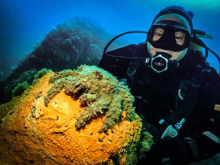
 A diver next to a moss crab in Carmel Pinnacles SMR. Photo © Stefanie, CC BY-NC 2.0.
Located about one mile offshore from Pescadero Point in Carmel Bay, Carmel Pinnacles SMR draws in recreational divers and underwater photographers eager to explore the impressive granite spires. Divers can take a boat to view the colorful invertebrates and diverse assortment of kelp forest species.
No take of any kind is allowed within Carmel Pinnacles SMR. Running parallel to the coastline in nearby Carmel Bay, Carmel Bay State Marine Conservation Area does allow recreational take of finfish. Carmel is a popular beach town that attracts many visitors who come to relax on iconic Carmel Beach, a stunning stretch of white sand beach lined by cypress trees and rocky tidepools.