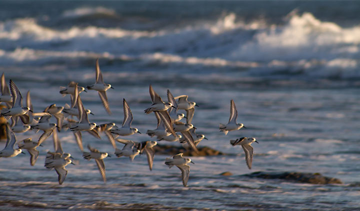
 Snowy plovers at Campus Point SMCA (No-Take). photo © A. Gai, CC BY-NC 2.0.
Campus Point SMCA (No-Take) encompasses two main headlands cut from marine terrace deposits, with beaches and bays in between. Marine terraces are formed when a shallow sea that has accumulated sediment over millions of years is lifted by tectonic activity.
Natural oil seeps 150 feet below the sea floor bubble up from deep reservoirs here. An estimated 10,000 gallons of oil leaks from these reservoirs every day, as it has done for the last several hundred thousand years. When the oil hits seawater, it forms tarballs that wash up on the beach. The tarballs undoubtedly inspired the name Coal Oil Point.
The coastline of Campus Point SMCA (No-Take) is mostly sandy beach where several species of concern like the western snowy plover find refuge, along with some rocky shoreline. This MPA contains a wide variety of ecosystems, including eelgrass and surfgrass beds, rocky reefs, extensive kelp forests, shallow tidepools, natural oil seeps, and sandy shores, each supporting a unique suite of species. At Coal Oil Point, a large reef system exposed during low tide creates extensive tidepools teeming with life, such as giant green anemones, California mussels, tidepool sculpins, sea hares, and sea stars. The surfgrass and sandy seafloor areas provide nursery habitat for flatfishes such as halibut, sole, and flounder, which feed on crabs and other invertebrates such as the California spiny lobster.
Offshore, one can find typical Southern California fishes such as garibaldi, California sheephead, and kelp bass swimming through forests of giant kelp. Campus Point SMCA (No-Take) is one of the southernmost areas where sea otters have been spotted, making the SMCA potential habitat for this recovering species.
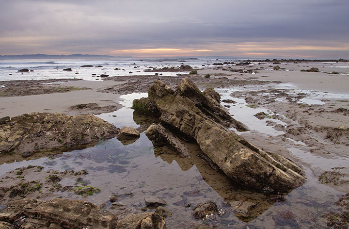 Tidepools at Campus Point SMCA (No-Take). Photo © A. Gai, CC BY-NC 2.0.
For centuries, Native American Tribes in California have relied on marine and coastal resources. Many Native American Tribes in California continue to regularly harvest marine resources within their ancestral territories and maintain relationships with the coast for ongoing customary uses. Campus Point SMCA (No-Take) lies at the heart of Chumash ancestral territory. Archeological records of Chumash inhabitants reveal evidence of a complex society spanning from Malibu in the south to Morro Bay in the north, as well as the Channel Islands.
Chumash ancestors fostered societies of great complexity and adaptability, and established important ocean trade routes. The tomol, a traditional redwood plank canoe, was an essential part of the Chumash's prosperous trading and fishing efforts. Today, contemporary Chumash peoples continue to nurture and revitalize the lifeways of their ancestors.
A Spanish Crown fleet led by European explorer Juan Rodriguez Cabrillo journeyed through the Santa Barbara Channel from Mexico in 1542, however European settlement did not occur for another 200 years when the Portola expedition landed in the area. The Campus Point area supported small-scale harvest, ranching, and whaling operations.
Big changes came about in 1896 when offshore drilling and oil exploration began in the Santa Barbara Channel. The 1969 Santa Barbara oil spill, the largest of its time and the third largest in American history, had a devastating impact on the area’s coastal ecosystems. Drilling in state waters has been banned ever since. The now-decommissioned Platform Holly, located directly offshore from the SMCA, is a reminder of that time.
The land adjacent to the Campus Point SMCA (No-Take) became part of the University of California, Santa Barbara in 1944. The Coal Oil Point Natural Reserve, run by the University of California Natural Reserve System, now protects the natural environment on land while the adjacent ocean is protected by Campus Point SMCA (No-Take).
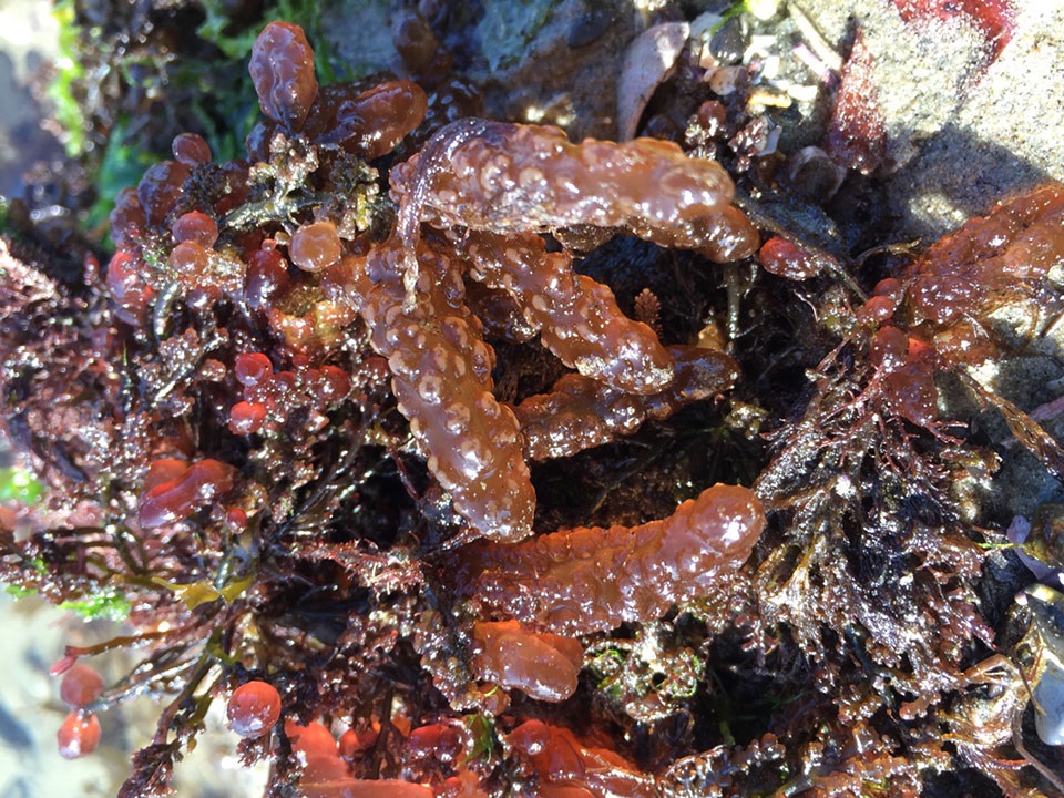 Red algae at Campus Point SMCA (No-Take). Photo © Mijocop, CC BY 2.0.
On any given day, Campus Point SMCA (No-Take) may be bustling with people. Sunbathers are plentiful on the wide sandy expanses of Sands and Devereux beaches. The waves here are ideal for surfing, and the water is frequently calm enough for a kayak, scuba, or freediving adventure. Divers can explore forests of giant kelp full of señorita, California sheephead, kelp bass, surfperch, red and purple sea urchins, California spiny lobster, sea stars, and warty sea cucumbers. Tidepools exposed during low tide may hold anemones, sea hares, mussels, snails, crabs, and limpets, offering a small snapshot of the life found farther offshore.
Campus Point SMCA is a "No-Take SMCA", so no fishing or harvest of any kind is allowed. Parking and access to the MPA can be found along Del Playa Drive, from which several trails lead down the bluffs to the coast. Walk out to Campus Point, the SMCA's namesake at the eastern boundary of the MPA, for beautiful coastal views, walking trails, and a good chance to observe migrating whales passing through the Santa Barbara Channel. On the western MPA boundary, Santa Barbara Shores County Park also has several coastal trails offering gorgeous views of these protected waters.