Overview

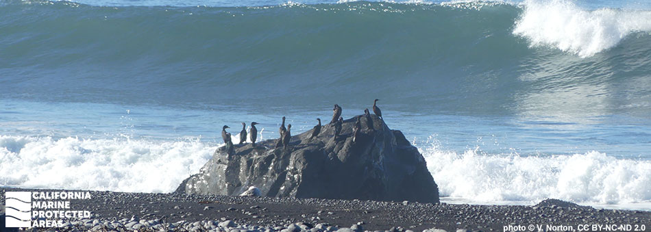
Big Flat State Marine Conservation Area (SMCA) is located off California’s Lost Coast, a stretch of coastline with limited road access, and may only be explored on foot or by boat. Located about 10 miles north of Shelter Cove, a small, remote fishing community, Big Flat SMCA spans more than two miles of coastline from Big Flat Creek in the south to Big Creek in the north. This marine protected area (MPA) protects more than 11 square miles of sandy beaches, rocky shores, coastal marsh, sandy seafloor, and over half a square mile of submarine canyon habitat ranging to depths of over 1,100 feet. These diverse habitats provide foraging grounds for many different species of fish, birds, marine mammals, and invertebrates.
Big Flat SMCA is one of 30 MPAs in the state with submarine canyons or steep walls found deeper than 650 feet. This location was chosen for an MPA to help preserve important rockfish habitat while minimizing socioeconomic impacts to recreational and commercial fishermen based out of Shelter Cove. Take of salmon by trolling and Dungeness crab by trap, hoop net, or hand is allowed, but all other take is prohibited.
Regulations
It is unlawful to injure, damage, take, or possess any living, geological, or cultural marine resource, EXCEPT:
Recreational take of salmon by trolling and Dungeness crab by trap, hoop net or hand is allowed. Commercial take of salmon with troll fishing gear and Dungeness crab by trap is allowed. Includes take exemptions for the following tribes:
- Bear River Band of the Rohnerville Rancheria
- Big Valley Band of Pomo Indians of the Big Valley Rancheria
- Cahto Indian Tribe of the Laytonville Rancheria
- Coyote Valley Band of Pomo Indians
- Elem Indian Colony of Pomo Indians of the Sulphur Bank Rancheria
- Guidiville Rancheria
- Habematolel Pomo of Upper Lake
- Hopland Band of Pomo Indians of the Hopland Rancheria
- Lower Lake Rancheria
- Manchester Band of Pomo Indians of the Manchester-Point Arena Rancheria
- Middletown Rancheria of Pomo Indians
- Pinoleville Pomo Nation
- Potter Valley Tribe
- Redwood Valley Rancheria of Pomo Indians
- Robinson Rancheria of Pomo Indians
- Round Valley Indian Tribes of the Round Valley Reservation
- Scotts Valley Band of Pomo Indians
- Sherwood Valley Rancheria of Pomo Indians
California Code of Regulations Title 14, Section 632(b)(15)(opens in new tab)
Quick Facts
MPA size: 11.59 square miles
Shoreline span: 2.5 miles
Depth range: 0 to 1,110 feet
Habitat composition*:
- Rock: 0.81 square miles
- Sand/mud: 11.17 square miles
*Habitat calculations are based on three-dimensional area and may exceed the total MPA area listed above.