Big Creek State Marine Reserve/State Marine Conservation Area

mountain rising from coastline

Overview

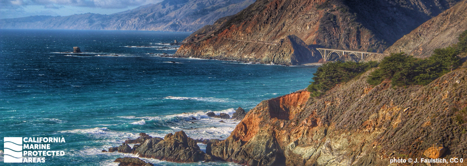
Big Creek State Marine Reserve (SMR) and Big Creek State Marine Conservation Area (SMCA) are found along a stretch of rugged and isolated coastline near the southern border of Monterey County. The two adjacent marine protected areas (MPAs) are located about 18 miles south of the town of Big Sur, and are visible from Highway 1. Big Creek SMR overlaps a portion of Landels-Hill Big Creek Reserve, a scientific research preserve owned by the University of California.

Due to their location in a remote area with limited coastal access, Big Creek SMR and Big Creek SMCA are rare examples of nearly pristine marine ecosystems. Together these MPAs cover more than 22 square miles, stretching from shore out to the three-nautical-mile state waters limit, at depths greater than 2,300 feet.

Big Creek SMR protects more than 14½ square miles of sandy beaches and seafloors, rocky tidepools and reefs, kelp forests, surfgrass beds, and over 3½ square miles of submarine canyon habitat. Big Creek SMCA protects nearly eight square miles of sandy seafloor, rocky reef, and kelp forest habitat, including nearly 2½ square miles of submarine canyon habitat. Kelp, surfperch, limpets, urchins, rockfish, cabezon, kelp greenling, southern sea otters, and countless seabirds are among the many species that thrive in these MPAs.

Regulations

Big Creek SMR

It is unlawful to injure, damage, take, or possess any living, geological, or cultural marine resource.

Except as pursuant to Federal law or emergency caused by hazardous weather, it is unlawful to anchor or moor a vessel in waters shallower than 10 fathoms (60 feet) in Big Creek State Marine Reserve.

California Code of Regulations Title 14, Section 632(b)(85)(opens in new tab)

Big Creek SMCA

It is unlawful to injure, damage, take, or possess any living, geological, or cultural marine resource, EXCEPT:

Recreational and commercial take of salmon and albacore is allowed. Commercial take of spot prawn is allowed.

California Code of Regulations Title 14, Section 632(b)(86)(opens in new tab)

Quick Facts

Big Creek SMR

MPA size: 14.51 square miles

Shoreline span: 6.1 miles

Depth range: 0 to 2,393 feet

Habitat composition*:

  • Rock: 1.90 square miles
  • Sand/mud: 13.70 square miles

Big Creek SMCA

MPA size: 7.85 square miles

Depth range: 107 to 1,964 feet

Habitat composition*:

  • Rock: 0.03 square miles
  • Sand/mud: 7.82 square miles

*Habitat calculations are based on 3-dimensional area and may exceed the total MPA area listed above.

Photo Gallery

19 SEP
2022

Longnose skate at Big Creek SMCA

0

CDFW/MARE photo

Showing 0 Comment

Video Gallery

Big Creek State Marine Reserve

Dive Deep with a Remotely Operated Vehicle: Big Creek State Marine Reserve

California's MPA Network

About Big Creek State Marine Reserve/State Marine Conservation Area

Natural History

Sunflower sea stars on the sandy sea floor
Sunflower sea stars on a sediment slope at Big Creek SMCA. CDFW/MARE photo

The Santa Lucia Mountains of Big Sur are part of the Salinian block, a piece of the southern Sierra Nevada Mountains sheared off by the San Andreas Fault and carried northwards over millions of years. Composed of a mixture of ancient river sediment and granite slabs, the mountains were raised by tectonic uplift in the area, creating the massive cliffs that make up the Big Sur Coast. Rainfall and winter storms gradually cut steep canyons into the mountains and the now submerged continental shelf. This dramatic, remote, and difficult-to-access landscape has helped the MPAs' marine ecosystems remain relatively untouched.

Big Creek SMR and Big Creek SMCA contain parts of the Sur and Lucia submarine canyon systems, sandy seafloor, rocky shores, kelp forests, surfgrass beds, and shallow coves that are home to abundant fishes, invertebrates, and algae. Attached to rocky reefs, both giant kelp and bull kelp grow towards the surface, creating habitat for dozens of rockfish species, pile perch, rubberlip seaperch, lingcod, and other reef and kelp forest fishes. Invertebrates like rock scallops and anemones also settle on rocky reefs, while urchins, abalone, gumboot chitons, sea stars, and sea cucumbers move slowly along the seafloor.

Marine mammals like California sea lions and harbor seals haul out to rest along the shores, whales pass by or through the MPAs during migrations, and southern sea otters frequently hunt amongst the kelp forests. Farther offshore, the submarine canyons and expanses of sandy sediments harbor a rich abundance of flatfish, sea pens, and sea whips.

Cultural History

Harbor seals on offshore rocks surrounded by kelp and surfgrass
Harbor seals on offshore rocks surrounded by kelp and surfgrass, Big Creek SMR photo © N. Roberts, CC BY-NC 2.0

For centuries, Native American Tribes in California have relied on marine and coastal resources. Many continue to regularly harvest marine resources within their ancestral territories and maintain relationships with the coast for ongoing customary uses.

Big Creek lies along the traditional border between the Esselen and Salinan native peoples, whose traditional diet relied on the productive waters of the coast for food during much of the year. Mussels, abalone, clams, and fish were frequently collected while otters and seals were hunted for their meat and fur.

The area was first seen by Europeans in 1542, but the Big Sur coast remained undeveloped and unexplored for another 200 years due to the rugged and inaccessible terrain. Over the next couple hundred years, minor logging, mining, ranching, and fishing industries sprang up along the coast. However, the mountainous terrain made transporting goods and resources difficult, and these industries never expanded to significant size. Access was, and still is, the main challenge of the Big Sur area, but construction of Highway 1 improved accessibility and changed the nature of this remote coastline when it officially opened in 1937.

A portion of the SMR has been protected since 1994; it was expanded in September, 2007 to its current size. The MPAs overlap a small portion of Landels-Hill Big Creek Reserve, which is part of the University of California Natural Reserve System. The mostly land-based reserve provides on-site research and education regarding local environmental change. The MPAs' nearly unaltered marine ecosystems act as a biological benchmark – a place that can be referenced for comparison to other locations. These MPAs are rare and extremely valuable resources for ocean studies.

Recreation

mountainous coastal road with arched bridge
Big Creek Bridge, at Big Creek SMR. photo © Floyd, CC BY-NC 2.0

Big Creek SMR and Big Creek SMCA are both difficult to access without special permission from private landowners or the Landels-Hill Big Creek Reserve. As such, most use by the public is simply through extraordinary views from the highway.

The MPAs come into view as you drive south on Highway 1 from Carmel (or north from San Simeon) on the central California coast. This majestic stretch of Big Sur coastline is known for its breathtaking views of wild and pristine shores. Although access to the water’s edge is limited, a boat trip can provide a more close-up view of this remarkable marine environment.

No take of any marine resources is allowed in the SMR, but within the SMCA, recreational anglers may take salmon and albacore. Restrooms, camping, and information regarding the area can be found at Limekiln State Park, a few miles south of the Big Creek MPAs, or Julia Pfeiffer Burns/Big Sur State Park, a few miles to the north of the Big Creek MPAs.

Coordinates

Big Creek SMR

This area is bounded by the mean high tide line and straight lines connecting the following points in the order listed except where noted:

36° 07.200′ N. lat. 121° 37.968′ W. long.;
36° 07.200′ N. lat. 121° 39.000′ W. long.;
36° 05.200′ N. lat. 121° 38.000′ W. long.;
36° 05.200′ N. lat. 121° 41.222′ W. long.; thence southward along the three nautical mile offshore boundary to
36° 02.650′ N. lat. 121° 39.654′ W. long.; and
36° 02.650′ N. lat. 121° 35.130′ W. long.

California Code of Regulations Title 14, Section 632(b)(85)

Big Creek SMCA

This area is bounded by the three nautical mile offshore boundary and straight lines connecting the following points in the order listed except where noted:

36° 07.200′ N. lat. 121° 39.000′ W. long.;
36° 07.200′ N. lat. 121° 42.869′ W. long.; thence southward along the three nautical mile offshore boundary to
36° 05.200′ N. lat. 121° 41.222′ W. long.;
36° 05.200′ N. lat. 121° 38.000′ W. long.; and
36° 07.200′ N. lat. 121° 39.000′ W. long.

California Code of Regulations Title 14, Section 632(b)(86)

Downloads for Big Creek State Marine Reserve/State Marine Conservation Area

Map

Map of Big Creek SMR - click to enlarge in new tab

Facts, Map & Regulations

MPA fact sheet - click to enlarge in new tab

Downloads for Big Creek State Marine Conservation Area

Map

Map of Big Creek State Marine Conservation Area - click to enlarge in new tab

Facts, Map & Regulations

MPA fact sheet - click to enlarge in new tab