Ten Mile State Marine Reserve, Ten Mile Beach State Marine Conservation Area, and Ten Mile Estuary State Marine Conservation Area

a bridge crossing a river that flows to the sea

Overview

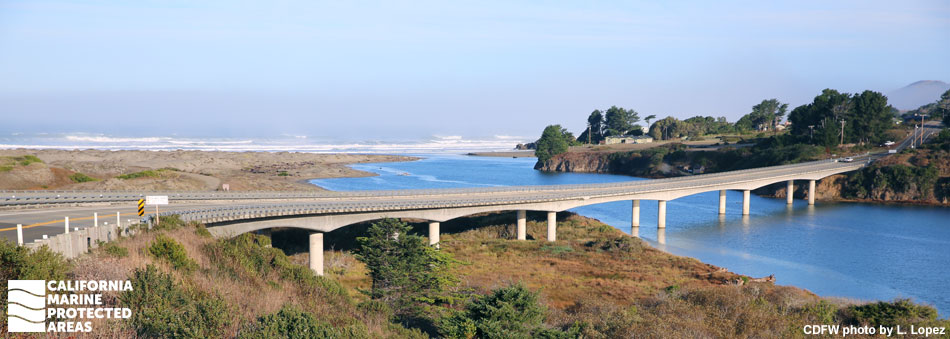
Ten Mile State Marine Reserve (SMR), Ten Mile Beach State Marine Conservation Area (SMCA), and Ten Mile Estuary SMCA are located less than 10 miles north of the town of Fort Bragg on the rugged Mendocino coast.

The northernmost of the three MPAs, Ten Mile SMR stretches along three miles of coastline and extends from shore out three nautical miles. Covering almost 12 square miles of open water habitat and reaching depths of over 300 feet, the SMR protects rocky shorelines, offshore islets, deep rocky reef, sandy seafloor, and surfgrass and kelp bed habitats.

Ten Mile Beach SMCA stretches along less than one mile of coastline, extending from shore out three nautical miles. Covering about three and a half square miles of open water habitat and reaching depths of over 280 feet, Ten Mile Beach SMCA protects sandy beaches, rocky shorelines, and sandy seafloor habitats.

The seafloor habitat of the two coastal MPAs is a mix of hard and soft sands, gravels, and rocks. The sheltered portions of rocky shoreline and marine terraces provide haul out areas for seals and sea lions, and critical nesting and roosting sites for seabirds. The rocky reef habitat is refuge for urchins, anemones, sea cucumbers, sponges, sea stars, and rockfish, and the sandy seafloor is inhabited by sand crabs, sea whips, sand dollars, and flatfish, among many other species.

Predominantly composed of coastal marsh habitat, Ten Mile Estuary SMCA is one of the least developed estuaries along the northern California coast. The extensive, intact estuarine, wetland, and riparian habitat of Ten Mile Estuary SMCA supports a range of species. The SMCA encompasses spawning and nursery grounds for rockfish and coho salmon, roosting and foraging areas for shorebirds and seabirds, and a transportation corridor for river otters.

Several coastal access points to the three MPAs facilitate recreation, research, long-term monitoring, and enforcement activities.

Regulations

Ten Mile SMR

It is unlawful to injure, damage, take, or possess any living, geological, or cultural marine resource.

California Code of Regulations Title 14, Section 632(b)(19)(opens in new tab)

Ten Mile Beach SMCA

It is unlawful to injure, damage, take, or possess any living, geological, or cultural marine resource, EXCEPT:
Recreational take of Dungeness crab by trap, hoop net or hand is allowed. Commercial take of Dungeness crab by trap is allowed. Includes take exemptions for some tribes.

California Code of Regulations Title 14, Section 632(b)(20)(opens in new tab)

Ten Mile Estuary SMCA

It is unlawful to injure, damage, take, or possess any living, geological, or cultural marine resource, EXCEPT:
Take of waterfowl in accordance with general waterfowl hunting regulations is allowed. Includes take exemptions for some tribes.

California Code of Regulations Title 14, Section 632(b)(21)(opens in new tab)

Quick Facts

Ten Mile SMR

MPA size: 11.95 square miles

Shoreline span: 3.2 miles

Depth range: 0 to 343 feet

Habitat composition*:

  • Rock: 3.22 square miles
  • Sand/mud: 10.38 square miles

Ten Mile Beach SMCA

MPA size: 3.54 square miles

Shoreline span: 0.9 miles

Depth range: 0 to 288 feet

Habitat composition*:

  • Rock: 0.04 square miles
  • Sand/mud: 3.51 square miles

Ten Mile Estuary SMCA

MPA size: 0.18 square miles

Shoreline span: 0.1 miles

Habitat composition*:

  • Coastal marsh: 0.78 square miles
  • Estuary: 0.08 square miles

*Habitat calculations are based on 3-dimensional area and may exceed the total MPA area listed above.

Photo Gallery

Video Gallery

Exploring California’s Marine Protected Areas: Ten Mile State Marine Reserve

California's MPA Network

About Ten Mile State Marine Reserve, Ten Mile Beach State Marine Conservation Area, and Ten Mile Estuary State Marine Conservation Area

Natural History

bald eagle, perched on a log in the water, with its prey under it's feet
Bald eagle with its prey at Ten Mile Estuary SMCA. photo © Sam, CC BY-NC 2.0

The coastline in this region is mostly rocky, with pronounced marine terraces below the towering coastal bluffs. Intertidal organisms like limpets, mussels, anemones, and various seaweeds cling to the rocks, and seals haul out on the rocky terraces.

The long stretch of coast is dotted with numerous offshore islets, pinnacles, sea stacks, and pocket coves. The rocky outcroppings are ideal nesting and foraging habitats for black oystercatcher, pigeon guillemot, pelagic cormorant, and western gull. Ten Mile SMR ends at Seaside Beach on its southern border, one of the few sandy beaches in this MPA. Here, large rocks protrude from the soft white sand. Though it is present throughout most of this MPA, rocky intertidal habitat is most accessible on the north side of Seaside Beach.

Under the surface, an area of rocky reef cuts through the SMR's sandy seafloor. This rocky reef features white-plumed anemones, red sea cucumbers and fan-like gorgonians, several species of crab and octopus, and many types of groundfish, such as rockfish, lingcod, and cabezon.

Ten Mile Beach SMCA is largely influenced by Ten Mile River which cuts through the marine terraces, depositing large amounts of sand from the river mouth into deeper water. This sand deposition helped form the white beach and fragile dunes that extend into Inglenook Fen-Ten Mile Dunes Natural Preserve. Offshore, the seafloor is almost entirely sand. Common soft seafloor inhabitants include sand dollars, sea whips, worms, and various species of flatfish that hide by burying themselves under the sediments.

Ocean tides and Ten Mile River waters converge at the western end of Ten Mile Estuary SMCA. The SMCA fluctuates between a lagoon and riverine environment because, compared to other estuaries in northern California, this estuary is not closely connected to the ocean. At times, the estuary becomes a freshwater lagoon. Migratory shorebirds like marbled godwits, whimbrels, semipalmated plovers, and western sandpipers are commonly seen near the western end of the estuary in the summer and early fall. Gulls often congregate here in large numbers, especially near the mouth of Ten Mile River. Flatfish, smelt, herring, and shiner perch use the protected estuary as nursery grounds, while three-spined stickleback and tidewater goby feast in the productive, nutrient-rich salt marsh. Dungeness crab find shelter in the eelgrass beds that line portions of the estuary.

Ten Mile Estuary SMCA also serves as an important migration corridor for various species. Steelhead trout and coho salmon dwell in the estuary as juveniles before heading out to sea. They pass through the estuary as adults while migrating back to their spawning grounds. River otters also use the estuary as a transportation corridor.

Cultural History

shorebirds on a broad sandy beach at low tide
Sandy beach and shorebirds at Ten Mile Beach SMCA. photo © M. Wood, CC BY-NC-SA 4.0

For centuries, Native American Tribes in California have relied on marine and coastal resources. Many Native American Tribes in California continue to regularly harvest marine resources within their ancestral territories and maintain relationships with the coast for ongoing customary uses. The area around the Ten Mile MPAs was originally inhabited by the Coast Yuki, or Metkuyak Ontilka people; their word for the land north of the Ten Mile River mouth is "Achiskihosbintem"; the land to the south of the river mouth is known as "Hebichwakem". Several tribes gained exemption from MPA regulations through a factual record of historical take within the Ten Mile Beach SMCA.

The first non-native peoples to visit the Mendocino coast were Russian fur traders who traveled up and down the coast periodically after 1803, but they did not set up permanent settlements. After 1860, the small enclave of Newport and the bustling lumber town of Kibesillah emerged to support the burgeoning timber industry. Kibesillah and Newport were gradually abandoned when the local lumber mill, located up Ten Mile River, was moved to Fort Bragg in 1916. A railroad was constructed to carry redwood logs from Ten Mile River to Fort Bragg, and most of the buildings were disassembled and the wood repurposed to build the town of Fort Bragg. The railroad line was converted to a haul road in 1949, which remained in use until 1983. The haul road was converted into a trail as part of a local habitat restoration program. This environmentally sensitive area is now a protected cultural and historic site.

Recreation

signage next to a sandy trail through grassy dunes
Path to Inglenook Fen-Ten Mile Dunes Preserve. CDFW photo by L. Kashiwada

Ten Mile SMR does not allow take of any marine resource, so the best way to enjoy it is by strolling along the beach or bluffs, tidepooling, bird watching, scanning the ocean for whales, or getting out on the water in a boat to sail or scuba dive.

Ten Mile Beach SMCA has a long stretch of beach and can be a great place to walk, wade, and swim. This area is accessible by either parking on the southwest side of Ten Mile Bridge and hiking almost half a mile along an unimproved trail, or via MacKerricher State Park. A three-mile beach walk from the State Park leads to Ten Mile Beach SMCA, but be sure to check the tides. Boaters will find the easiest access to Ten Mile Beach SMCA out of Noyo Harbor at Fort Bragg. Recreational and commercial fishermen are welcome to try their hand at catching Dungeness crab in the SMCA.

Launching kayaks from the shores of Ten Mile River requires long portages from the nearest parking. Directly south of Ten Mile Estuary SMCA, Inglenook Fen-Ten Mile Dunes Natural Preserve offers various recreational opportunities. To access this unique dune habitat, park in the small lot just west of Highway 1 at mile marker 69.52. From the lot, a wheelchair-accessible trail extends to Ten Mile River Bridge, which offers views of the estuary and beach. Bird watching is a popular activity, as more than 90 bird species inhabit the area. The Old Smith Ranch Trail, which opened to the public in July 2020 for hiking and bird watching, meanders alongside Ten Mile River for a couple of miles to the east of Ten Mile Bridge.

Coordinates

Ten Mile SMR

This area is bounded by the mean high tide line and straight lines connecting the following points in the order listed except where noted:

39° 35.900' N. lat. 123° 47.243' W. long.;
39° 35.900' N. lat. 123° 51.479' W. long.; thence southward along the three nautical mile offshore boundary to
39° 33.300' N. lat. 123° 50.559' W. long.; and
39° 33.300' N. lat. 123° 46.015' W. long.

California Code of Regulations Title 14, Section 632(b)(19)

Ten Mile Beach SMCA

This area is bounded by the mean high tide and straight lines connecting the following points in the order listed except where noted:

39° 33.300' N. lat. 123° 46.015' W. long.;
39° 33.300' N. lat. 123° 50.559' W. long.; thence southward along the three nautical mile offshore boundary to
39° 32.500' N. lat. 123° 50.418' W. long.;
39° 32.500' N. lat. 123° 46.242' W. long.; thence northward along the mean high tide line onshore boundary to
39° 33.098' N. lat. 123° 46.003' W. long.;
39° 33.199' N. lat. 123° 45.966' W. long.

California Code of Regulations Title 14, Section 632(b)(20)

Ten Mile Estuary SMCA

This area consists of waters below the mean high tide line within the Ten Mile Estuary, eastward of a line connecting the following two points:

39° 33.199' N. lat. 123° 45.966' W. long.; and
39° 33.098' N. lat. 123° 46.003' W. long. and westward of a line connecting the following two points:
39° 32.400' N. lat. 123° 44.785' W. long.; and
39° 32.382' N. lat. 123° 44.769' W. long.

California Code of Regulations Title 14, Section 632(b)(21)

Downloads for Ten Mile State Marine Reserve

Map

Map of Ten Mile State Marine Reserve - click to enlarge in new tab

Facts, Map & Regulations

MPA fact sheet - click to enlarge in new tab

Downloads for Ten Mile Beach State Marine Conservation Area

Map

Map of Ten Mile Beach State Marine Conservation Area - click to enlarge in new tab

Facts, Map & Regulations

MPA fact sheet - click to enlarge in new tab

Downloads for Ten Mile Estuary State Marine Conservation Area

Map

Map of Ten Mile Estuary State Marine Conservation Area - click to enlarge in new tab

Facts, Map & Regulations

MPA fact sheet - click to enlarge in new tab