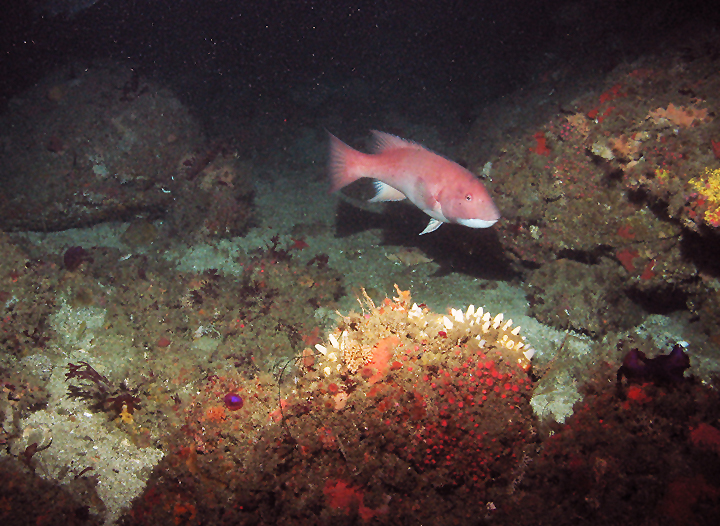
 Female California sheephead near a rocky reef covered in colorful invertebrates at South Point SMR. photo © MARE.
South Point SMR and FMR, like the rest of the Northern Channel Islands, are located where warm water currents from the tropics and cold water currents from Alaska converge. This mix of temperatures combined with upwelled nutrients from the deep and the meeting of species from southern and northern ranges accounts for the rich and varied marine life found here.
Within the Channel Islands chain, Santa Rosa Island sits the second-farthest west and is influenced more heavily by the cold California Current. South Point SMR's northern boundary is about 3½ miles of predominantly rocky shoreline, with occasional sandy coves where northern elephant seals haul out to rest. Along the shore, rocky tidepools teem with colorful sea stars, sea urchins, anemones, barnacles, and California mussels.
In nearshore waters, dense surfgrass beds shelter snails, sea stars, clams, and rock crabs, while pipefish, señoritas and perch move among the long, swaying shoots. The rocky reefs support a variety of large red, brown, and green algae species, including forests of giant kelp. Lingcod, kelp bass, cabezon, and white seabass can be spotted swimming through the swaying fronds, while remnant populations of red abalone and black abalone search for drifting kelp to eat. The reef and kelp forest also provide shelter for scallops, California spiny lobster, and keyhole limpets.
At a depth of about 70 feet, the nearshore shelf drops off to sandy plateaus reaching depths of over 1,000 feet. Two rocky reefs are found at 90- and 120-foot depths.
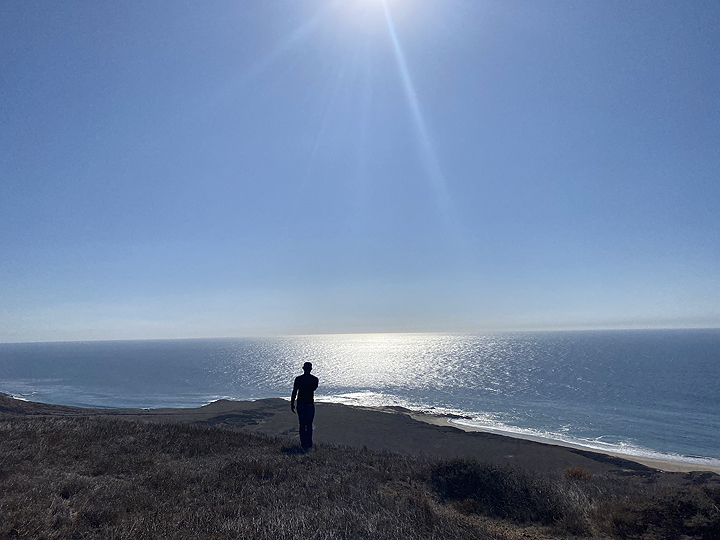 Visitor at South Point, Santa Rosa Island. photo © C. Allison, MPA Collaborative Network.
For centuries, Native American Tribes in California have relied on marine and coastal resources. Many continue to regularly harvest marine resources within their ancestral territories and maintain relationships with the coast for ongoing customary uses.
Santa Rosa Island is a traditional home of the Chumash, who occupied the island almost continuously for 10,000 years. The potentially oldest human remains in North and South America were found on Santa Rosa Island near Arlington Springs in 1959. Modern carbon dating of a human bone fragment from the site determined the age of the fragment to be around 13,000 years old. Eight historic Native American village sites have been discovered on the island to date.
The first recorded instance of European exploration dates to 1542, when Juan Rodriguez Cabrillo landed on the island and documented three villages. In 1850, the Channel Islands were added to the United States, and cattle and sheep enterprises were established on Santa Rosa Island that continued until 1998. From the 1940s to the 1960s, the island also hosted an army base and an air force base, and was explored for oil drilling.
Channel Islands National Park was established in 1980 to protect Santa Rosa, Santa Cruz, San Miguel, Anacapa and Santa Barbara islands, replacing the previously designated Channel Islands National Monument that had only protected Anacapa and Santa Barbara islands. The Channel Islands National Marine Sanctuary was also established in 1980, protecting 1,470 square miles of ocean up to six nautical miles offshore around each of the five islands.
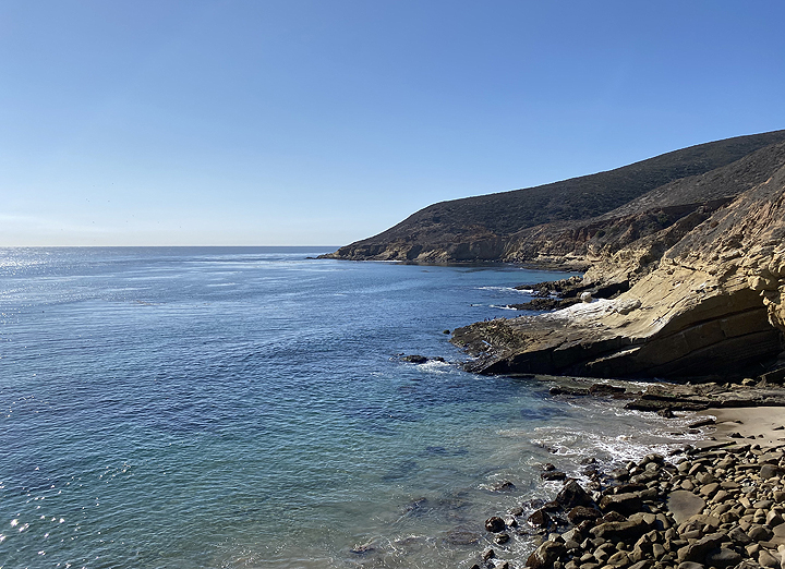 Coastline at South Point SMR. photo © C. Allison, MPA Collaborative Network.
Santa Rosa Island is accessible by either boat or plane. Flights to the island take approximately 45 minutes and are offered year-round through Channel Islands Aviation. Public boat trips with Island Packers out of Ventura Harbor can take upwards of three hours and run regularly from April through November, two to four days per week.
Visitors can also access the island via private boat. There is no visitor center or amenities, but the island still offers many recreational opportunities including hiking, picnicking, camping, and diving, as well as fishing outside of any SMRs and FMRs.
There is no transportation on Santa Rosa Island, so South Point must be accessed on foot or by boat. Backcountry beach camping along the South Point SMR shoreline is permitted from September 16 through December 3.
The hiking route to Johnson's Lee, just east of South Point is a very strenuous 13- to 18-mile trek from Bechers Bay, depending on the route taken. Johnson's Lee is a small, protected anchorage as well as a popular dive site. Due to the strong, persistent wind and currents, water activities are recommended for the experienced visitor only.
Birders should be sure to pack their binoculars, as more than 195 species are present on and around the island.
This area is bounded by the mean high tide line and straight lines connecting the following points in the order listed:
33° 55.014' N. lat. 120° 10.000' W. long.;
33° 50.400' N. lat. 120° 10.000' W. long.;
33° 50.400' N. lat. 120° 06.500' W. long.;
33° 53.800' N. lat. 120° 06.500' W. long.; and
33° 53.800' N. lat. 120° 06.544' W. long.
Note: This area includes South Point State Marine Reserve and the adjoining federal South Point Marine Reserve. Coordinates are provided for outer boundaries of the joined state and federal areas.
The state reserve and federal reserve share identical regulations. For state reserve boundaries only, see California Code of Regulations Title 14, Section 632. For federal reserve boundaries only, see Code of Federal Regulations, Federal Register 15 Part 922 and 50 CFR Part 660.