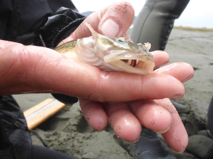
 South Humboldt Bay SMRMA provides nursery habitat to species like the Pacific staghorn sculpin. photo © F. Shaughnessy, all rights reserved.
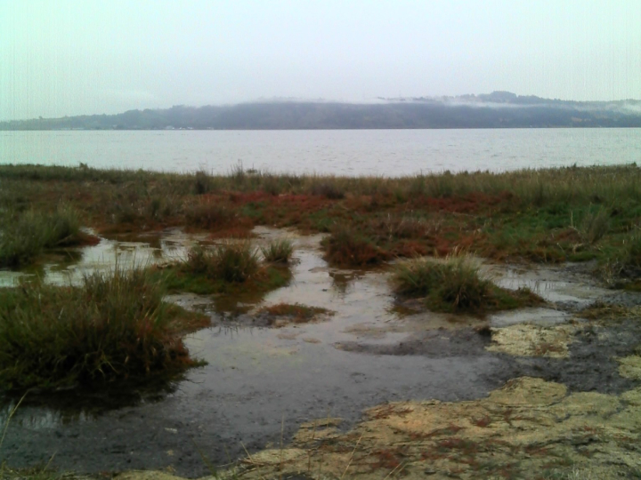
Humboldt Bay is California’s only deep-water bay north of San Francisco, reaching depths of approximately 40 feet. With the combination of saltwater influx and several freshwater sources via sloughs, rivers, and creeks, Humboldt Bay supports intertidal mudflats and eelgrass beds, coastal and freshwater marsh, sand dunes, and riparian forest. Humboldt Bay has several designated areas to protect wildlife including the Humboldt Bay National Wildlife Refuge and South Humboldt Bay SMRMA.
Located in the southwest portion of Humboldt Bay, South Humboldt Bay SMRMA contains extensive eelgrass beds, which are beneficial to both humans and wildlife. Eelgrass oxygenates coastal waters and sediments, helps protect shorelines from erosion through vast networks of shallow roots, stabilizes sediments, and is highly effective in carbon sequestration. Seabirds, waterfowl, fish, and invertebrates depend on the eelgrass beds. The eelgrass within the SMRMA serves as an important nursery for marine and estuarine fishes, including halibut, salmon, staghorn sculpin, surfperch, leopard sharks, Pacific herring, rockfish and rays, and invertebrates like Dungeness crab. This habitat is used for foraging, breeding, and transit between freshwater spawning grounds and the sea. More than 200 bird species, including 80 kinds of water birds, regularly feed, rest, or nest at the SMRMA, nearby Humboldt Bay Wildlife Refuge, and other areas around the bay.
 The Wiyot have relied on the various habitats in Humboldt Bay for food and other resources for centuries. CDFW photo by A. Lui.
For centuries, Native American Tribes in California have relied on marine and coastal resources. Many Native American Tribes in California continue to regularly harvest marine resources within their ancestral territories and maintain relationships with the coast for ongoing customary uses. Wiyot people have lived in the Wigki (Humboldt Bay) region for thousands of years. The Wiyot foraged shellfish and razor clams from the beach, smelt from the surf, mussels from large driftwood logs, and clams from the mudflats. Through a factual record of historical take within the South Humboldt Bay SMRMA, the Wiyot Tribe is exempt from the MPA regulations.
With its entrance obscured by rocky cliffs and sand dunes, Humboldt Bay escaped the eye of many ocean explorers during European exploration of the eastern Pacific between the 1500s and 1700s. The first documented European arrival in the area occurred in the early 1800s by the O'Cain sea otter hunting expedition. Interest in the area grew in the 1850s as settlers arrived by ship in search of timber and gold. Humboldt Bay was valued for commerce with San Francisco. Estuaries were converted to agricultural land where cattle ranching and potato and grain farming were common. Conversion to agriculture diminished the bay and slough surface areas from 27,000 to 17,000 acres by 1900. From the 1940s to early 1950s, the last active whaling station on the Pacific Coast operated out of Field’s Landing, which lies northeast of South Humboldt Bay SMRMA. Today, around 80,000 people live in the cities around Humboldt Bay. The bay continues to support hundreds of fish, invertebrate, and bird species, and is home to the largest commercial oyster farming operation in California.
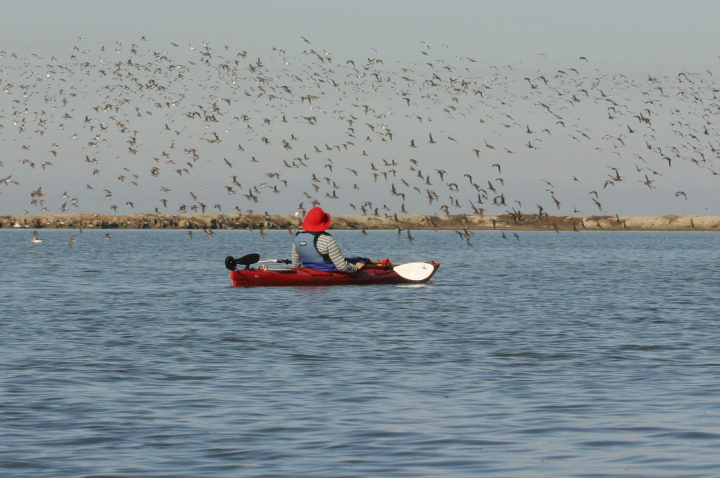 Kayaking is a great way to enjoy the wildlife found in South Humboldt Bay SMRMA. photo © A. Pickard, all rights reserved.
Using a non-motorized craft such as a kayak, canoe, or paddleboard is often the best way to view the estuary and its incredible diversity of fish, plants, birds, and marine mammals. On average 100,000 birds land in Humboldt Bay each season. Commonly seen residents include the great blue heron, great egret, black brant, marbled godwit, western sandpiper, and hundreds of other migrating birds. Binoculars or a spotting scope increase the odds of seeing wildlife in their natural habitats, and viewing opportunities are best in winter and spring. South Humboldt Bay SMRMA also allows for waterfowl hunting in accordance with general waterfowl regulations, but take of other marine resources is prohibited.