T.%20Abe%20Lloyd_CC%20BY-NC%202.0_Brandt'sCormorants_Gulls_SkunkPointSMR.png?ver=SiAM1gw9mMiTx0_ptUqkjQ%3d%3d) Skunk Point SMR offers fantastic birdwatching opportunities. photo © Abe Lloyd, CC BY-NC 2.0.
Skunk Point SMR offers fantastic birdwatching opportunities. photo © Abe Lloyd, CC BY-NC 2.0.
Skunk Point SMR, like the rest of the Channel Islands region, is located at the convergence of warm currents that rush north up the Southern California coast and the cold California current that pushes south from Alaska. Nutrient-rich water, the mixing of temperatures from the convergence of currents, and the meeting of species from southern and northern ranges account for the rich and varied marine life found at the Channel Islands. Within the island chain, Santa Rosa Island sits the second farthest west and is influenced more heavily by the California current.
Rounding the corner from Bechers Bay, Skunk Point is a sprawling white sand beach backed by dunes, which serve as seasonal breeding, foraging, and nesting grounds for snowy plovers. Snowy plovers lay camouflaged eggs on the back dunes at Skunk Point, where they can be easily crushed by beachgoers. To protect snowy plover nests, this area is closed for part of the year. From Skunk Point, the predominantly sandy shoreline continues south, where harbor seals haul out on shore. At the southern end of Skunk Point SMR, just north of East Point, is Abalone Rocks Marsh, the second largest wetland on the northern islands. The only lagoon in the northern Channel Islands, this brackish marsh is an important resting and feeding stop for migratory birds, while resident waterfowl nest in the shallow waters.
Offshore, eelgrass beds line the sandy sections of the seafloor at Skunk Point SMR. Snails, sea stars, clams, and rock crabs seek protection in eelgrass beds, while pipefish, señoritas, and perch move among long, swaying shoots. Interspersing the sand patches, scattered, shallow rocky reefs provide refuge for sea urchins, sea stars, anemones, coralline algae, and California mussels. The rocky intertidal transitions to kelp forest, where giant kelp is the dominant species. Kelp bass, lingcod, cabezon, sea cucumbers, and scallops use the cover of the understory kelp fronds and rocky substrate to forage and hide.
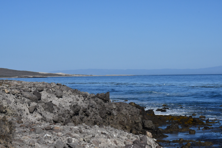 Shoreline at Skunk Point SMR. photo © C. Allison, MPA Collaborative Network.
For centuries, Native American Tribes in California have relied on marine and coastal resources. Many Native American Tribes in California continue to regularly harvest marine resources within their ancestral territories and maintain relationships with the coast for ongoing customary uses. Traditionally home to the Chumash, there was an almost continuous history of Native American occupation on Santa Rosa Island from between 10,000 and 200 years ago. The potentially oldest human remains in North and South America were found on Santa Rosa Island near Arlington Springs in 1959. Using modern carbon dating of a fragment of bone, these remains were later dated to 13,000 years ago. Eight historic Native American village sites have been discovered on the island.
The first recorded instance of European exploration dates to 1542, when Juan Rodriguez Cabrillo landed and documented three villages. In 1850, the Channel Islands were added to the United States, and cattle and sheep enterprises were established on Santa Rosa Island and continued until 1998. From the 1940s to the 1960s, the island was used for other purposes such as an army base and air force base and for oil drilling exploration. In 1980, Channel Islands National Park was established, protecting Santa Rosa, Santa Cruz, and San Miguel Islands in addition to Anacapa and Santa Barbara Islands, previously designated as Channel Islands National Monument. The Channel Islands National Marine Sanctuary was also established in 1980, protecting 1,470 square miles of ocean encompassing the waters up to six nautical miles offshore around each of the five islands.
_30344026318_8552eb53da_o.png?ver=wfDMobxt163E8d2f_E5bww%3d%3d) Northern Channel Islands. Santa Rosa Island, where Skunk Point SMR is located, can be accessed by boat or plane. photo © W. Hsieh, CC BY-NC.
Northern Channel Islands. Santa Rosa Island, where Skunk Point SMR is located, can be accessed by boat or plane. photo © W. Hsieh, CC BY-NC.
Santa Rosa Island is accessible by either boat or plane. Flights to the island take approximately 45 minutes and are offered year-round through Channel Islands Aviation. Public boat trips with Island Packers out of Ventura Harbor can take upwards of three hours and run regularly from April to November, two to four days per week. Visitors can also access the island via private boat.
There is no visitor center, and no goods or services, but the island still offers many recreational opportunities including hiking, picnicking, camping, and diving, as well as fishing (outside any SMRs). There is no transportation on Santa Rosa Island, so Skunk Point SMR must be accessed by boat or plane, and then by foot. From the main campground at Bechers Bay, a 10-mile hike will take you to Skunk Point.
The back beaches and sand dunes from Skunk Point to just north of East Point are closed from March 1 through September 15 to protect critical nesting habitat for the snowy plover. Birders should be sure to pack their binoculars, as more than 195 species may be found on the island.