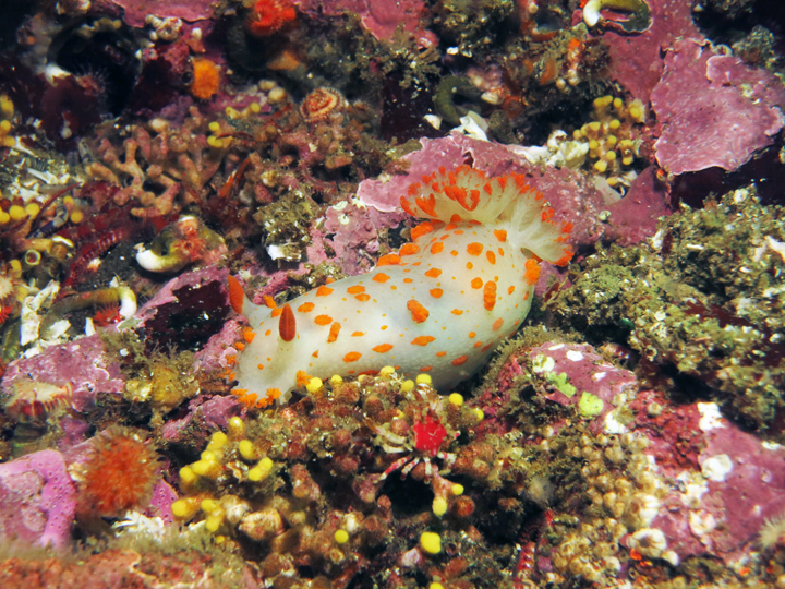
 Sea clown triopha at Russian Gulch SMCA. photo © K. Joe.
Russian Gulch State Beach sits at the mouth of Russian Gulch Creek, nestled within a sheltered cove. River otters can be seen playing in the creek while black oystercatchers forage on rocks near shore.
Beyond the calm, sheltered beach, intertidal organisms that are specially adapted to withstand the pounding waves live among the rocks. Collections of small barnacles, limpets, and mussels attach to the rock faces, while the few tidepools that form are populated with assemblages of anemones, periwinkles, sea stars, and sea palm. Urchins, crustose coralline algae, sea cucumbers, and sea slugs such as the sea clown triopha add vibrancy to the rocky walls and surge channels throughout the MPA. Among the narrow chutes and rocky valleys beneath the surface of Russian Gulch SMCA, red abalone and flat abalone are common. Crabs, rock scallops, and nearshore fish species, especially cabezon, greenling, lingcod, and surfperch, are targeted by anglers, crabbers, free divers, and spear fishermen. A variety of rockfish frequent the deeper waters, including black rockfish, blue rockfish, quillback rockfish, and kelp rockfish.
From the headlands of Russian Gulch, gulls and ospreys can be spotted flying overhead, and gray whales can be seen offshore as they migrate through the area from December to April.
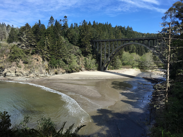 Beach at Russian Gulch SMCA. photo © C. Shen.
For centuries, Native American Tribes in California have relied on marine and coastal resources. Many California Native American Tribes continue to regularly harvest marine resources within their ancestral territories and maintain relationships with the coast for ongoing customary uses. North Coast Pomo inhabited the territory from Cleone south to the Navarro River for thousands of years. Their main village, consisting of redwood bark houses, was located at the mouth of Big River a few miles south of Russian Gulch.
The history of early settlement is poorly documented before the timber industry began. In 1850, news reached San Francisco that a shipwreck had occurred up the coast. A crew sent out to salvage the ship's cargo recognized the economic potential of the enormous stands of redwood trees on shore. This discovery sparked the establishment of the local timber industry.
The cove at Russian Gulch served as a common stop for schooners in the second half of the 19th century, collecting passengers and coast redwood lumber. Iron rings that were used to tether the schooners can still be found on the headlands within the SMCA. Redwood shingles and railroad ties were also produced at a mill at Russian Gulch, and the bay was used as a harbor and frequent stopover point by fishing boats and freight and passenger ships.
In the mid-1920s, F.O. Warner, a developer from Los Angeles, bought up nearby land to develop it as a resort. However, a campaign began in 1928 to establish a state park at Russian Gulch. The state acquired the land in 1933, and it officially became Russian Gulch State Park in 1934. Russian Gulch SMCA was designated as an MPA in 2012.
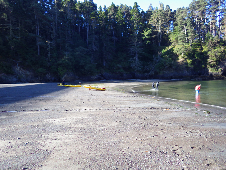 Divers and kayakers at Russian Gulch SMCA. photo © K. Nielsen, CC BY-NC-SA 4.0.
Russian Gulch SMCA is adjacent to Russian Gulch State Park, which offers more than 1,000 acres to explore. Parking and restrooms are available next to Russian Gulch Beach, just off of Highway 1. The beach area in the narrow bay at the mouth of Russian Gulch Creek is a great spot for beachcombing and picnics. Kayaking is a popular activity here, as kayaks can be launched easily from the beach. The rocky headlands' caves, tunnels, rock walls, and inlets are popular sites for exploration.
Protected from the strong currents of the open ocean and offering an easy beach entry, Russian Gulch is a popular scuba diving spot. Recreational take is permitted in accordance with current regulations within Russian Gulch SMCA and anglers and spear fishermen may try their luck for lingcod and rockfish.
Coastal trails along the northern and southern headlands offer spectacular views of the SMCA. One of the most famous sites is the Devil's Punchbowl, a 60-foot-deep and 100-foot-wide blowhole. Visitors can watch ocean water roll in and out of this blowhole, formed by a collapsed sea arch, and listen to the booming echo that blasts from the blowhole during high tide. The headlands are also a great spot for sunset picnics and offer a prime vantage point for whale watching from December to April.