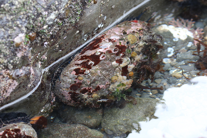
 Red abalone and brooding anemones in a tidepool at Van Damme SMCA. photo © Michael Hawk, CC BY-NC 2.0.
Little River flows westward for nearly six miles, emptying into Van Damme SMCA. The river provides habitat for steelhead, coho salmon, sculpin, and stickleback, which forage in between salt and freshwater environments. A wide variety of birds can be found along the shore where Little River flows into the Pacific. Western gulls can be spotted flying overhead, while black oystercatchers and least sandpipers forage along the shoreline.
At low tide, harbor seals often haul out to rest on rocks close to shore. Beneath the surface, the sea floor ranges from soft sediment to rocky reef and kelp forest. Bat stars, leather stars, snails, sponges, tunicates, and gumboot chitons can be found at varying depths within the kelp forest habitat. Populations of nearshore fish, especially rockfish, cabezon, greenling, lingcod, and surfperch, swim among the kelp blades at Van Damme SMCA. Colorful coralline algae, red sea urchins, purple sea urchins, red abalone, pinto abalone, giant green anemones, nudibranchs, and giant red sea cucumbers create a rainbow of invertebrate marine life on the rocky reef. Gray whales can be spotted offshore during their spring and fall migrations.
There are numerous deep channels and caves to explore in Van Damme SMCA. One of the most notable is known as the Cave of the Trolls, a 20-foot-tall and 100-foot-long tunnel that can be found along the northern part of the cove.
Recent surveys inside Van Damme SMCA have documented unprecedented losses of kelp due to a dramatic increase in purple urchins, which are voracious herbivores. Formerly lush kelp forests have given way to “urchin barrens”, expanses of bare rock carpeted with hungry urchins. These hardy, spiny creatures often outcompete other herbivores such as abalone. Local red abalone populations have decreased considerably over the last few years. The rise of urchins and associated decline in kelp and abalone is likely due to a combination of issues, including unusually high ocean temperatures, changing ocean circulation patterns caused by climate change, and the decimation of sea star populations–major urchin predators–due to sea star wasting syndrome. Researchers are working to better understand these issues. This MPA may provide a reference to surrounding fished areas to help determine if recovery within the MPA is more rapid than outside the MPA, enabling appropriate management decisions.
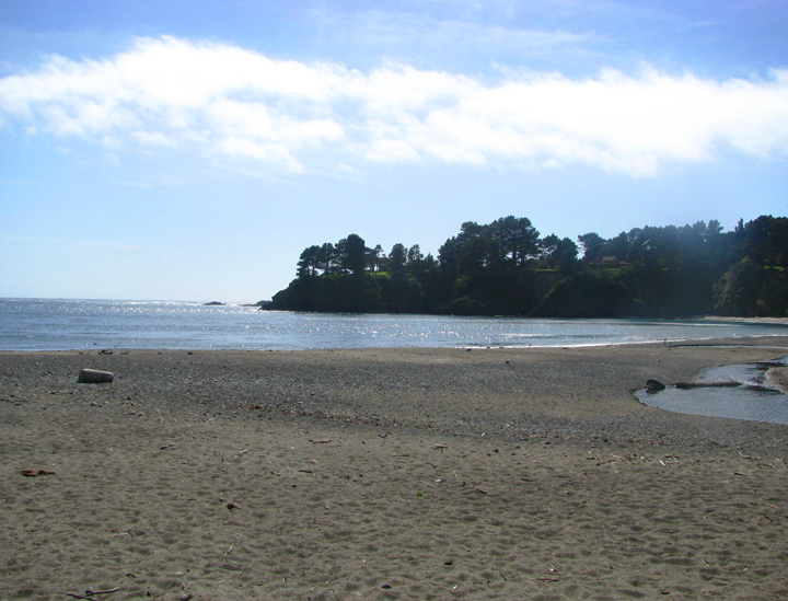
 Beach at Van Damme SMCA. CDFW photo by L. Kashiwada.
For centuries, Native American Tribes in California have relied on marine and coastal resources. Many Native American Tribes in California continue to regularly harvest marine resources within their ancestral territories and maintain relationships with the coast for ongoing customary uses. Van Damme is located within the territory of the Northern Coast Pomo people who call this area ‘Kala-ili’.
The history of early settlement in this area is poorly documented until the timber industry began in the 1850s. The bay that Van Damme SMCA sits within was originally known as Beall's Harbor and Kent's Landing for the two original family landowners, but the name was changed to Little River Bay in 1864. In that year, the mill town of Little River was founded, eventually boasting a schoolhouse, hotels, blacksmith shops, and a post office. The first mill was built around 1875, with a second mill built in 1885, along with a shipyard, wharf, and lumber port. Overharvesting of the inland timber, however, forced the mills to shut down around the turn of the century. The town declined rapidly thereafter, with the closing of the schoolhouse, shipyard, and weekly steamship service.
Charles Van Damme purchased the property that is now the Van Damme State Park at the beginning of the 20th century with profits from his San Francisco ferry business. Upon his death in 1934, the property became part of the California State Parks system. Spring Ranch, on the headlands north of the MPA, encompasses 350 acres and is one of the oldest coastal ranches in California. The ranch structures were constructed in 1857 and the Kent family planted some of the first eucalyptus trees on the Mendocino Coast, which are still standing today. Spring Ranch was originally a dairy and beef cattle operation and after passing through various ownerships became a part of Van Damme State Park in 1996.
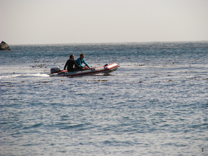
 Divers in an inflatable boat at Van Damme State Marine Conservation Area. photo © Jimmy Coupe, CC BY 2.0.
Van Damme SMCA is easily accessible with free parking on the ocean side of Highway 1, adjacent to Little River Beach. Restrooms are available and there is overnight camping for RVs. The campgrounds and facilities of Van Damme State Park are within easy walking distance across the highway. The sandy part of the beach is an ideal spot for picnics, wading, and a relaxing day at the beach.
Kayaking is a popular activity here and kayak tours of the sea caves in the area launch from the beach. The cove is one of the most popular destinations in the area for divers and is especially great for novice divers. The headlands and outer reef protect the beach from strong swells and currents, which makes entering the water from this beach fairly easy.
Within Van Damme SMCA, recreational take is permitted in accordance with current fishing regulations. The teeming marine life makes it a popular spot for spearfishing competitions.
Van Damme SMCA is surrounded by Van Damme State Park, which offers ample recreational opportunities. Ten miles of hiking trails run along Little River, including a boardwalk nature trail through a pygmy forest farther inland. To the north of the MPA, the headlands known as Spring Ranch are also part of the state park; the location offers another network of trails with spectacular ocean views.