 Garibaldi in a kelp forest at Goat Harbor, Long Point SMR. photo © NOAA Photo Library, CC BY 2.0.
Long Point SMR is the warmest, most wave-sheltered portion of the eastern Channel Islands. Long Point is a stretch of rocky reef that extends in a large ridge to depths of over 90 feet. The rocky seafloor is the perfect environment for sea fans, anemones, limpets, and barnacles. Beyond the reef to the west, barracuda, yellowtail, and schooling mackerel congregate in deep water.
The bays of Goat Harbor and Italian Gardens are strewn with nearshore cobblestone that shifts to a sandy seafloor as depth increases. Italian Gardens is home to a large population of giant sea bass and serves as an important spawning aggregation site. The giant sea bass is a critically endangered species that plays an important role near the top of the food chain. They can weigh up to 700 pounds, and females can produce up to 60 million eggs during the spawning season. Bottom-dwelling bat rays, California halibut, sole, and other small flatfish use this area as well. The reef off Goat Harbor is sheltered from strong currents and waves. Aggregations of blacksmith, leopard sharks, and kelp bass hide from predators in the kelp forest here. As the ocean floor deepens, large boulders form reefs covered with a variety of soft corals, anemones, and other invertebrates.
Between Goat Harbor and Italian Gardens, a rock formation known as Twin Rocks juts out of the water. Historically, Santa Catalina Island has been home to seven nesting pairs of bald eagles, and Twin Rocks has served as one of these nesting areas.
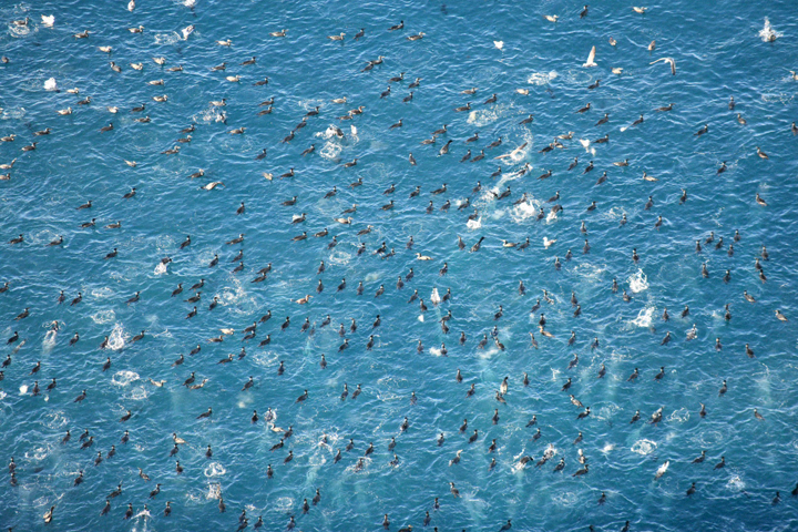 Cormorants at Long Point SMR. photo © B.J. Dion, CC BY-NC-SA 2.0.
Native American Tribes in California have relied on marine and coastal resources for centuries. Many Native American Tribes in California continue to regularly harvest marine resources within their ancestral territories and maintain relationships with the coast for ongoing customary uses. Originally inhabited by Native Americans known as the Tongva, Santa Catalina Island, also known as Pimugna or Pimu by these first peoples, provided abundant resources for permanent villages for thousands of years. Ancient tools hand-fashioned from stone, shell, and bone, and piles of abalone shells have been uncovered at ancient village sites.
Captain Juan Rodriguez Cabrillo, a Portuguese navigator in service to Spain, was likely the first European explorer to visit the island, anchoring two tiny caravel ships off the Bay of Avalon in 1542. In November 1602, Philip the Third of Spain sent an expedition under command of Sebastian Vizcaino to map the California coastline. He anchored in what is now the crescent shaped harbor of Avalon on Saint Catherine’s Day and renamed the small sunny island “Santa Catarina” or “Cathalina”.
In the 1800s, wild goat hunters used the site now known as Goat Harbor in Long Point SMR as a preferred landing spot. The hills and valleys around Goat Harbor were once overrun with wild goats, hence the need for goat hunters. The harbor was the starting point for the first trail across the island to Middle Ranch. Southeast of Goat Harbor lies a bay known as Italian Gardens. The bay is named for the Italian fishermen who made the local reef a favorite fishing spot in the 1800s. These fishermen, based out of San Pedro on the mainland, also dried their nets on the beaches of Italian Gardens.
In 1885, the island was sold for $200,000 to George R. Shatto, who sold land parcels to buyers from all over the country. In 1919, the island again changed hands and was sold for $3 million to the multi-millionaire chewing gum mogul and owner of the Chicago Cubs baseball team, William Wrigley Jr., who set out to make it a tourist destination. In the 1970s, Wrigley deeded 88 percent of the island to the Catalina Island Conservancy, and today much of it remains undeveloped and wild. Santa Catalina Island’s rich history can be seen in the many historic landmarks that dot the landscape.
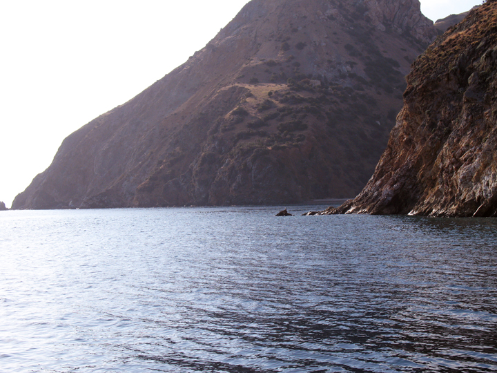 Long Point SMR. CDFW photo by T. Mason.
Long Point SMR is only accessible by boat. Kayaks can be rented in Avalon for a five-mile paddle to Long Point Beach, or in Two Harbors for a seven-mile paddle to Goat Harbor.
Several primitive, boat-in campgrounds provide the opportunity to stay the night on the edge of the SMR. Goat Harbor has anchorage in sand available for five to 10 boats, and three campsites. The "U" shaped harbor is great for swimming and snorkeling and is a popular dive spot. Three separate cobblestone beaches at Italian Gardens provide primitive boat-in campgrounds, and the wide bay offers snorkeling and diving opportunities. Long Point Beach has two campsites and Pirate's Cove is a small, protected section with anchorage in sand for a couple of boats.
All take is prohibited within Long Point SMR; however, snorkel and scuba diving conditions are excellent. Long Point SMR is a popular dive spot for tour operators out of Avalon and Two Harbors. The bays at Goat Harbor and Italian Gardens offer good visibility and calm waters, which is great for beginners. Long Point is famous for diving at Pirate's Cove. There is a rocky ridge that extends underwater from the point to depths of around 90 feet and the area features extensive kelp forests.