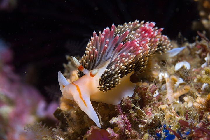
 Hilton's aeolid, a type of nudibranch (sea slug), at Gull Island SMR. photo © C. Hoover, CC BY-NC 2.0.
Gull Island SMR and FMR are located where warm water currents from the tropics and cold water currents from Alaska converge. Deep basins surrounding the island produce an annual upwelling of cold, nutrient-rich water from the ocean depths to the surface. These nutrients, combined with the mix of temperatures and the meeting of species from southern and northern ranges, account for the richly varied marine life found here.
Large underwater canyons, seamounts, pinnacles, kelp forests, rocky reefs, boulder fields, and sandy plains create a varied underwater landscape. Gull Island lies less than a mile off the southern shore of Santa Cruz Island, surrounded by waters characterized by underwater rock piles, ledges, and plunging drop-offs. A short distance east of the island is an area known as the “Outer Walls,” where underwater ledges stair-step from 25 to 50 feet, before plummeting to 110 feet deep. Looking out into the open blue water from this site, divers have occasionally encountered migrating gray whales, tuna, yellowtail, and dense schools of bocaccio.
The pinnacles off Gull Island are covered with animals that find refuge in their cracks and crevices. Nudibranchs (sea slugs) such as the thick-horned aeolid and the Spanish shawl thrive in the strong, nutrient-filled currents that sustain their preferred food sources, including sponges and hydroids. Patches of slow-growing, vibrantly colored purple hydrocoral are found at 60- to 120-foot depths in the SMR; this is one of the few locations in the Northern Channel Islands where the hydrocoral thrives. California spiny lobsters, two-spot octopus, purple urchins, and various colorful sea stars such as bat stars, giant-spined sea stars, and bright blood stars hide among the pinnacle crevices.
A band of kelp forests surround Gull Island and Santa Cruz Island. Kelp bass, California sheephead, cabezon, and torpedo rays are often seen within the kelp forest, while Pacific barracuda and schools of Pacific bonito may be spotted beyond the kelp in open water.
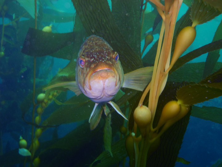 Kelp bass in giant kelp at Gull Island SMR. photo © I. Girling.
For centuries, Native American Tribes in California have relied on marine and coastal resources. Many Native American Tribes in California continue to regularly harvest marine resources within their ancestral territories and maintain relationships with the coast for ongoing customary uses.
Ancestors of the Chumash people occupied Santa Cruz Island for at least 9,000 years. They used the tomol, a traditional redwood plank canoe, to travel between the islands and mainland.
During the earliest recorded European visit to the island in 1769, Spanish explorers unintentionally left an iron cross staff at a local Chumash village. Considering it lost, they were surprised when a tomol paddled up next to their ship the following day to return the forgotten staff. The explorers subsequently named the island Santa Cruz Island, which means “Island of the Holy Cross”.
Through a land grant from the Mexican government, Captain Andres Castillero became the first private owner of Santa Cruz Island in 1839. He sold it in 1857 to William Barron, a San Francisco businessman, who started a sheep operation there. By 1886, Justinian Caire, a French immigrant, acquired all the shares of the Santa Cruz Island Company and started a self-sustaining sheep and cattle ranch, vineyard, and groves of nut and fruit trees. Upon Caire’s death, a hotly contested land dispute began a decades-long legal battle over the Santa Cruz Island Company. The legal fight finally resolved with transfer of the property to The Nature Conservancy in the 1990s. Channel Islands National Park now owns and operates approximately 24 percent of Santa Cruz Island, and The Nature Conservancy, the University of California Natural Reserve System, and the Santa Cruz Island Foundation operate the remainder.
Much of the island is dedicated to marine and terrestrial scientific research and education. Channel Islands National Park was established in 1980 to protect Santa Rosa, Santa Cruz, San Miguel, Anacapa and Santa Barbara islands, replacing the previously designated Channel Islands National Monument that had protected only Anacapa and Santa Barbara islands. The Channel Islands National Marine Sanctuary was also established in 1980, protecting 1,470 square miles of ocean up to six nautical miles offshore around each of the five islands.
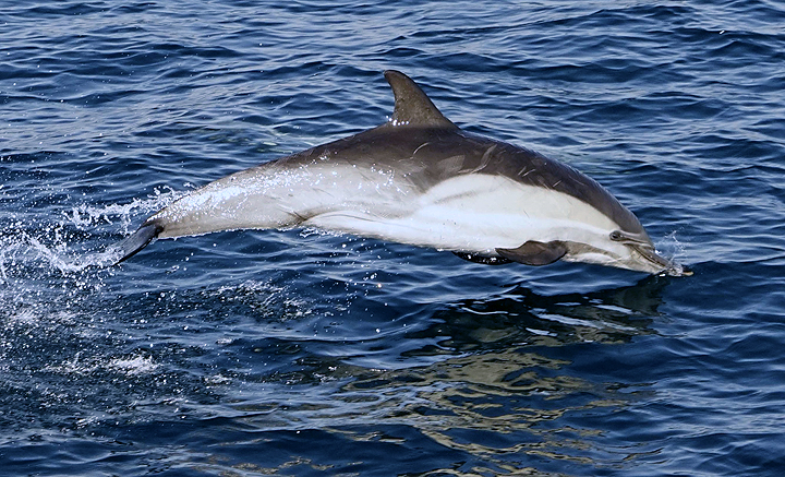 Short-beaked common dolphin, Gull Island SMR. photo © T. Giller, CC BY-NC 2.0.
Santa Cruz Island is the perfect place for a day trip or multi-night camping trip. Of the Northern Channel Islands, it is one of the easiest to access by boat. Trips operated through the National Park Service-authorized concessionaire, Island Packers, leave from Ventura Harbor and take about an hour to reach the island. During the short voyage it is common to see whale spouts, pods of dolphins, and many different seabirds.
The Channel Islands National Park Visitor Center on Santa Cruz Island is located at the Scorpion Ranch House, where a variety of interactive exhibits and resources can teach visitors about the island’s history. The hiking opportunities are endless on the island, and offer spectacular views of the SMR.
On calm days, snorkelers can drift along the coastline and in coastal pools in search of marine life. Farther offshore in deeper waters, scuba divers can explore the large rocky reefs near Gull Island; visibility is frequently good here, occasionally reaching 100 feet. Close encounters with curious seals and playful sea lions are common, and divers should expect to see plenty of fish and colorful invertebrates, perfect for taking close-up photos. No fishing or take of any kind is allowed within the SMR and FMR.
Gull Island State Marine Reserve/Federal Marine Reserve
This area is bounded by the mean high tide line and straight lines connecting the following points in the order listed except where noted:
33° 58.065' N. lat. 119° 50.967' W. long.;
33° 58.000' N. lat. 119° 51.000' W. long.;
33° 58.000' N. lat. 119° 53.000' W. long.;
33° 51.717' N. lat. 119° 53.000' W. long.;
33° 51.717' N. lat. 119° 48.000' W. long.; and
33° 57.769' N. lat. 119° 48.000' W. long.
Note: This area includes Gull Island State Marine Reserve and the adjoining federal Gull Island Marine Reserve. Coordinates are provided for outer boundaries of the joined state and federal areas.
The state reserve and federal reserve share identical regulations. For state reserve boundaries only, see California Code of Regulations Title 14, Section 632. For federal reserve boundaries only, see Code of Federal Regulations, Federal Register 15 Part 922 and 50 CFR Part 660