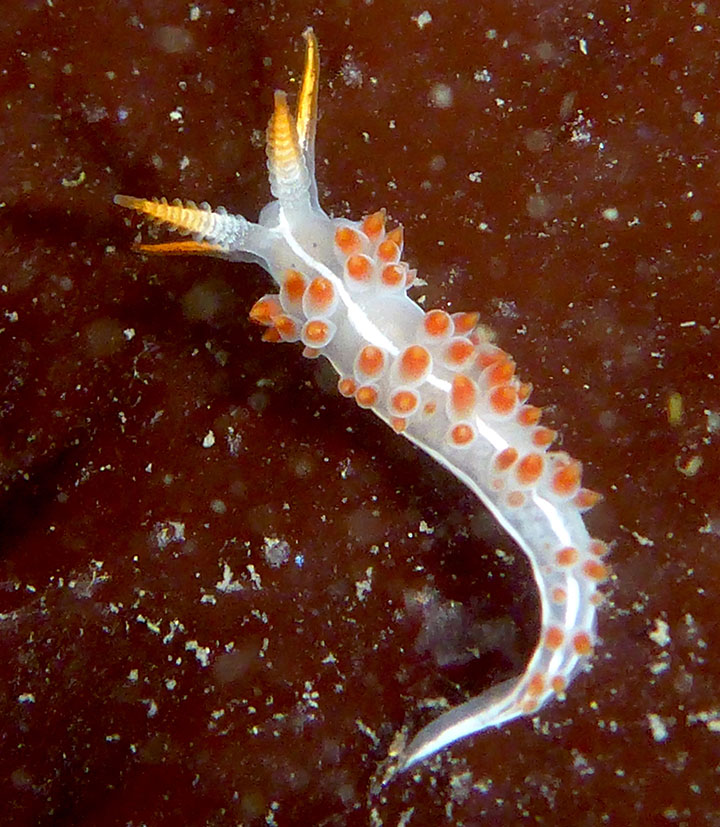
 Three-lined aeolid in Duxbury Reef SMCA. Photo © A. Young, CC BY-NC 2.0.
The formation of Duxbury Reef began millions of years ago as silica-rich diatoms, a type of small plankton, died, sank, and formed thin layers on the shallow sea floor. Over time, the layers were compressed to form sheets of fine-grained, silica-rich rock, along with layers of volcanic ash. These layers form the shale in Duxbury Reef.
Duxbury Reef is both exceptionally large and shallow. Low tide exposes fractures in the parallel channels of the shale reef. These fractures form ridges that extend into Bolinas Bay for more than half a mile, their rocky irregularities forming tidepools lined with seaweed and teeming with animals well-adapted to extreme variations in temperature. During low tide, a wide array of tidepool animals can be seen in the SMCA: mossy chitons, giant green anemones, tiny colorful nudibranchs (sea slugs), small fishes such as gobies and blennies, octopus, porcelain crab, black turban snails, and brittle stars with thread-like legs.
Just offshore and to the southeast, the reef recedes to a sandy seafloor; to the north, rocky outcroppings provide anchor points for kelp forests. The exposed bedrock to the north typically supports bull kelp, a large algae well-adapted to high wave-energy areas. The rocky reef and kelp ecosystems offshore are highly productive and inhabited by lingcod, dozens of rockfish species, cabezon, greenling, and halibut, as well as invertebrates such as sea stars, purple and red sea urchins, giant Pacific octopus, and Dungeness crab.
Duxbury Reef SMCA supports populations of sooty shearwaters, western gulls, common murres, Cassin’s auklets, and many other bird species. Humpback and blue whales are frequently seen in the area; both species are dependent on coastal upwelling to provide the nutrients that support their preferred food sources. Chinook salmon, white seabass, white sharks, and leatherback sea turtles have all been observed in the Duxbury Reef area.
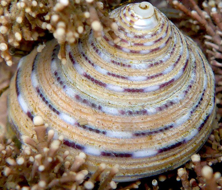 Three-colored top shell in Duxbury Reef SMCA. Photo © A. Young, CC BY-NC 2.0.
For centuries, Native American Tribes in California have relied on marine and coastal resources. Many Native American Tribes in California continue to regularly harvest marine resources within their ancestral territories and maintain relationships with the coast for ongoing customary uses. The Coast Miwok peoples were the original inhabitants of the Marin County coast, including lands adjacent to Duxbury Reef SMCA. The traditional Coast Miwok diet consists of several species of fish including halibut and rockfish, and invertebrates such as crabs, clams, mussels, abalone and oysters. Kule Loklo, a replica Miwok village run jointly by members of the Coast Miwok and California State Parks, is located near Point Reyes National Seashore Visitor Center.
The first European landing in northern California occurred on June 17, 1579 on the southern side of Point Reyes, now known as Drakes Estero, by the Sir Francis Drake Expedition. Originally used as a safe harbor for trading vessels, the fertile land soon became home to Spanish settlement during the Missionary period until Mexico gained its independence from Spain in 1821. Point Reyes was then used as ranch land and dairy pasture, undergoing several ownership changes until 1962, when much of the land was purchased by the National Park Service for conservation purposes.
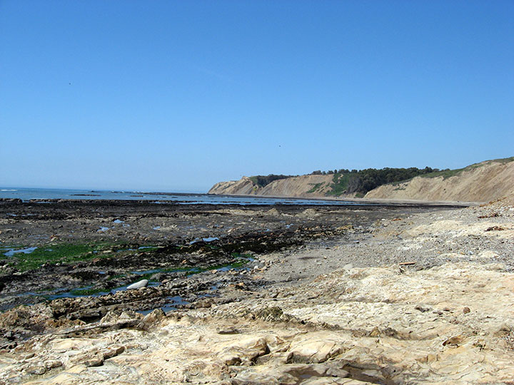 Low tide at Duxbury Reef SMCA. Photo © J. Merz, CC BY-ND 2.0.
Duxbury Reef SMCA is a wonderful place to view tidepools, wildlife, and explore the coast. It can be accessed from land along a hiking trail that is ideal for bird and marine mammal watching. Recreational fishermen can take finfish from shore and visitors arriving during low tide have an opportunity to see tidepool invertebrates that are usually hidden from view. At high tide or during large swells, visitors will instead witness thunderous ocean breakers crashing into rocky cliffs.
Visitors should attempt to minimize disturbance to plants and animals living on and between the rocks, and be mindful of their own safety. Never turn your back to the ocean. A “minus tide” of -0.5 to -1.5 feet is required for a successful tidepool adventure. Always check the tides in advance, arrive at least an hour before low tide, and leave no more than an hour after the tide begins to rise. Check the Point Reyes National Seashore website for safety tips on tidepooling.