Big Flat State Marine Conservation Area

a large green curling wave contrasts the dark sand beach, in center frame a rounded dark rock has a dozen double crested cormorants sit, these birds are darkly colored some craning their long necks looking for fish to dive on

Overview

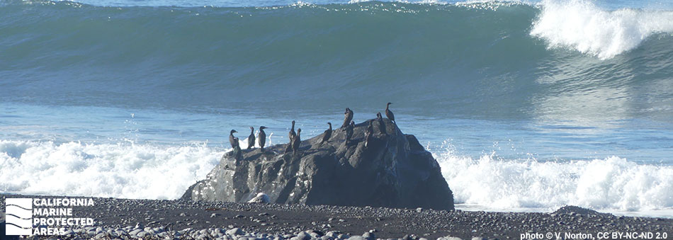
Big Flat State Marine Conservation Area (SMCA) is located off California’s Lost Coast, a stretch of coastline with limited road access, and may only be explored on foot or by boat. Located about 10 miles north of Shelter Cove, a small, remote fishing community, Big Flat SMCA spans more than two miles of coastline from Big Flat Creek in the south to Big Creek in the north. This marine protected area (MPA) protects more than 11 square miles of sandy beaches, rocky shores, coastal marsh, sandy seafloor, and over half a square mile of submarine canyon habitat ranging to depths of over 1,100 feet. These diverse habitats provide foraging grounds for many different species of fish, birds, marine mammals, and invertebrates.

Big Flat SMCA is one of 30 MPAs in the state with submarine canyons or steep walls found deeper than 650 feet. This location was chosen for an MPA to help preserve important rockfish habitat while minimizing socioeconomic impacts to recreational and commercial fishermen based out of Shelter Cove. Take of salmon by trolling and Dungeness crab by trap, hoop net, or hand is allowed, but all other take is prohibited.

Regulations

It is unlawful to injure, damage, take, or possess any living, geological, or cultural marine resource, EXCEPT:
Recreational take of salmon by trolling and Dungeness crab by trap, hoop net or hand is allowed. Commercial take of salmon with troll fishing gear and Dungeness crab by trap is allowed. Includes take exemptions for the following tribes:

  • Bear River Band of the Rohnerville Rancheria
  • Big Valley Band of Pomo Indians of the Big Valley Rancheria
  • Cahto Indian Tribe of the Laytonville Rancheria
  • Coyote Valley Band of Pomo Indians
  • Elem Indian Colony of Pomo Indians of the Sulphur Bank Rancheria
  • Guidiville Rancheria
  • Habematolel Pomo of Upper Lake
  • Hopland Band of Pomo Indians of the Hopland Rancheria
  • Lower Lake Rancheria
  • Manchester Band of Pomo Indians of the Manchester-Point Arena Rancheria
  • Middletown Rancheria of Pomo Indians
  • Pinoleville Pomo Nation
  • Potter Valley Tribe
  • Redwood Valley Rancheria of Pomo Indians
  • Robinson Rancheria of Pomo Indians
  • Round Valley Indian Tribes of the Round Valley Reservation
  • Scotts Valley Band of Pomo Indians
  • Sherwood Valley Rancheria of Pomo Indians

California Code of Regulations Title 14, Section 632(b)(15)(opens in new tab)

Quick Facts

MPA size: 11.59 square miles

Shoreline span: 2.5 miles

Depth range: 0 to 1,110 feet

Habitat composition*:

  • Rock: 0.81 square miles
  • Sand/mud: 11.17 square miles

*Habitat calculations are based on 3-dimensional area and may exceed the total MPA area listed above.

Photo Gallery

3 OCT
2023

A variety of invertebrates on the seafloor in the SMCA

0

CDFW/MARE photo

Showing 0 Comment

Video Gallery

California's MPA Network

About Big Flat State Marine Conservation Area

Natural History

on the brownish gray muddy seafloor a large starry skate rests flat, sporting tan coloration with white spots, skates are related to sharks and stingrays, having a slightly more angled nose and wingtips compared to a commonly known round stingray
Starry skate in Big Flat SMCA. CDFW/MARE photo

Big Flat SMCA lies between Big Creek to the north, and Big Flat Creek to the south, and is accessible via a rough and rocky eight-mile hike. The creeks are critical to the lifecycle of salmon, which come upstream to spawn, and downstream to grow to adulthood in ocean waters. The coastline between these creeks is a mix of rocky intertidal, coastal bluffs, and sandy beach. Offshore, the seafloor habitat is sand, soft sediment, and rocky reefs, and includes part of a submarine canyon known as Spanish Canyon.

These diverse habitats provide homes to immobile invertebrates like gorgonians (a type of soft coral), sponges, and white-plumed anemones, as well as mobile invertebrates like Dungeness crab, sea stars, and sea cucumbers. Flatfishes such as California halibut and petrale sole easily blend into the soft sandy seafloor, while lingcod, kelp greenling, and many species of rockfish find refuge in the rocky crevices. The significant amount of rockfish habitat in this MPA is one reason why Big Flat SMCA was sited here.

Cultural History

orange and white fish with spiny fins
Copper rockfish in Big Flat SMCA. CDFW/MARE photo

For centuries, Native American Tribes in California have relied on marine and coastal resources. Many Native American Tribes in California continue to regularly harvest marine resources within their ancestral territories and maintain relationships with the coast for ongoing customary uses. Through a factual record of historical take within the Big Flat SMCA, several tribes are exempt from the MPA regulations.

The area is famously remote and undeveloped, with the nearest established population at Shelter Cove, about 10 miles south of the MPA. Plans to continue construction of Highway 1 through the area were not feasible, and the highway was rerouted inland north of Fort Bragg to Highway 101. Without roadway access, development was limited, giving rise to the name "Lost Coast". The land adjacent to Big Flat SMCA is within the King Range National Conservation Area, the nation’s first national conservation area.

Recreation

large white plumed anemones extend into the dark sea
White-plumed anemones in Big Flat SMCA. CDFW/MARE photo

Big Flat SMCA is one of the most remote MPAs in the state, accessible only by foot or boat. Backpackers hike the Lost Coast Trail that runs along the shoreline. It is a popular site for surfers, especially around Black Rock near the southern boundary of the MPA. Surfers are dropped off by boat, or hike in and camp overnight, given the nine-mile trek from Shelter Cove.

Hikers often bring binoculars to Big Flat SMCA to watch for birds and other wildlife. The MPA encompasses the upper reaches of the submarine Spanish Canyon, a hotspot for upwelled nutrients that feed a host of species important to predators large and small. The coastline is an ideal place to watch for whales. Visitors can also pursue fishing for salmon and catching Dungeness crab by trap, hoop net, or hand pursuant to MPA regulations.


Coordinates

This area is bounded by the mean high tide line and straight lines connecting the following points in the order listed except where noted:

40° 09.400' N. lat. 124° 12.671' W. long.;
40° 09.400' N. lat. 124° 19.366' W. long.; thence southward along the three nautical mile offshore boundary to
40° 07.500' N. lat. 124° 16.203' W. long.; and
40° 07.500' N. lat. 124° 10.313' W. long.

California Code of Regulations Title 14, Section 632(b)(15)

Downloads for Big Flat State Marine Conservation Area

Map

Map of Big Flat State Marine Conservation Area - click to enlarge in new window

Facts, Map & Regulations

MPA fact sheet - click to enlarge in new window