California state waters are open to recreational groundfish fishing effective April 19, 2024. Federal recreational groundfish season opened on April 1.
In-Season Updates
Some marine protected areas (MPAs) restrict or prohibit sport fishing within MPAs. Visit the MPA pages for more information.
 Click to enlarge in new window
Northern Management Area
Ocean waters between 42°00' N. latitude (CA-OR Border) and 40°10' N. latitude (near Cape Mendocino)
Includes all of Del Norte County and most of Humboldt County
Click image below to open file in new tab

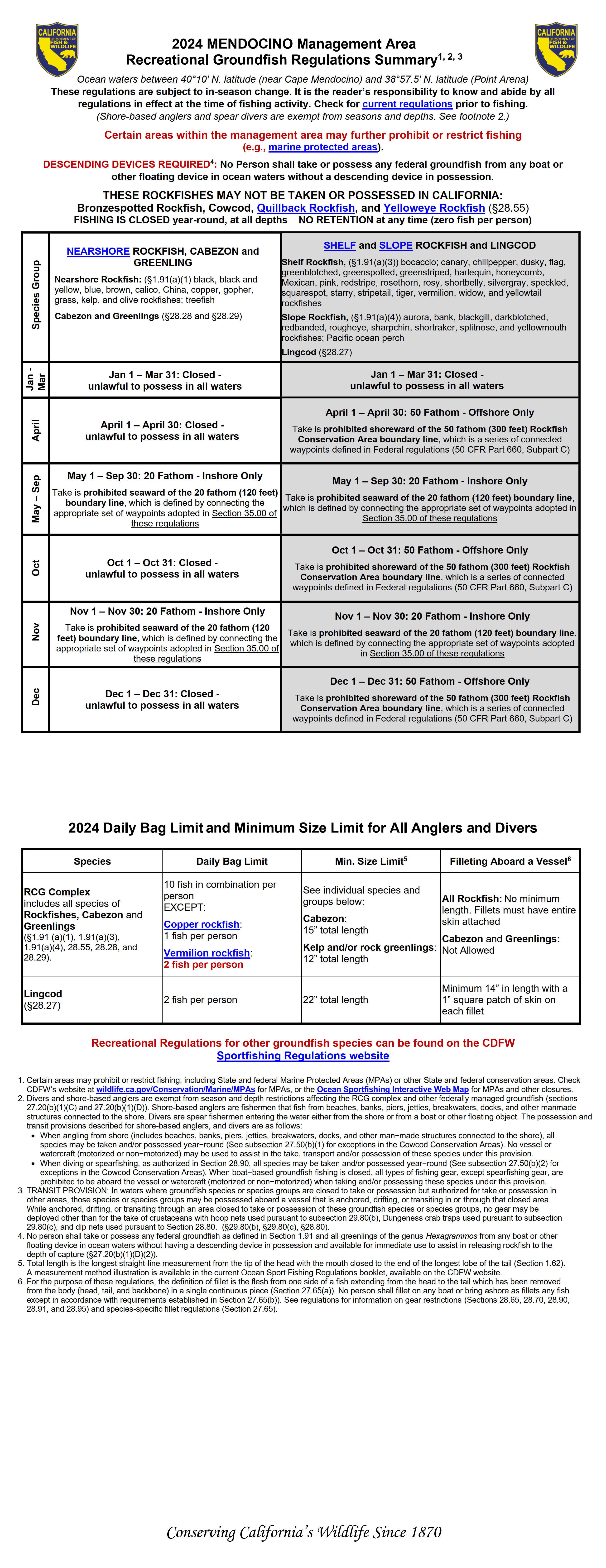
Mendocino Management Area
Ocean waters between 40°10' N. latitude (near Cape Mendocino) and 38°57.5' N. latitude (Point Arena)
Includes a portion of Humboldt County and most of Mendocino County
Click image below to open file in new tab
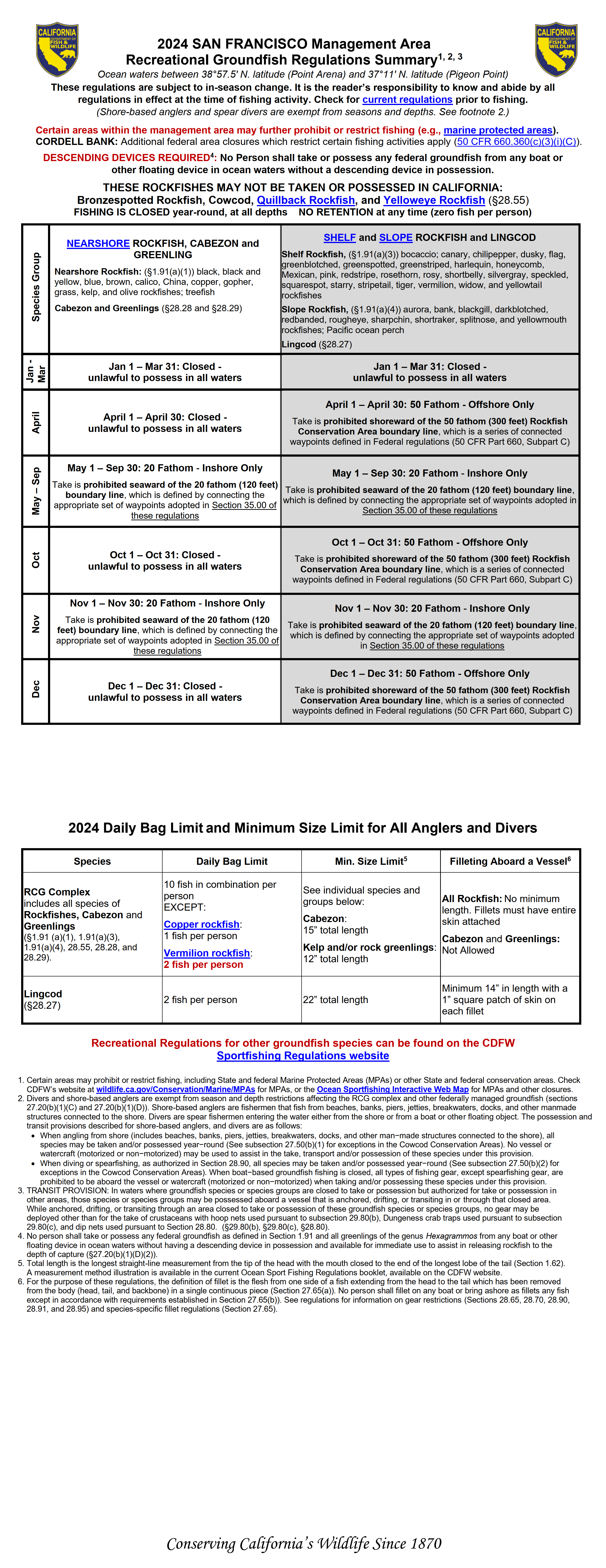
San Francisco Management Area
Ocean waters between 38°57.5' N. latitude (Point Arena) and 37°11' N. latitude (Pigeon Point)
Includes a portion of Mendocino County, all of Sonoma, Marin, San Francisco, Alameda and Contra Costa Counties, and most of San Mateo County
Click image below to open file in new tab
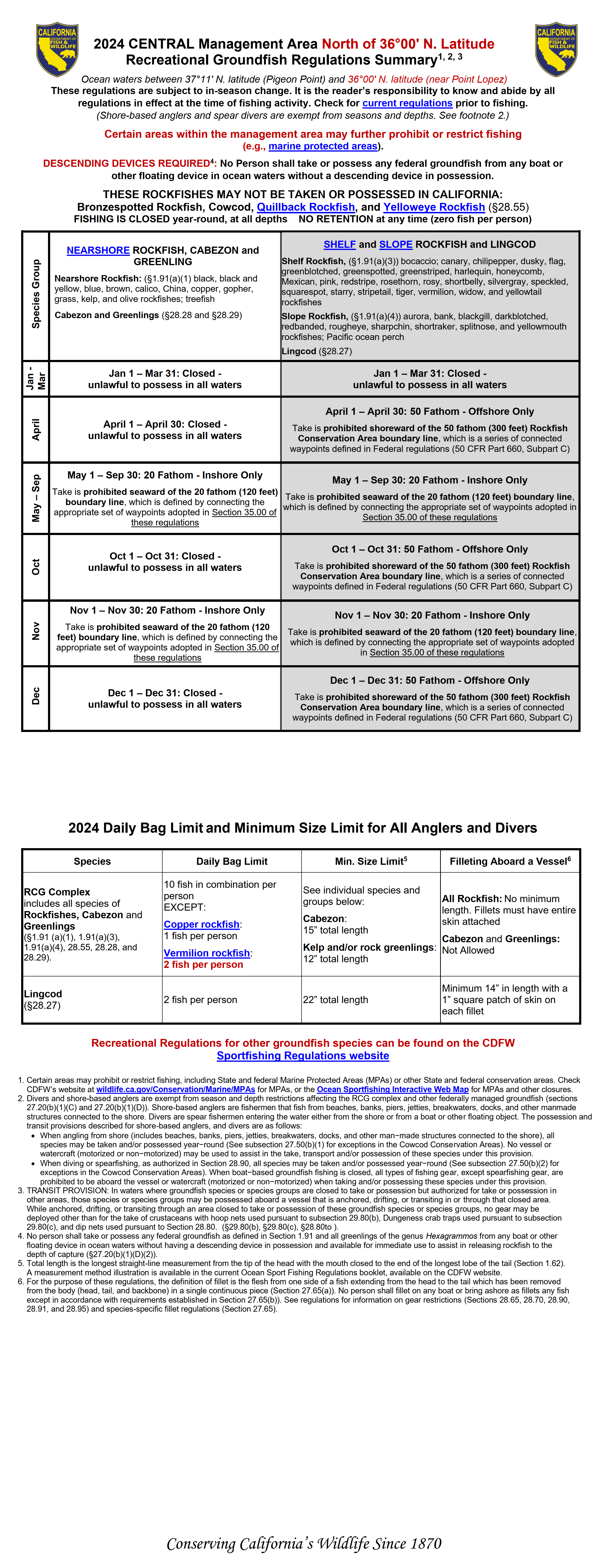
Central Management Area - North
Ocean waters between 37°11' N. latitude (Pigeon Point) and 36°00' N. latitude (Point Lopez)
Includes all of Santa Cruz County, and parts of San Mateo and Monterey Counties
Click image below to open file in new tab
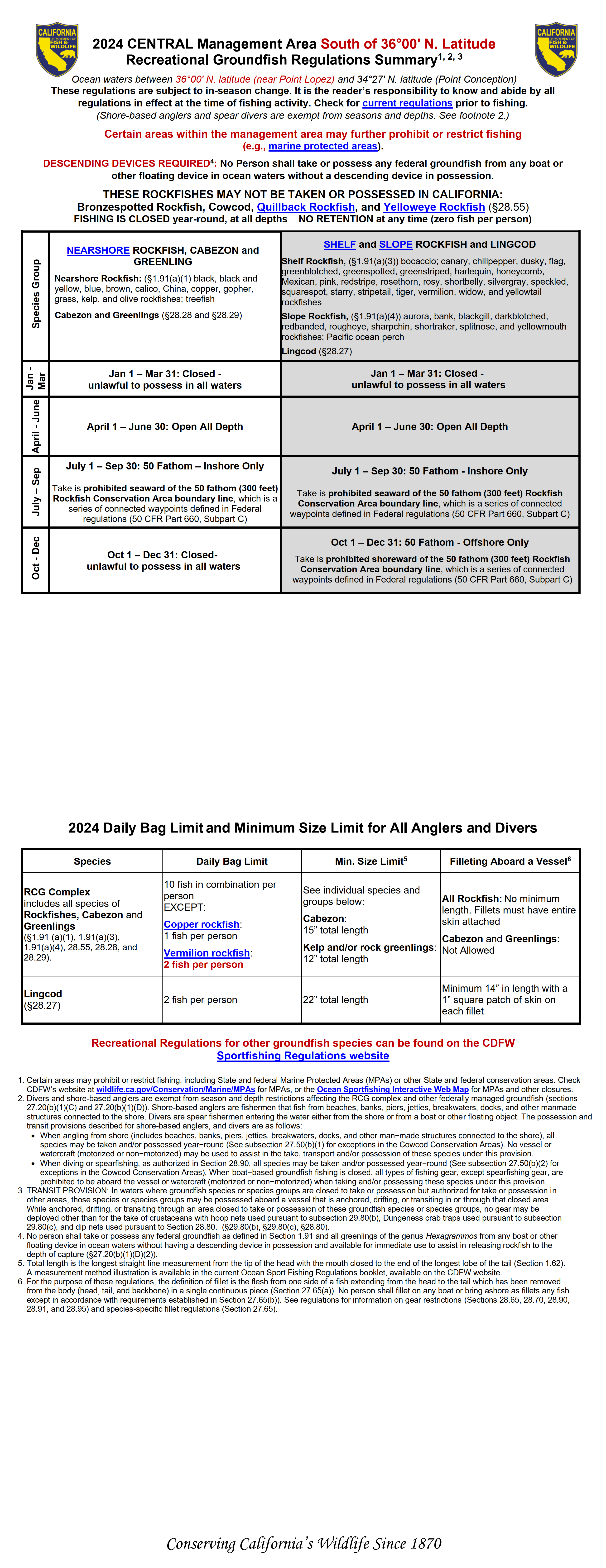
Central Management Area - South
Ocean waters between 36°0' N. latitude (Point Lopez) and 34°27' N. latitude (Point Conception)
Includes all of San Luis Obispo county, and parts of Monterey and Santa Barbara Counties
Click image below to open file in new tab
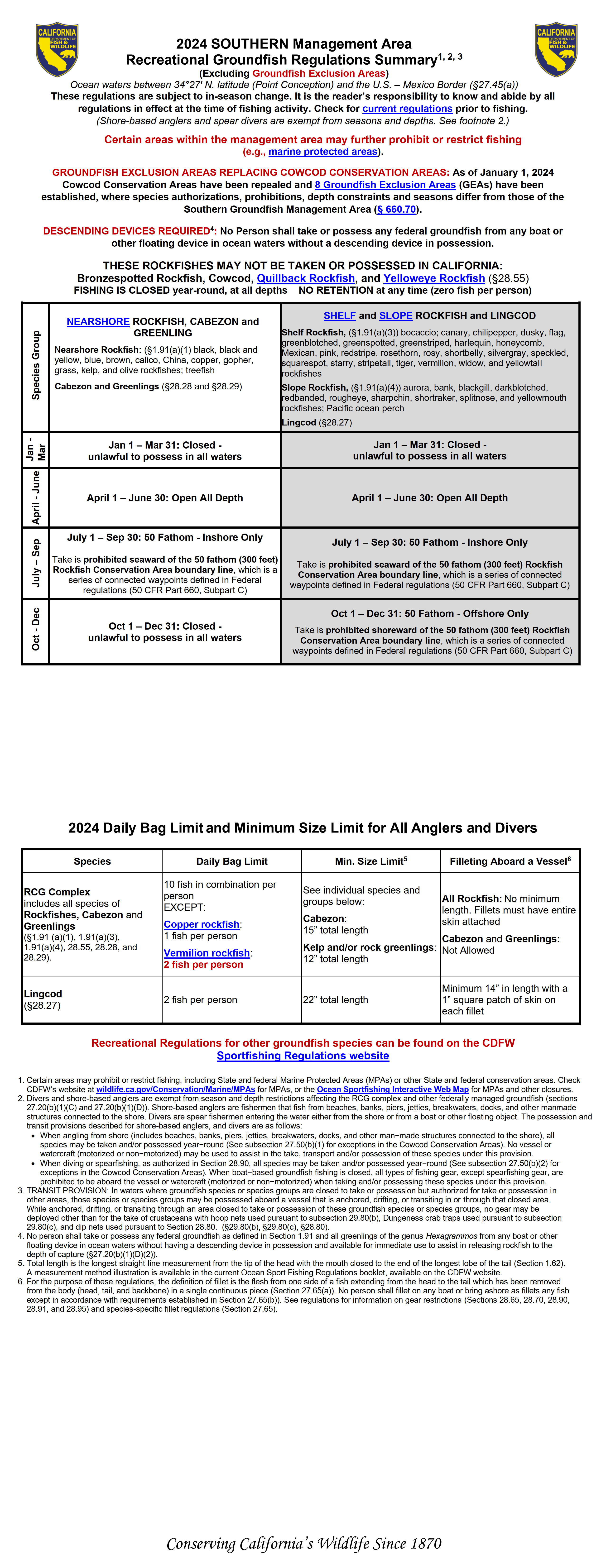
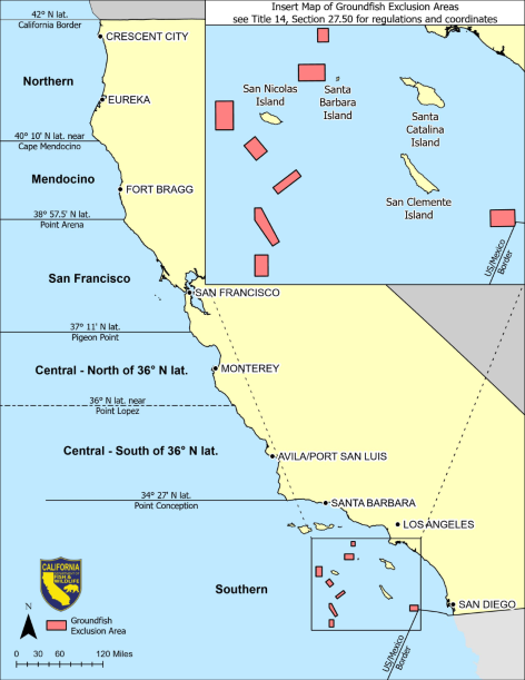
Southern Management Area
Ocean waters between 34°27' N. latitude (Point Conception) and the U.S.-Mexico Border, excluding the Cowcod Conservation Areas
Includes a portion of Santa Barbara County, and all of Ventura, Los Angeles, Orange and San Diego Counties
Click image below to open file in new tab